Dunstable elevation
Dunstable (England, Central Bedfordshire), United Kingdom elevation is 150 meters and Dunstable elevation in feet is 492 ft above sea level [src 1]. Dunstable is a seat of a third-order administrative division (feature code) with elevation that is 78 meters (256 ft) bigger than average city elevation in United Kingdom.
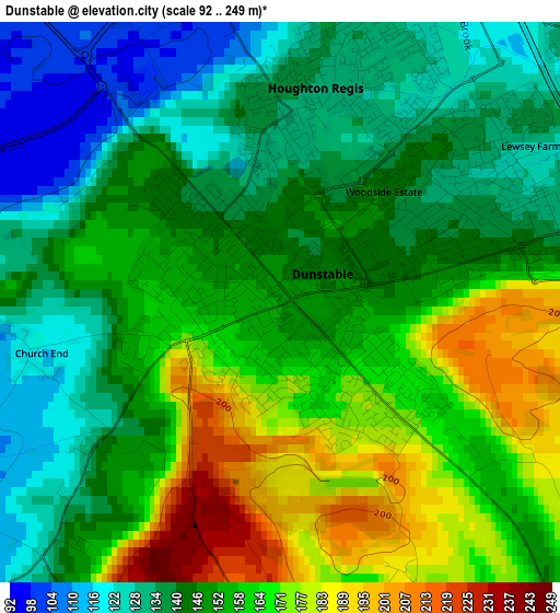
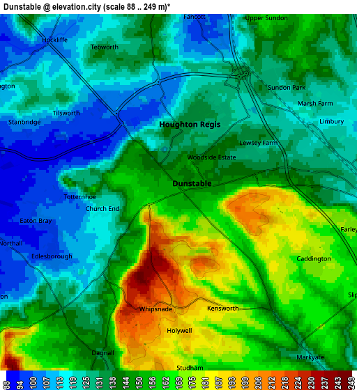
Below is the Elevation map of Dunstable, which displays elevation range with different colors. Scale of the first map is from 92 to 249 m (302 to 817 ft) with average elevation of 152 meters (=499 ft) [note 1]
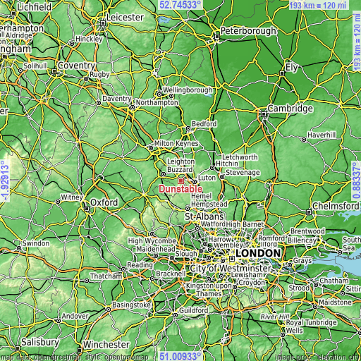
These maps also provides idea of topography and contour of this city, they are displayed at different zoom levels. More info about maps, scale and edge coordinates you can find below images.
| \ | Map #1 | Map #2 | Topo.Map |
| Scale [m] | 92..249 m | 88..249 m | × |
| Scale [ft] | 302..817 ft | 289..817 ft | × |
| Average | 152 m = 499 ft | 141.1 m = 463 ft | × |
| Width | 6.03 km = 3.7 mi | 12.06 km = 7.5 mi | 193 km = 119.9 mi |
| Height | 6.03 km = 3.7 mi | 12.06 km = 7.5 mi | 193 km = 119.9 mi |
| ↑Max Latitude | 51.912826° | 51.939926° | 52.74533° |
| Latitude at center | 51.88571° | 51.88571° | 51.88571° |
| ↓Min Latitude | 51.858577° | 51.831428° | 51.00933° |
| ← Min Longitude | -0.566825° | -0.610771° | -1.92913° |
| Longitude center | -0.52288° | -0.52288° | -0.52288° |
| →Max Longitude | -0.478935° | -0.434989° | 0.88337° |
Nearby cities:
Cities around Dunstable sort by population:
• Luton elevation 117 m
7.3 km,  95°
95°
• Toddington 150 m
7.1 km,  354°
354°
• Eaton Bray 102 m
4.8 km,  258°
258°
• Caddington 176 m
5 km,  115°
115°
• Markyate 133 m
6.7 km,  142°
142°
• Kensworth 188 m
4 km,  160°
160°
• Stanbridge 111 m
5.8 km,  296°
296°
• Totternhoe 111 m
3.5 km,  269°
269°
• Hockliffe 101 m
6.7 km,  319°
319°
• Chalton 108 m
4.9 km,  17°
17°
• Milton Bryan 136 m
8.3 km,  329°
329°
• Houghton Regis 134 m
2.1 km,  3°
3°
Multilingual:
 En español:
Dunstable elevación 150 m.
 En France:
Dunstable élévation 150 m.
 Auf Deutsch:
Dunstable höhe über dem Meeresspiegel ist 150 m.

Sources and notes:
- [note 1] Map square and city borders are not equal. Map elevation data is calculated only from area inside that square.
- [src 1] Elevation data from geonames database provided with same terms of usage.
- [src 2] The elevation map of Dunstable is generated using elevation data from NASA's 3 arcsec (90m) resolution SRTM data.
- [src 3] Base (background) map © OpenStreetMap contributors tiles are generated by Geofabrik and OpenTopoMap.
Copyright & License:
This Dunstable Elevation Map is licensed under CC BY-SA. You may reuse any part from this page, if you give a proper credit by linking to this URL:
 More info on terms of use page.