Toddington elevation
Toddington (England, Central Bedfordshire), United Kingdom elevation is 150 meters and Toddington elevation in feet is 492 ft above sea level [src 1]. Toddington is a seat of a third-order administrative division (feature code) with elevation that is 78 meters (256 ft) bigger than average city elevation in United Kingdom.
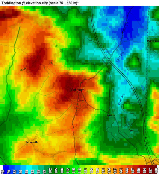
Below is the Elevation map of Toddington, which displays elevation range with different colors. Scale of the first map is from 76 to 160 m (249 to 525 ft) with average elevation of 116.8 meters (=383 ft) [note 1]
These maps also provides idea of topography and contour of this city, they are displayed at different zoom levels. More info about maps, scale and edge coordinates you can find below images.
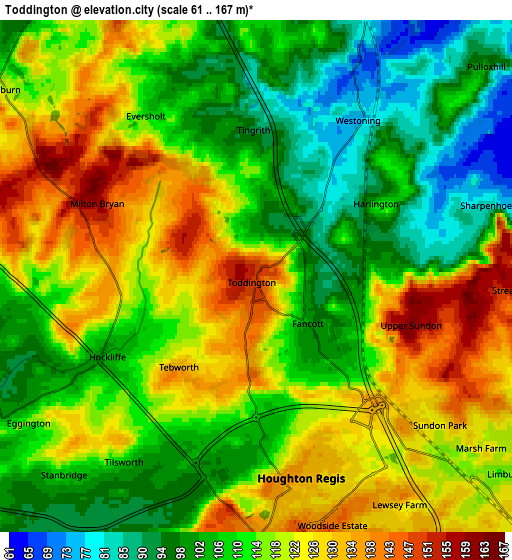
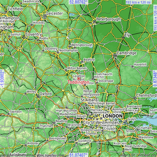
| \ | Map #1 | Map #2 | Topo.Map |
| Scale [m] | 76..160 m | 61..167 m | × |
| Scale [ft] | 249..525 ft | 200..548 ft | × |
| Average | 116.8 m = 383 ft | 113.9 m = 374 ft | × |
| Width | 6.02 km = 3.7 mi | 12.05 km = 7.5 mi | 192.8 km = 119.8 mi |
| Height | 6.02 km = 3.7 mi | 12.05 km = 7.5 mi | 192.7 km = 119.7 mi |
| ↑Max Latitude | 51.976298° | 52.00336° | 52.80762° |
| Latitude at center | 51.94922° | 51.94922° | 51.94922° |
| ↓Min Latitude | 51.922126° | 51.895015° | 51.07407° |
| ← Min Longitude | -0.576715° | -0.620661° | -1.93902° |
| Longitude center | -0.53277° | -0.53277° | -0.53277° |
| →Max Longitude | -0.488825° | -0.444879° | 0.87348° |
Nearby cities:
Cities around Toddington sort by population:
• Harlington elevation 107 m
3.2 km,  61°
61°
• Westoning 78 m
4.3 km,  34°
34°
• Stanbridge 111 m
6.4 km,  224°
224°
• Hockliffe 101 m
4.2 km,  241°
241°
• Streatley 151 m
6.1 km,  93°
93°
• Chalton 108 m
3.2 km,  137°
137°
• Eversholt 105 m
4.6 km,  336°
336°
• Steppingley 105 m
6.5 km,  2°
2°
• Potsgrove 150 m
5.9 km,  281°
281°
• Houghton Regis 134 m
5 km,  170°
170°
• Battlesden 124 m
4.3 km,  268°
268°
• Milton Bryan 136 m
3.5 km, 271°
Multilingual:
 En español:
Toddington elevación 150 m.
 En France:
Toddington élévation 150 m.
 Auf Deutsch:
Toddington höhe über dem Meeresspiegel ist 150 m.

Sources and notes:
- [note 1] Map square and city borders are not equal. Map elevation data is calculated only from area inside that square.
- [src 1] Elevation data from geonames database provided with same terms of usage.
- [src 2] The elevation map of Toddington is generated using elevation data from NASA's 3 arcsec (90m) resolution SRTM data.
- [src 3] Base (background) map © OpenStreetMap contributors tiles are generated by Geofabrik and OpenTopoMap.
Copyright & License:
This Toddington Elevation Map is licensed under CC BY-SA. You may reuse any part from this page, if you give a proper credit by linking to this URL:
 More info on terms of use page.