Eastwood elevation
Eastwood (England, Nottinghamshire), United Kingdom elevation is 58 meters and Eastwood elevation in feet is 190 ft above sea level [src 1]. Eastwood is a populated place (feature code) with elevation that is 14 meters (46 ft) smaller than average city elevation in United Kingdom.
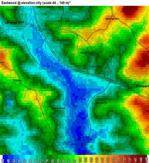
Below is the Elevation map of Eastwood, which displays elevation range with different colors. Scale of the first map is from 44 to 149 m (144 to 489 ft) with average elevation of 80.9 meters (=265 ft) [note 1]
These maps also provides idea of topography and contour of this city, they are displayed at different zoom levels. More info about maps, scale and edge coordinates you can find below images.
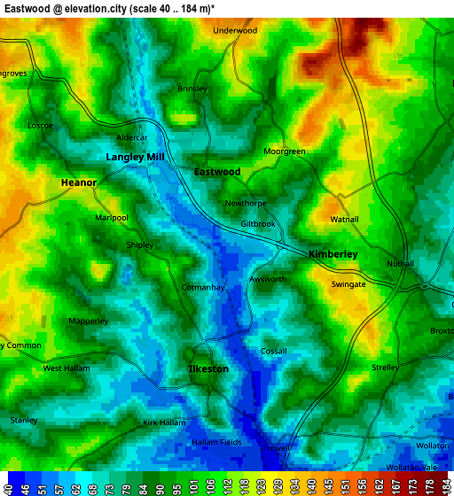
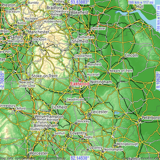
| \ | Map #1 | Map #2 | Topo.Map |
| Scale [m] | 44..149 m | 40..184 m | × |
| Scale [ft] | 144..489 ft | 131..604 ft | × |
| Average | 80.9 m = 265 ft | 92.4 m = 303 ft | × |
| Width | 5.88 km = 3.7 mi | 11.76 km = 7.3 mi | 188.2 km = 116.9 mi |
| Height | 5.88 km = 3.7 mi | 11.76 km = 7.3 mi | 188.2 km = 116.9 mi |
| ↑Max Latitude | 53.026439° | 53.052862° | 53.83803° |
| Latitude at center | 53° | 53° | 53° |
| ↓Min Latitude | 52.973545° | 52.947074° | 52.14538° |
| ← Min Longitude | -1.343945° | -1.387891° | -2.70625° |
| Longitude center | -1.3° | -1.3° | -1.3° |
| →Max Longitude | -1.256055° | -1.212109° | 0.10625° |
Nearby cities:
Cities around Eastwood sort by population:
• Ilkeston elevation 103 m
3.3 km,  191°
191°
• Arnold 66 m
11.2 km,  90°
90°
• Hucknall 80 m
7.6 km,  61°
61°
• Heanor 127 m
3.9 km,  292°
292°
• Ripley 126 m
7.6 km,  298°
298°
• Basford 35 m
8.6 km,  115°
115°
• Pinxton 102 m
10.1 km,  353°
353°
• Kimberley 93 m
2.9 km,  129°
129°
• New Basford 73 m
9.5 km,  108°
108°
• West Hallam 86 m
5.1 km,  230°
230°
• Kilburn 93 m
9.3 km,  273°
273°
• Awsworth 88 m
1.6 km,  137°
137°
Multilingual:
 En español:
Eastwood elevación 58 m.
 En France:
Eastwood élévation 58 m.


Sources and notes:
- [note 1] Map square and city borders are not equal. Map elevation data is calculated only from area inside that square.
- [src 1] Elevation data from geonames database provided with same terms of usage.
- [src 2] The elevation map of Eastwood is generated using elevation data from NASA's 3 arcsec (90m) resolution SRTM data.
- [src 3] Base (background) map © OpenStreetMap contributors tiles are generated by Geofabrik and OpenTopoMap.
Copyright & License:
This Eastwood Elevation Map is licensed under CC BY-SA. You may reuse any part from this page, if you give a proper credit by linking to this URL:
 More info on terms of use page.