Ferryhill elevation
Ferryhill (England, County Durham), United Kingdom elevation is 122 meters and Ferryhill elevation in feet is 400 ft above sea level [src 1]. Ferryhill is a seat of a third-order administrative division (feature code) with elevation that is 50 meters (164 ft) bigger than average city elevation in United Kingdom.
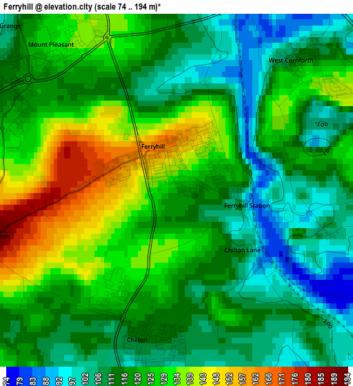
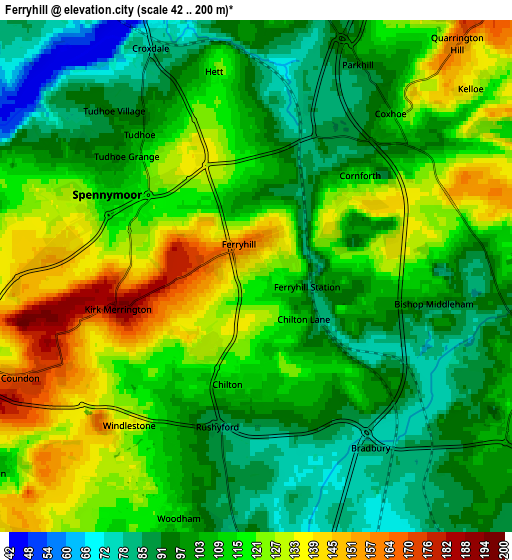
Below is the Elevation map of Ferryhill, which displays elevation range with different colors. Scale of the first map is from 74 to 194 m (243 to 636 ft) with average elevation of 119.8 meters (=393 ft) [note 1]
These maps also provides idea of topography and contour of this city, they are displayed at different zoom levels. More info about maps, scale and edge coordinates you can find below images.
| \ | Map #1 | Map #2 | Topo.Map |
| Scale [m] | 74..194 m | 42..200 m | × |
| Scale [ft] | 243..636 ft | 138..656 ft | × |
| Average | 119.8 m = 393 ft | 110.7 m = 363 ft | × |
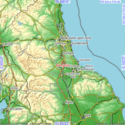
| Width | 5.65 km = 3.5 mi | 11.3 km = 7 mi | 180.8 km = 112.3 mi |
| Height | 5.65 km = 3.5 mi | 11.3 km = 7 mi | 180.8 km = 112.3 mi |
| ↑Max Latitude | 54.708727° | 54.734107° | 55.48816° |
| Latitude at center | 54.68333° | 54.68333° | 54.68333° |
| ↓Min Latitude | 54.657917° | 54.632489° | 53.86222° |
| ← Min Longitude | -1.593945° | -1.637891° | -2.95625° |
| Longitude center | -1.55° | -1.55° | -1.55° |
| →Max Longitude | -1.506055° | -1.462109° | -0.14375° |
Nearby cities:
Cities around Ferryhill sort by population:
• Newton Aycliffe elevation 95 m
7.4 km,  191°
191°
• Spennymoor 111 m
3.8 km,  297°
297°
• Shildon 132 m
8.4 km,  225°
225°
• Sedgefield 112 m
7.3 km,  117°
117°
• Bowburn 98 m
6.3 km,  14°
14°
• Coxhoe 108 m
4.6 km,  40°
40°
• Coundon 175 m
5.4 km,  245°
245°
• Trimdon 144 m
8 km,  77°
77°
• Fishburn 118 m
7.3 km,  90°
90°
• West Cornforth 112 m
2.9 km, 42°
• Kelloe 133 m
6.2 km,  50°
50°
• Bishop Middleham 98 m
4 km,  98°
98°
Multilingual:
 En español:
Ferryhill elevación 122 m.
 En France:
Ferryhill élévation 122 m.
 Auf Deutsch:
Ferryhill höhe über dem Meeresspiegel ist 122 m.

Sources and notes:
- [note 1] Map square and city borders are not equal. Map elevation data is calculated only from area inside that square.
- [src 1] Elevation data from geonames database provided with same terms of usage.
- [src 2] The elevation map of Ferryhill is generated using elevation data from NASA's 3 arcsec (90m) resolution SRTM data.
- [src 3] Base (background) map © OpenStreetMap contributors tiles are generated by Geofabrik and OpenTopoMap.
Copyright & License:
This Ferryhill Elevation Map is licensed under CC BY-SA. You may reuse any part from this page, if you give a proper credit by linking to this URL:
 More info on terms of use page.