Sedgefield elevation
Sedgefield (England, County Durham), United Kingdom elevation is 112 meters and Sedgefield elevation in feet is 367 ft above sea level [src 1]. Sedgefield is a populated place (feature code) with elevation that is 40 meters (131 ft) bigger than average city elevation in United Kingdom.
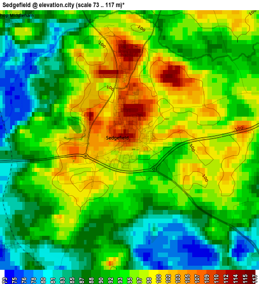
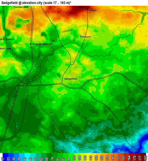
Below is the Elevation map of Sedgefield, which displays elevation range with different colors. Scale of the first map is from 73 to 117 m (240 to 384 ft) with average elevation of 92.8 meters (=304 ft) [note 1]
These maps also provides idea of topography and contour of this city, they are displayed at different zoom levels. More info about maps, scale and edge coordinates you can find below images.
| \ | Map #1 | Map #2 | Topo.Map |
| Scale [m] | 73..117 m | 17..183 m | × |
| Scale [ft] | 240..384 ft | 56..600 ft | × |
| Average | 92.8 m = 304 ft | 91.1 m = 299 ft | × |
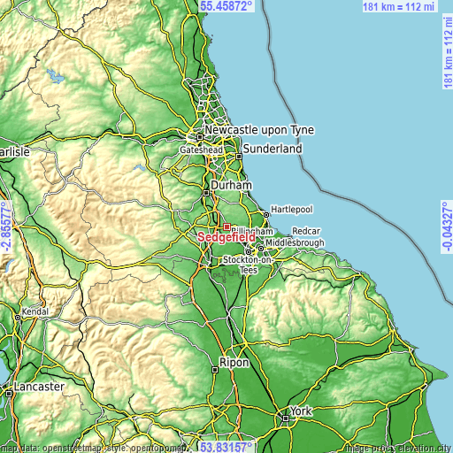
| Width | 5.65 km = 3.5 mi | 11.31 km = 7 mi | 180.9 km = 112.4 mi |
| Height | 5.65 km = 3.5 mi | 11.31 km = 7 mi | 180.9 km = 112.4 mi |
| ↑Max Latitude | 54.678705° | 54.704105° | 55.45872° |
| Latitude at center | 54.65329° | 54.65329° | 54.65329° |
| ↓Min Latitude | 54.627859° | 54.602411° | 53.83157° |
| ← Min Longitude | -1.493465° | -1.537411° | -2.85577° |
| Longitude center | -1.44952° | -1.44952° | -1.44952° |
| →Max Longitude | -1.405575° | -1.361629° | -0.04327° |
Nearby cities:
Cities around Sedgefield sort by population:
• Ferryhill elevation 122 m
7.3 km,  297°
297°
• Coxhoe 108 m
7.7 km,  333°
333°
• Trimdon 144 m
5.2 km,  14°
14°
• Fishburn 118 m
3.4 km, 14°
• West Cornforth 112 m
7.1 km,  320°
320°
• Kelloe 133 m
7.5 km,  347°
347°
• Trimdon Grange 140 m
6.9 km, 12°
• Stillington 53 m
5.6 km,  161°
161°
• Bishop Middleham 98 m
3.7 km, 317°
• Carlton 51 m
8 km,  151°
151°
• Bishopton 45 m
7.8 km,  172°
172°
• Grindon 67 m
5.9 km,  133°
133°
Multilingual:
 En español:
Sedgefield elevación 112 m.
 En France:
Sedgefield élévation 112 m.
 Auf Deutsch:
Sedgefield höhe über dem Meeresspiegel ist 112 m.

Sources and notes:
- [note 1] Map square and city borders are not equal. Map elevation data is calculated only from area inside that square.
- [src 1] Elevation data from geonames database provided with same terms of usage.
- [src 2] The elevation map of Sedgefield is generated using elevation data from NASA's 3 arcsec (90m) resolution SRTM data.
- [src 3] Base (background) map © OpenStreetMap contributors tiles are generated by Geofabrik and OpenTopoMap.
Copyright & License:
This Sedgefield Elevation Map is licensed under CC BY-SA. You may reuse any part from this page, if you give a proper credit by linking to this URL:
 More info on terms of use page.