Frome elevation
Frome (England, Somerset), United Kingdom elevation is 104 meters and Frome elevation in feet is 341 ft above sea level [src 1]. Frome is a populated place (feature code) with elevation that is 32 meters (105 ft) bigger than average city elevation in United Kingdom.
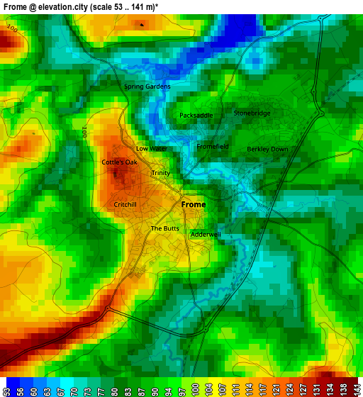
Below is the Elevation map of Frome, which displays elevation range with different colors. Scale of the first map is from 53 to 141 m (174 to 463 ft) with average elevation of 90.4 meters (=297 ft) [note 1]
These maps also provides idea of topography and contour of this city, they are displayed at different zoom levels. More info about maps, scale and edge coordinates you can find below images.
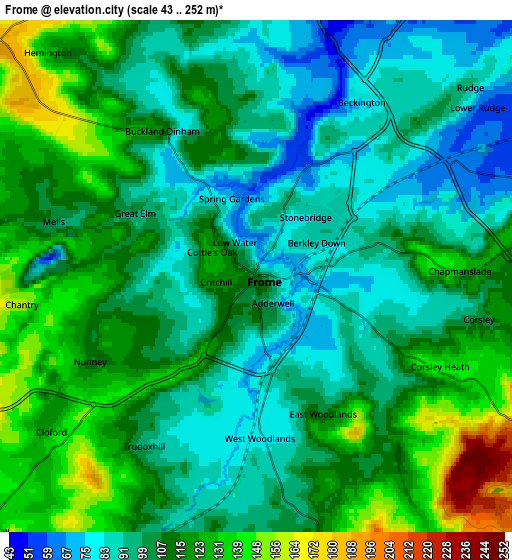
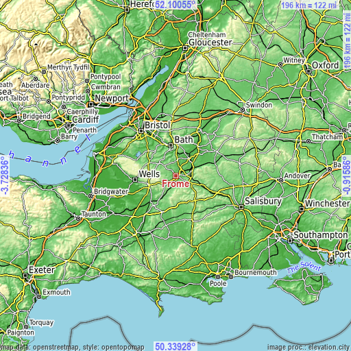
| \ | Map #1 | Map #2 | Topo.Map |
| Scale [m] | 53..141 m | 43..252 m | × |
| Scale [ft] | 174..463 ft | 141..827 ft | × |
| Average | 90.4 m = 297 ft | 107.8 m = 354 ft | × |
| Width | 6.12 km = 3.8 mi | 12.24 km = 7.6 mi | 195.8 km = 121.7 mi |
| Height | 6.12 km = 3.8 mi | 12.24 km = 7.6 mi | 195.8 km = 121.7 mi |
| ↑Max Latitude | 51.255851° | 51.283346° | 52.10055° |
| Latitude at center | 51.22834° | 51.22834° | 51.22834° |
| ↓Min Latitude | 51.200812° | 51.173268° | 50.33928° |
| ← Min Longitude | -2.366055° | -2.410001° | -3.72836° |
| Longitude center | -2.32211° | -2.32211° | -2.32211° |
| →Max Longitude | -2.278165° | -2.234219° | -0.91586° |
Nearby cities:
Cities around Frome sort by population:
• Warminster elevation 120 m
10.3 km,  104°
104°
• Westbury 65 m
10 km,  69°
69°
• Southwick 46 m
9.9 km,  39°
39°
• Rode 59 m
6.8 km,  24°
24°
• Chapmanslade 125 m
5.1 km,  88°
88°
• Wellow 84 m
11.3 km,  341°
341°
• Upton Scudamore 135 m
9 km, 88°
• Kilmington 213 m
11.3 km,  181°
181°
• North Bradley 51 m
11 km,  47°
47°
• Hinton Charterhouse 140 m
10.6 km,  357°
357°
• Wingfield 58 m
10.4 km, 24°
• Corsley 105 m
5.4 km, 100°
Multilingual:
 En español:
Frome elevación 104 m.
 En France:
Frome élévation 104 m.


Sources and notes:
- [note 1] Map square and city borders are not equal. Map elevation data is calculated only from area inside that square.
- [src 1] Elevation data from geonames database provided with same terms of usage.
- [src 2] The elevation map of Frome is generated using elevation data from NASA's 3 arcsec (90m) resolution SRTM data.
- [src 3] Base (background) map © OpenStreetMap contributors tiles are generated by Geofabrik and OpenTopoMap.
Copyright & License:
This Frome Elevation Map is licensed under CC BY-SA. You may reuse any part from this page, if you give a proper credit by linking to this URL:
 More info on terms of use page.