Kilmington elevation
Kilmington (England, Wiltshire), United Kingdom elevation is 213 meters and Kilmington elevation in feet is 699 ft above sea level [src 1]. Kilmington is a seat of a third-order administrative division (feature code) with elevation that is 141 meters (463 ft) bigger than average city elevation in United Kingdom.
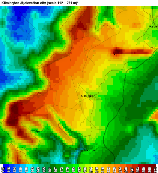
Below is the Elevation map of Kilmington, which displays elevation range with different colors. Scale of the first map is from 112 to 271 m (367 to 889 ft) with average elevation of 190.2 meters (=624 ft) [note 1]
These maps also provides idea of topography and contour of this city, they are displayed at different zoom levels. More info about maps, scale and edge coordinates you can find below images.
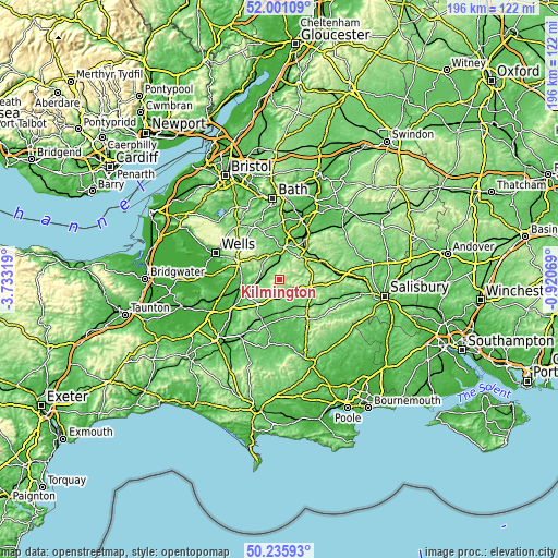
| \ | Map #1 | Topo.Map |
| Scale [m] | 112..271 m | × |
| Scale [ft] | 367..889 ft | × |
| Average | 190.2 m = 624 ft | × |
| Width | 6.13 km = 3.8 mi | 196.3 km = 122 mi |
| Height | 6.13 km = 3.8 mi | 196.3 km = 122 mi |
| ↑Max Latitude | 51.154512° | 52.00109° |
| Latitude at center | 51.12694° | 51.12694° |
| ↓Min Latitude | 51.099352° | 50.23593° |
| ← Min Longitude | -2.370885° | -3.73319° |
| Longitude center | -2.32694° | -2.32694° |
| →Max Longitude | -2.282995° | -0.92069° |
Nearby cities:
Cities around Kilmington sort by population:
• Frome elevation 104 m
11.3 km,  1°
1°
• Warminster 120 m
13.4 km,  50°
50°
• Gillingham 73 m
10.5 km,  160°
160°
• Wincanton 110 m
9.5 km,  215°
215°
• Bruton 66 m
8.9 km,  259°
259°
• Mere 105 m
6 km,  135°
135°
• Redlynch 150 m
7.6 km,  245°
245°
• Evercreech 87 m
12.7 km,  280°
280°
• Bourton 128 m
5.8 km,  180°
180°
• Motcombe 87 m
13.3 km, 144°
• Chapmanslade 125 m
12.6 km,  25°
25°
• Corsley 105 m
11.7 km, 28°
Multilingual:
 En español:
Kilmington elevación 213 m.
 En France:
Kilmington élévation 213 m.
 Auf Deutsch:
Kilmington höhe über dem Meeresspiegel ist 213 m.

Sources and notes:
- [note 1] Map square and city borders are not equal. Map elevation data is calculated only from area inside that square.
- [src 1] Elevation data from geonames database provided with same terms of usage.
- [src 2] The elevation map of Kilmington is generated using elevation data from NASA's 3 arcsec (90m) resolution SRTM data.
- [src 3] Base (background) map © OpenStreetMap contributors tiles are generated by Geofabrik and OpenTopoMap.
Copyright & License:
This Kilmington Elevation Map is licensed under CC BY-SA. You may reuse any part from this page, if you give a proper credit by linking to this URL:
 More info on terms of use page.