Gillingham elevation
Gillingham (England, Dorset), United Kingdom elevation is 73 meters and Gillingham elevation in feet is 240 ft above sea level [src 1]. Gillingham is a populated place (feature code) with elevation that is 1 meters (3 ft) bigger than average city elevation in United Kingdom.
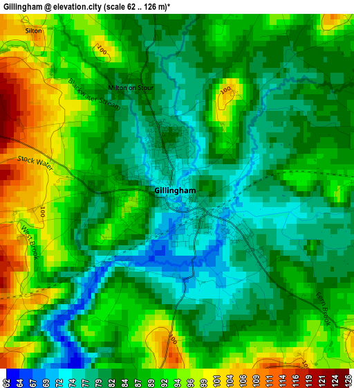
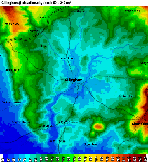
Below is the Elevation map of Gillingham, which displays elevation range with different colors. Scale of the first map is from 62 to 126 m (203 to 413 ft) with average elevation of 86.5 meters (=284 ft) [note 1]
These maps also provides idea of topography and contour of this city, they are displayed at different zoom levels. More info about maps, scale and edge coordinates you can find below images.
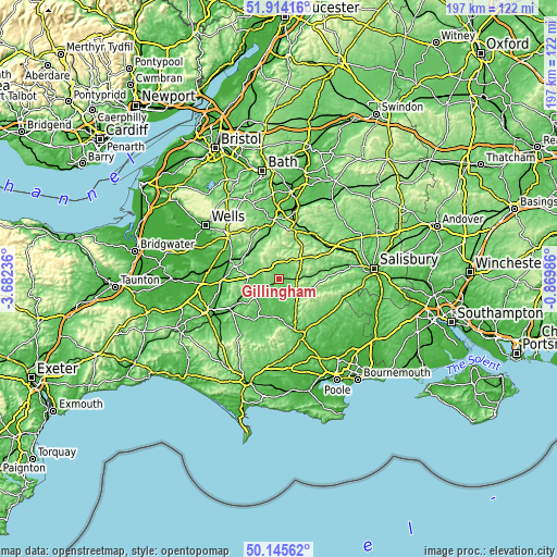
| \ | Map #1 | Map #2 | Topo.Map |
| Scale [m] | 62..126 m | 50..240 m | × |
| Scale [ft] | 203..413 ft | 164..787 ft | × |
| Average | 86.5 m = 284 ft | 102.7 m = 337 ft | × |
| Width | 6.14 km = 3.8 mi | 12.29 km = 7.6 mi | 196.6 km = 122.2 mi |
| Height | 6.15 km = 3.8 mi | 12.29 km = 7.6 mi | 196.6 km = 122.2 mi |
| ↑Max Latitude | 51.065955° | 51.093563° | 51.91416° |
| Latitude at center | 51.03833° | 51.03833° | 51.03833° |
| ↓Min Latitude | 51.010689° | 50.983031° | 50.14562° |
| ← Min Longitude | -2.320055° | -2.364001° | -3.68236° |
| Longitude center | -2.27611° | -2.27611° | -2.27611° |
| →Max Longitude | -2.232165° | -2.188219° | -0.86986° |
Nearby cities:
Cities around Gillingham sort by population:
• Shaftesbury elevation 207 m
6.9 km,  122°
122°
• Wincanton 110 m
9.3 km,  282°
282°
• Manston 51 m
9.8 km,  176°
176°
• Mere 105 m
5.7 km,  6°
6°
• Stalbridge 76 m
11.3 km,  217°
217°
• Templecombe 92 m
10.7 km,  245°
245°
• Henstridge 79 m
10.7 km,  230°
230°
• Marnhull 69 m
8 km,  199°
199°
• Bourton 128 m
5.4 km,  318°
318°
• Motcombe 87 m
4.3 km,  103°
103°
• Hindon 131 m
12.1 km,  60°
60°
• Kilmington 213 m
10.5 km,  340°
340°
Multilingual:
 En español:
Gillingham elevación 73 m.
 En France:
Gillingham élévation 73 m.
 Auf Deutsch:
Gillingham höhe über dem Meeresspiegel ist 73 m.

Sources and notes:
- [note 1] Map square and city borders are not equal. Map elevation data is calculated only from area inside that square.
- [src 1] Elevation data from geonames database provided with same terms of usage.
- [src 2] The elevation map of Gillingham is generated using elevation data from NASA's 3 arcsec (90m) resolution SRTM data.
- [src 3] Base (background) map © OpenStreetMap contributors tiles are generated by Geofabrik and OpenTopoMap.
Copyright & License:
This Gillingham Elevation Map is licensed under CC BY-SA. You may reuse any part from this page, if you give a proper credit by linking to this URL:
 More info on terms of use page.