Westbury elevation
Westbury (England, Wiltshire), United Kingdom elevation is 65 meters and Westbury elevation in feet is 213 ft above sea level [src 1]. Westbury is a seat of a third-order administrative division (feature code) with elevation that is 7 meters (23 ft) smaller than average city elevation in United Kingdom.
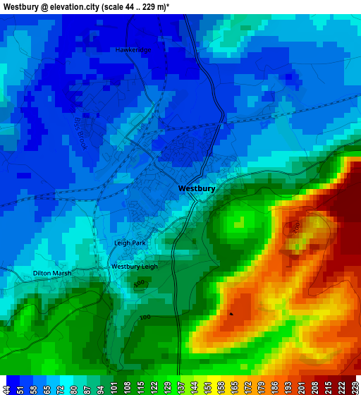
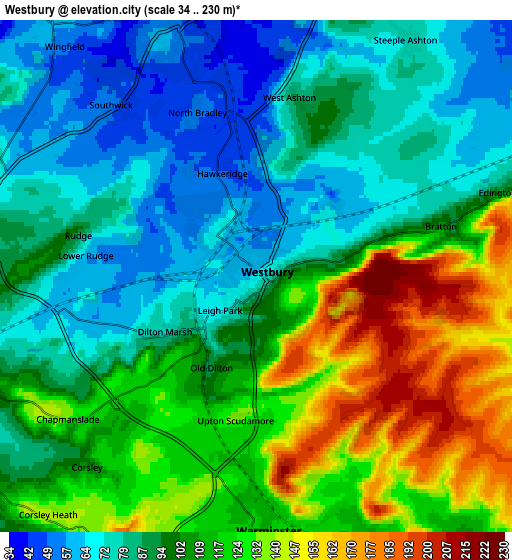
Below is the Elevation map of Westbury, which displays elevation range with different colors. Scale of the first map is from 44 to 229 m (144 to 751 ft) with average elevation of 94.3 meters (=309 ft) [note 1]
These maps also provides idea of topography and contour of this city, they are displayed at different zoom levels. More info about maps, scale and edge coordinates you can find below images.
| \ | Map #1 | Map #2 | Topo.Map |
| Scale [m] | 44..229 m | 34..230 m | × |
| Scale [ft] | 144..751 ft | 112..755 ft | × |
| Average | 94.3 m = 309 ft | 101.7 m = 334 ft | × |
| Width | 6.12 km = 3.8 mi | 12.23 km = 7.6 mi | 195.7 km = 121.6 mi |
| Height | 6.12 km = 3.8 mi | 12.23 km = 7.6 mi | 195.7 km = 121.6 mi |
| ↑Max Latitude | 51.287492° | 51.314968° | 52.13161° |
| Latitude at center | 51.26° | 51.26° | 51.26° |
| ↓Min Latitude | 51.232491° | 51.204966° | 50.37154° |
| ← Min Longitude | -2.231445° | -2.275391° | -3.59375° |
| Longitude center | -2.1875° | -2.1875° | -2.1875° |
| →Max Longitude | -2.143555° | -2.099609° | -0.78125° |
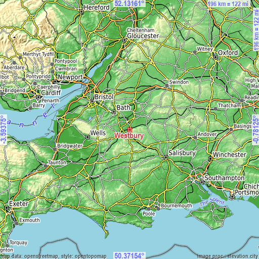
Nearby cities:
Cities around Westbury sort by population:
• Trowbridge elevation 41 m
6.7 km,  347°
347°
• Warminster 120 m
6.2 km,  174°
174°
• Boreham 120 m
6.9 km, 167°
• Southwick 46 m
5.2 km,  322°
322°
• Bratton 102 m
4.5 km,  75°
75°
• Rode 59 m
7.1 km,  292°
292°
• Edington 113 m
5.9 km,  72°
72°
• Chapmanslade 125 m
5.5 km,  231°
231°
• Upton Scudamore 135 m
3.4 km,  186°
186°
• Bishopstrow 114 m
7.8 km,  163°
163°
• Corsley 105 m
6.1 km,  222°
222°
• North Bradley 51 m
4.1 km,  342°
342°
Multilingual:
 En español:
Westbury elevación 65 m.
 En France:
Westbury élévation 65 m.


Sources and notes:
- [note 1] Map square and city borders are not equal. Map elevation data is calculated only from area inside that square.
- [src 1] Elevation data from geonames database provided with same terms of usage.
- [src 2] The elevation map of Westbury is generated using elevation data from NASA's 3 arcsec (90m) resolution SRTM data.
- [src 3] Base (background) map © OpenStreetMap contributors tiles are generated by Geofabrik and OpenTopoMap.
Copyright & License:
This Westbury Elevation Map is licensed under CC BY-SA. You may reuse any part from this page, if you give a proper credit by linking to this URL:
 More info on terms of use page.