Trowbridge elevation
Trowbridge (England, Wiltshire), United Kingdom elevation is 41 meters and Trowbridge elevation in feet is 135 ft above sea level [src 1]. Trowbridge is a seat of a second-order administrative division (feature code) with elevation that is 31 meters (102 ft) smaller than average city elevation in United Kingdom.
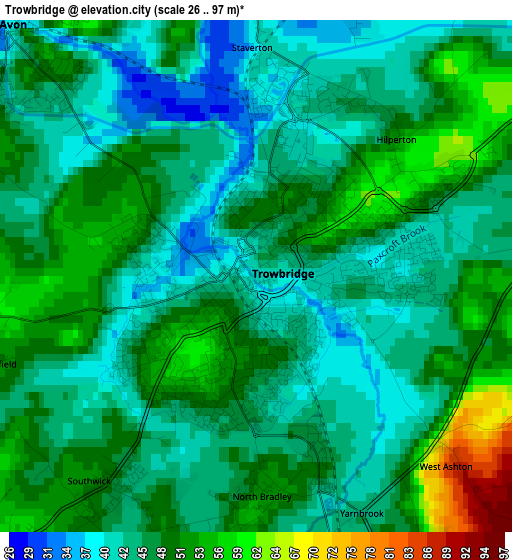
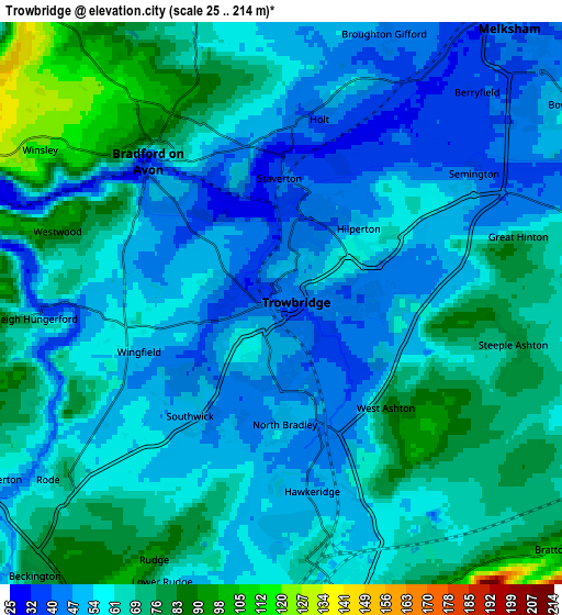
Below is the Elevation map of Trowbridge, which displays elevation range with different colors. Scale of the first map is from 26 to 97 m (85 to 318 ft) with average elevation of 47 meters (=154 ft) [note 1]
These maps also provides idea of topography and contour of this city, they are displayed at different zoom levels. More info about maps, scale and edge coordinates you can find below images.
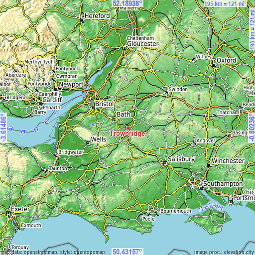
| \ | Map #1 | Map #2 | Topo.Map |
| Scale [m] | 26..97 m | 25..214 m | × |
| Scale [ft] | 85..318 ft | 82..702 ft | × |
| Average | 47 m = 154 ft | 60.8 m = 199 ft | × |
| Width | 6.11 km = 3.8 mi | 12.22 km = 7.6 mi | 195.5 km = 121.5 mi |
| Height | 6.11 km = 3.8 mi | 12.22 km = 7.6 mi | 195.4 km = 121.4 mi |
| ↑Max Latitude | 51.346347° | 51.373787° | 52.18938° |
| Latitude at center | 51.31889° | 51.31889° | 51.31889° |
| ↓Min Latitude | 51.291417° | 51.263927° | 50.43157° |
| ← Min Longitude | -2.252555° | -2.296501° | -3.61486° |
| Longitude center | -2.20861° | -2.20861° | -2.20861° |
| →Max Longitude | -2.164665° | -2.120719° | -0.80236° |
Nearby cities:
Cities around Trowbridge sort by population:
• Melksham elevation 41 m
7.7 km,  38°
38°
• Westbury 65 m
6.7 km,  167°
167°
• Bradford-on-Avon 33 m
4.3 km,  317°
317°
• Holt 41 m
4.2 km,  10°
10°
• Southwick 46 m
3 km,  214°
214°
• Bratton 102 m
7.9 km,  132°
132°
• Westwood 95 m
5.2 km,  289°
289°
• Limpley Stoke 69 m
7.9 km, 291°
• Rode 59 m
6.4 km,  232°
232°
• Freshford 49 m
6.9 km, 288°
• Wingfield 58 m
3.6 km,  260°
260°
• North Bradley 51 m
2.7 km, 174°
Multilingual:
 En español:
Trowbridge elevación 41 m.
 En France:
Trowbridge élévation 41 m.
 Auf Deutsch:
Trowbridge höhe über dem Meeresspiegel ist 41 m.
 На русском:
Троубридже, Троубридж высота над уровнем моря 41 м
Sources and notes:
- [note 1] Map square and city borders are not equal. Map elevation data is calculated only from area inside that square.
- [src 1] Elevation data from geonames database provided with same terms of usage.
- [src 2] The elevation map of Trowbridge is generated using elevation data from NASA's 3 arcsec (90m) resolution SRTM data.
- [src 3] Base (background) map © OpenStreetMap contributors tiles are generated by Geofabrik and OpenTopoMap.
Copyright & License:
This Trowbridge Elevation Map is licensed under CC BY-SA. You may reuse any part from this page, if you give a proper credit by linking to this URL:
 More info on terms of use page.