Boreham elevation
Boreham (England, Wiltshire), United Kingdom elevation is 120 meters and Boreham elevation in feet is 394 ft above sea level [src 1]. Boreham is a populated place (feature code) with elevation that is 48 meters (157 ft) bigger than average city elevation in United Kingdom.
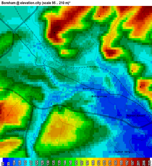
Below is the Elevation map of Boreham, which displays elevation range with different colors. Scale of the first map is from 95 to 210 m (312 to 689 ft) with average elevation of 133.8 meters (=439 ft) [note 1]
These maps also provides idea of topography and contour of this city, they are displayed at different zoom levels. More info about maps, scale and edge coordinates you can find below images.
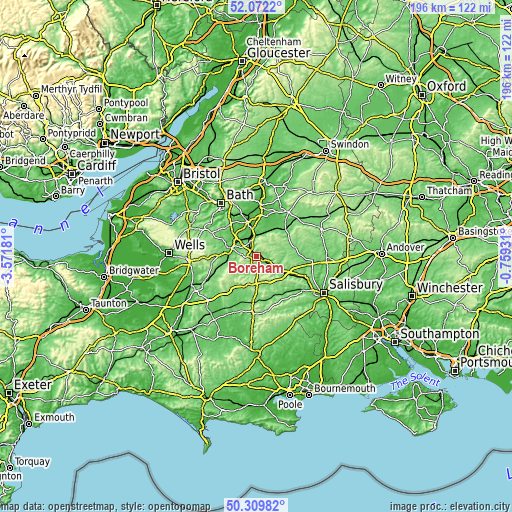
| \ | Map #1 | Topo.Map |
| Scale [m] | 95..210 m | × |
| Scale [ft] | 312..689 ft | × |
| Average | 133.8 m = 439 ft | × |
| Width | 6.12 km = 3.8 mi | 196 km = 121.8 mi |
| Height | 6.12 km = 3.8 mi | 195.9 km = 121.7 mi |
| ↑Max Latitude | 51.226968° | 52.0722° |
| Latitude at center | 51.19944° | 51.19944° |
| ↓Min Latitude | 51.171895° | 50.30982° |
| ← Min Longitude | -2.209505° | -3.57181° |
| Longitude center | -2.16556° | -2.16556° |
| →Max Longitude | -2.121615° | -0.75931° |
Nearby cities:
Cities around Boreham sort by population:
• Warminster elevation 120 m
1.1 km,  300°
300°
• Westbury 65 m
6.9 km,  347°
347°
• Bratton 102 m
8.4 km,  19°
19°
• Edington 113 m
9.4 km,  25°
25°
• Chapmanslade 125 m
6.7 km, 299°
• Upton Scudamore 135 m
3.9 km,  330°
330°
• North Bradley 51 m
11 km, 345°
• Chicklade 144 m
10.4 km,  164°
164°
• Codford 87 m
9.8 km,  124°
124°
• Boyton 95 m
8.2 km,  126°
126°
• Corsley 105 m
6 km,  291°
291°
• Bishopstrow 114 m
1 km, 134°
Multilingual:
 En español:
Boreham elevación 120 m.
 En France:
Boreham élévation 120 m.


Sources and notes:
- [note 1] Map square and city borders are not equal. Map elevation data is calculated only from area inside that square.
- [src 1] Elevation data from geonames database provided with same terms of usage.
- [src 2] The elevation map of Boreham is generated using elevation data from NASA's 3 arcsec (90m) resolution SRTM data.
- [src 3] Base (background) map © OpenStreetMap contributors tiles are generated by Geofabrik and OpenTopoMap.
Copyright & License:
This Boreham Elevation Map is licensed under CC BY-SA. You may reuse any part from this page, if you give a proper credit by linking to this URL:
 More info on terms of use page.