Grove elevation
Grove (England, Oxfordshire), United Kingdom elevation is 76 meters and Grove elevation in feet is 249 ft above sea level [src 1]. Grove is a populated place (feature code) with elevation that is 4 meters (13 ft) bigger than average city elevation in United Kingdom.
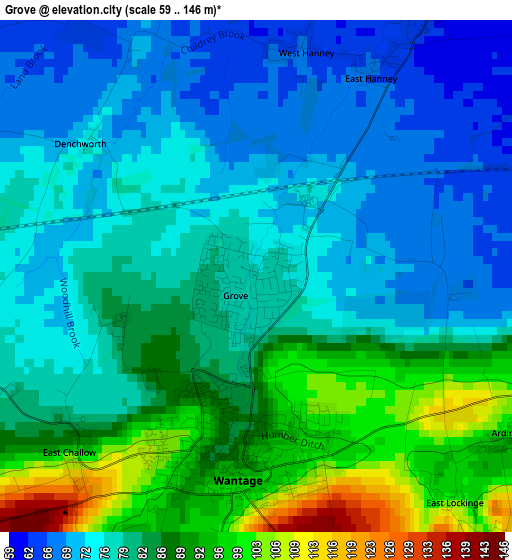
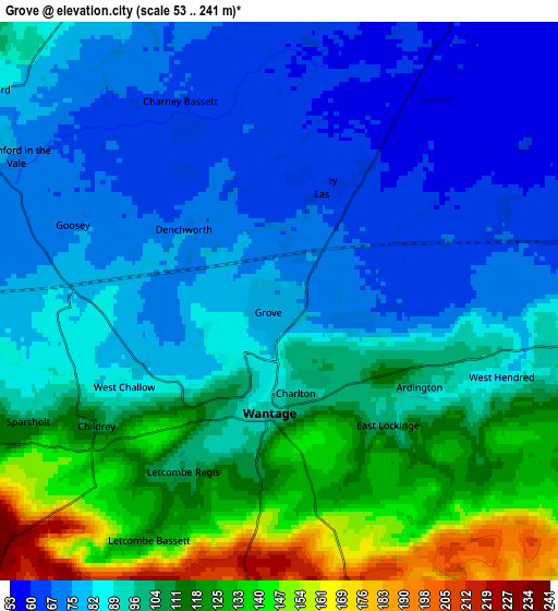
Below is the Elevation map of Grove, which displays elevation range with different colors. Scale of the first map is from 59 to 146 m (194 to 479 ft) with average elevation of 81 meters (=266 ft) [note 1]
These maps also provides idea of topography and contour of this city, they are displayed at different zoom levels. More info about maps, scale and edge coordinates you can find below images.
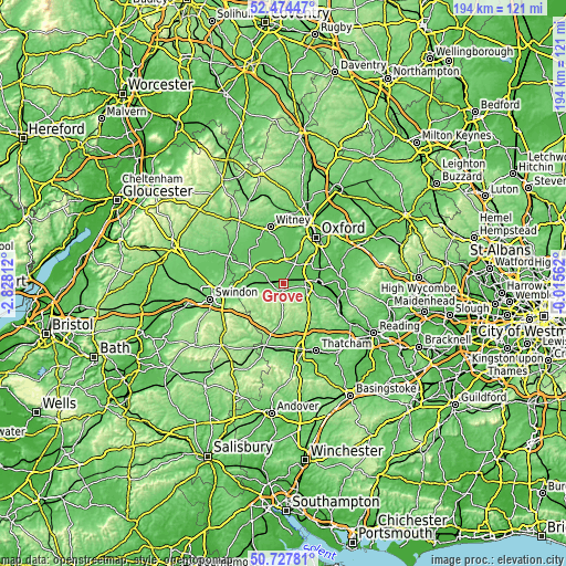
| \ | Map #1 | Map #2 | Topo.Map |
| Scale [m] | 59..146 m | 53..241 m | × |
| Scale [ft] | 194..479 ft | 174..791 ft | × |
| Average | 81 m = 266 ft | 95.3 m = 313 ft | × |
| Width | 6.07 km = 3.8 mi | 12.14 km = 7.5 mi | 194.2 km = 120.7 mi |
| Height | 6.07 km = 3.8 mi | 12.14 km = 7.5 mi | 194.2 km = 120.7 mi |
| ↑Max Latitude | 51.636823° | 51.664089° | 52.47447° |
| Latitude at center | 51.60954° | 51.60954° | 51.60954° |
| ↓Min Latitude | 51.582241° | 51.554926° | 50.72781° |
| ← Min Longitude | -1.465815° | -1.509761° | -2.82812° |
| Longitude center | -1.42187° | -1.42187° | -1.42187° |
| →Max Longitude | -1.377925° | -1.333979° | -0.01562° |
Nearby cities:
Cities around Grove sort by population:
• Abingdon elevation 57 m
11.8 km,  54°
54°
• Didcot 58 m
12.4 km,  90°
90°
• Wantage 95 m
2.4 km,  186°
186°
• Sutton Courtenay 53 m
10.6 km,  70°
70°
• Kingston Bagpuize 86 m
8 km,  0°
0°
• Stanford in the Vale 77 m
6.7 km,  299°
299°
• Harwell 80 m
9.1 km,  97°
97°
• Marcham 61 m
8.4 km,  40°
40°
• Steventon 64 m
7.1 km,  76°
76°
• East Hanney 63 m
3.3 km,  33°
33°
• West Ilsley 135 m
10.3 km,  138°
138°
• Farnborough 211 m
9.3 km,  155°
155°
Multilingual:
 En español:
Grove elevación 76 m.
 En France:
Grove élévation 76 m.


Sources and notes:
- [note 1] Map square and city borders are not equal. Map elevation data is calculated only from area inside that square.
- [src 1] Elevation data from geonames database provided with same terms of usage.
- [src 2] The elevation map of Grove is generated using elevation data from NASA's 3 arcsec (90m) resolution SRTM data.
- [src 3] Base (background) map © OpenStreetMap contributors tiles are generated by Geofabrik and OpenTopoMap.
Copyright & License:
This Grove Elevation Map is licensed under CC BY-SA. You may reuse any part from this page, if you give a proper credit by linking to this URL:
 More info on terms of use page.