Harrogate elevation
Harrogate (England, North Yorkshire), United Kingdom elevation is 127 meters and Harrogate elevation in feet is 417 ft above sea level [src 1]. Harrogate is a populated place (feature code) with elevation that is 55 meters (180 ft) bigger than average city elevation in United Kingdom.
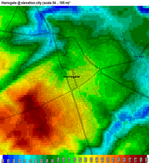
Below is the Elevation map of Harrogate, which displays elevation range with different colors. Scale of the first map is from 54 to 185 m (177 to 607 ft) with average elevation of 113.3 meters (=372 ft) [note 1]
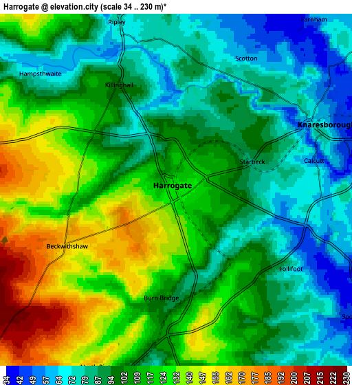
These maps also provides idea of topography and contour of this city, they are displayed at different zoom levels. More info about maps, scale and edge coordinates you can find below images.
| \ | Map #1 | Map #2 | Topo.Map |
| Scale [m] | 54..185 m | 34..230 m | × |
| Scale [ft] | 177..607 ft | 112..755 ft | × |
| Average | 113.3 m = 372 ft | 105.7 m = 347 ft | × |
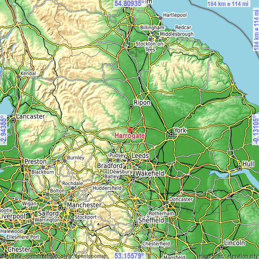
| Width | 5.75 km = 3.6 mi | 11.49 km = 7.1 mi | 183.9 km = 114.3 mi |
| Height | 5.75 km = 3.6 mi | 11.49 km = 7.1 mi | 183.8 km = 114.2 mi |
| ↑Max Latitude | 54.016608° | 54.04242° | 54.80935° |
| Latitude at center | 53.99078° | 53.99078° | 53.99078° |
| ↓Min Latitude | 53.964936° | 53.939076° | 53.15579° |
| ← Min Longitude | -1.581245° | -1.625191° | -2.94355° |
| Longitude center | -1.5373° | -1.5373° | -1.5373° |
| →Max Longitude | -1.493355° | -1.449409° | -0.13105° |
Nearby cities:
Cities around Harrogate sort by population:
• Knaresborough elevation 77 m
4.9 km,  65°
65°
• Otley 65 m
14 km,  227°
227°
• Wetherby 30 m
12.1 km,  125°
125°
• Boroughbridge 23 m
14.1 km,  39°
39°
• Bramhope 163 m
12.9 km,  203°
203°
• Collingham 22 m
12 km,  136°
136°
• Bardsey 73 m
13.2 km,  152°
152°
• Pannal 88 m
3.4 km,  178°
178°
• Pool 57 m
11.4 km,  207°
207°
• Stainburn 148 m
8.2 km,  219°
219°
• East Keswick 58 m
12.1 km, 152°
• Spofforth 45 m
7.1 km,  124°
124°
Multilingual:
 En español:
Harrogate elevación 127 m.
 En France:
Harrogate élévation 127 m.
 Auf Deutsch:
Harrogate höhe über dem Meeresspiegel ist 127 m.

Sources and notes:
- [note 1] Map square and city borders are not equal. Map elevation data is calculated only from area inside that square.
- [src 1] Elevation data from geonames database provided with same terms of usage.
- [src 2] The elevation map of Harrogate is generated using elevation data from NASA's 3 arcsec (90m) resolution SRTM data.
- [src 3] Base (background) map © OpenStreetMap contributors tiles are generated by Geofabrik and OpenTopoMap.
Copyright & License:
This Harrogate Elevation Map is licensed under CC BY-SA. You may reuse any part from this page, if you give a proper credit by linking to this URL:
 More info on terms of use page.