Otley elevation
Otley (England, City and Borough of Leeds), United Kingdom elevation is 65 meters and Otley elevation in feet is 213 ft above sea level [src 1]. Otley is a seat of a third-order administrative division (feature code) with elevation that is 7 meters (23 ft) smaller than average city elevation in United Kingdom.
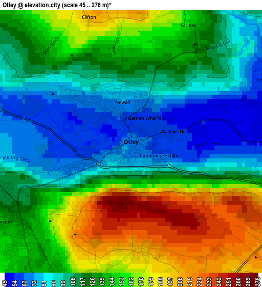
Below is the Elevation map of Otley, which displays elevation range with different colors. Scale of the first map is from 45 to 278 m (148 to 912 ft) with average elevation of 129.7 meters (=426 ft) [note 1]
These maps also provides idea of topography and contour of this city, they are displayed at different zoom levels. More info about maps, scale and edge coordinates you can find below images.
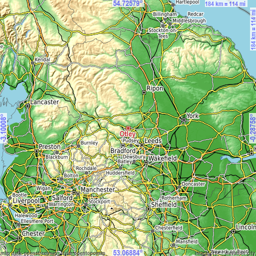
| \ | Map #1 | Map #2 | Topo.Map |
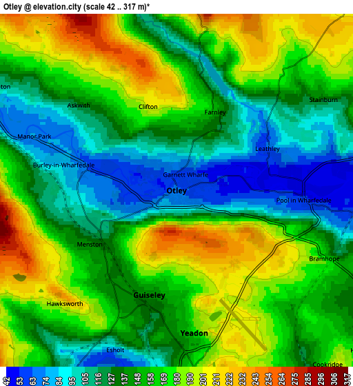
| Scale [m] | 45..278 m | 42..317 m | × |
| Scale [ft] | 148..912 ft | 138..1040 ft | × |
| Average | 129.7 m = 426 ft | 151 m = 495 ft | × |
| Width | 5.76 km = 3.6 mi | 11.51 km = 7.2 mi | 184.2 km = 114.5 mi |
| Height | 5.76 km = 3.6 mi | 11.51 km = 7.2 mi | 184.2 km = 114.5 mi |
| ↑Max Latitude | 53.931411° | 53.957276° | 54.72579° |
| Latitude at center | 53.90553° | 53.90553° | 53.90553° |
| ↓Min Latitude | 53.879633° | 53.85372° | 53.06884° |
| ← Min Longitude | -1.737775° | -1.781721° | -3.10008° |
| Longitude center | -1.69383° | -1.69383° | -1.69383° |
| →Max Longitude | -1.649885° | -1.605939° | -0.28758° |
Nearby cities:
Cities around Otley sort by population:
• Yeadon elevation 165 m
4.6 km,  174°
174°
• Shipley 93 m
9.3 km,  210°
210°
• Guiseley 140 m
3.5 km,  200°
200°
• Bingley 91 m
11.4 km,  236°
236°
• Horsforth 145 m
7.9 km,  152°
152°
• Baildon 155 m
9 km,  223°
223°
• Ilkley 102 m
8.7 km,  283°
283°
• Burley in Wharfedale 109 m
4.2 km, 277°
• Menston 144 m
3.7 km, 242°
• Bramhope 163 m
5.6 km,  114°
114°
• Pool 57 m
5.1 km,  96°
96°
• Stainburn 148 m
5.9 km,  58°
58°
Multilingual:
 En español:
Otley elevación 65 m.
 En France:
Otley élévation 65 m.


Sources and notes:
- [note 1] Map square and city borders are not equal. Map elevation data is calculated only from area inside that square.
- [src 1] Elevation data from geonames database provided with same terms of usage.
- [src 2] The elevation map of Otley is generated using elevation data from NASA's 3 arcsec (90m) resolution SRTM data.
- [src 3] Base (background) map © OpenStreetMap contributors tiles are generated by Geofabrik and OpenTopoMap.
Copyright & License:
This Otley Elevation Map is licensed under CC BY-SA. You may reuse any part from this page, if you give a proper credit by linking to this URL:
 More info on terms of use page.