Collingham elevation
Collingham (England, City and Borough of Leeds), United Kingdom elevation is 22 meters and Collingham elevation in feet is 72 ft above sea level [src 1]. Collingham is a seat of a third-order administrative division (feature code) with elevation that is 50 meters (164 ft) smaller than average city elevation in United Kingdom.
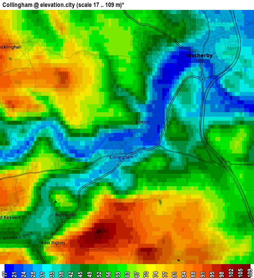
Below is the Elevation map of Collingham, which displays elevation range with different colors. Scale of the first map is from 17 to 109 m (56 to 358 ft) with average elevation of 56.9 meters (=187 ft) [note 1]
These maps also provides idea of topography and contour of this city, they are displayed at different zoom levels. More info about maps, scale and edge coordinates you can find below images.
| \ | Map #1 | Topo.Map |
| Scale [m] | 17..109 m | × |
| Scale [ft] | 56..358 ft | × |
| Average | 56.9 m = 187 ft | × |
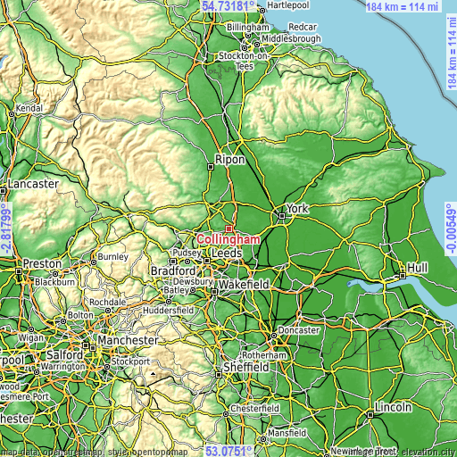
| Width | 5.76 km = 3.6 mi | 184.2 km = 114.5 mi |
| Height | 5.76 km = 3.6 mi | 184.2 km = 114.5 mi |
| ↑Max Latitude | 53.937547° | 54.73181° |
| Latitude at center | 53.91167° | 53.91167° |
| ↓Min Latitude | 53.885777° | 53.0751° |
| ← Min Longitude | -1.455685° | -2.81799° |
| Longitude center | -1.41174° | -1.41174° |
| →Max Longitude | -1.367795° | -0.00549° |
Nearby cities:
Cities around Collingham sort by population:
• Wetherby elevation 30 m
2.5 km,  41°
41°
• Boston Spa 29 m
4.4 km,  100°
100°
• Bardsey 73 m
3.7 km,  216°
216°
• Bramham 35 m
5.1 km,  132°
132°
• Thorp Arch 25 m
6 km,  85°
85°
• Thorner 87 m
5.7 km,  189°
189°
• Shadwell 127 m
7.5 km,  212°
212°
• East Keswick 58 m
3.3 km,  233°
233°
• Scarcroft 123 m
5.6 km, 206°
• Spofforth 45 m
5.3 km,  333°
333°
• Walton 35 m
5.7 km,  74°
74°
• Clifford 28 m
4.7 km,  112°
112°
Multilingual:
 En español:
Collingham elevación 22 m.
 En France:
Collingham élévation 22 m.
 Auf Deutsch:
Collingham höhe über dem Meeresspiegel ist 22 m.

Sources and notes:
- [note 1] Map square and city borders are not equal. Map elevation data is calculated only from area inside that square.
- [src 1] Elevation data from geonames database provided with same terms of usage.
- [src 2] The elevation map of Collingham is generated using elevation data from NASA's 3 arcsec (90m) resolution SRTM data.
- [src 3] Base (background) map © OpenStreetMap contributors tiles are generated by Geofabrik and OpenTopoMap.
Copyright & License:
This Collingham Elevation Map is licensed under CC BY-SA. You may reuse any part from this page, if you give a proper credit by linking to this URL:
 More info on terms of use page.