Lyneham elevation
Lyneham (England, Wiltshire), United Kingdom elevation is 120 meters and Lyneham elevation in feet is 394 ft above sea level [src 1]. Lyneham is a populated place (feature code) with elevation that is 48 meters (157 ft) bigger than average city elevation in United Kingdom.
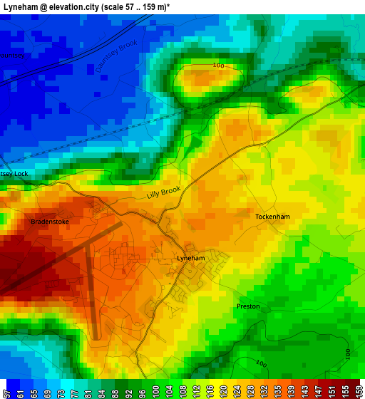
Below is the Elevation map of Lyneham, which displays elevation range with different colors. Scale of the first map is from 57 to 159 m (187 to 522 ft) with average elevation of 103.5 meters (=340 ft) [note 1]
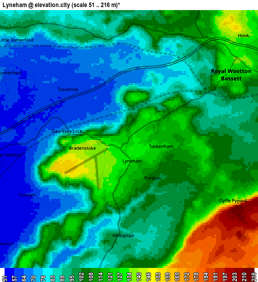
These maps also provides idea of topography and contour of this city, they are displayed at different zoom levels. More info about maps, scale and edge coordinates you can find below images.
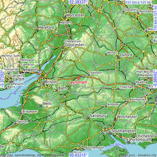
| \ | Map #1 | Map #2 | Topo.Map |
| Scale [m] | 57..159 m | 51..216 m | × |
| Scale [ft] | 187..522 ft | 167..709 ft | × |
| Average | 103.5 m = 340 ft | 99 m = 325 ft | × |
| Width | 6.08 km = 3.8 mi | 12.16 km = 7.6 mi | 194.6 km = 120.9 mi |
| Height | 6.08 km = 3.8 mi | 12.16 km = 7.6 mi | 194.6 km = 120.9 mi |
| ↑Max Latitude | 51.544008° | 51.57133° | 52.38337° |
| Latitude at center | 51.51667° | 51.51667° | 51.51667° |
| ↓Min Latitude | 51.489315° | 51.461944° | 50.63315° |
| ← Min Longitude | -2.010615° | -2.054561° | -3.37292° |
| Longitude center | -1.96667° | -1.96667° | -1.96667° |
| →Max Longitude | -1.922725° | -1.878779° | -0.56042° |
Nearby cities:
Cities around Lyneham sort by population:
• Calne elevation 77 m
9.1 km,  197°
197°
• Royal Wootton Bassett 129 m
5.1 km,  56°
56°
• Wroughton 118 m
11.9 km,  86°
86°
• Malmesbury 82 m
11.6 km,  308°
308°
• Purton 105 m
10.3 km,  38°
38°
• Sutton Benger 58 m
7.9 km,  262°
262°
• Lydiard Millicent 121 m
9.4 km,  49°
49°
• Minety 91 m
11.2 km,  5°
5°
• Leigh 91 m
12 km,  22°
22°
• Charlton 92 m
11.1 km,  325°
325°
• Lydiard Tregoze 117 m
8.9 km,  65°
65°
• Bremhill 101 m
8 km,  213°
213°
Multilingual:
 En español:
Lyneham elevación 120 m.
 En France:
Lyneham élévation 120 m.


Sources and notes:
- [note 1] Map square and city borders are not equal. Map elevation data is calculated only from area inside that square.
- [src 1] Elevation data from geonames database provided with same terms of usage.
- [src 2] The elevation map of Lyneham is generated using elevation data from NASA's 3 arcsec (90m) resolution SRTM data.
- [src 3] Base (background) map © OpenStreetMap contributors tiles are generated by Geofabrik and OpenTopoMap.
Copyright & License:
This Lyneham Elevation Map is licensed under CC BY-SA. You may reuse any part from this page, if you give a proper credit by linking to this URL:
 More info on terms of use page.