Neston elevation
Neston (England, Cheshire West and Chester), United Kingdom elevation is 49 meters and Neston elevation in feet is 161 ft above sea level [src 1]. Neston is a seat of a third-order administrative division (feature code) with elevation that is 23 meters (75 ft) smaller than average city elevation in United Kingdom.
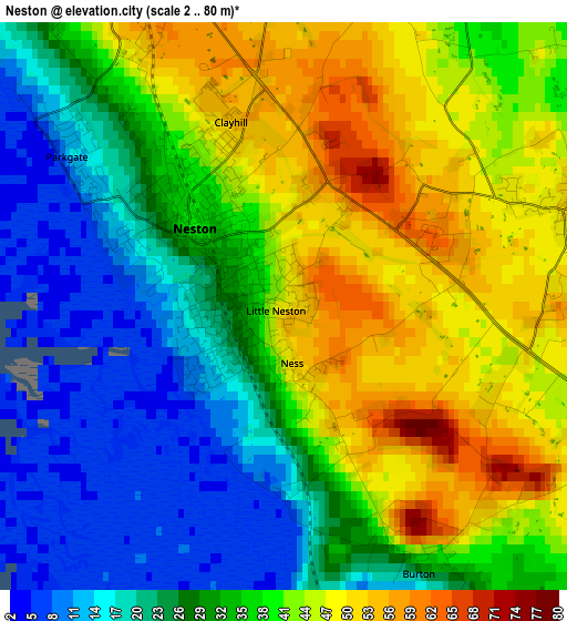
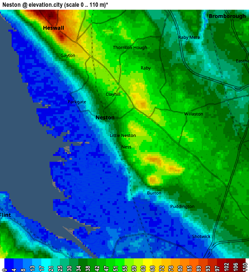
Below is the Elevation map of Neston, which displays elevation range with different colors. Scale of the first map is from 2 to 80 m (7 to 262 ft) with average elevation of 34.2 meters (=112 ft) [note 1]
These maps also provides idea of topography and contour of this city, they are displayed at different zoom levels. More info about maps, scale and edge coordinates you can find below images.
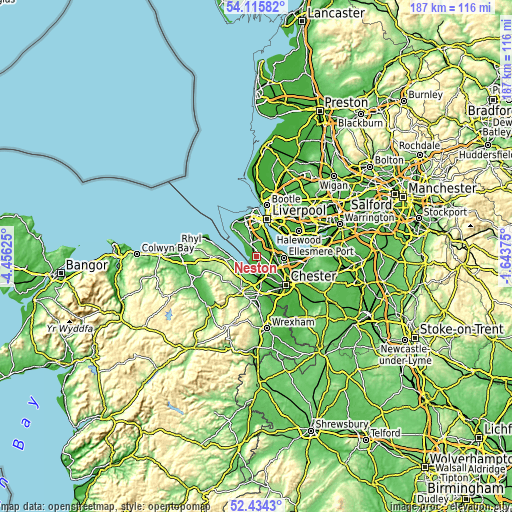
| \ | Map #1 | Map #2 | Topo.Map |
| Scale [m] | 2..80 m | 0..110 m | × |
| Scale [ft] | 7..262 ft | 0..361 ft | × |
| Average | 34.2 m = 112 ft | 31.2 m = 102 ft | × |
| Width | 5.84 km = 3.6 mi | 11.69 km = 7.3 mi | 187 km = 116.2 mi |
| Height | 5.84 km = 3.6 mi | 11.69 km = 7.3 mi | 187 km = 116.2 mi |
| ↑Max Latitude | 53.309595° | 53.335844° | 54.11582° |
| Latitude at center | 53.28333° | 53.28333° | 53.28333° |
| ↓Min Latitude | 53.257049° | 53.230752° | 52.4343° |
| ← Min Longitude | -3.093945° | -3.137891° | -4.45625° |
| Longitude center | -3.05° | -3.05° | -3.05° |
| →Max Longitude | -3.006055° | -2.962109° | -1.64375° |
Nearby cities:
Cities around Neston sort by population:
• Deeside elevation 28 m
9.2 km,  175°
175°
• Heswall 88 m
5.8 km,  327°
327°
• Flint 29 m
6.9 km,  232°
232°
• Bebington 43 m
7.7 km,  16°
16°
• Bromborough 12 m
8.6 km,  32°
32°
• New Ferry 24 m
9.4 km, 23°
• Willaston 40 m
3.8 km,  68°
68°
• Bagillt 22 m
7.9 km,  255°
255°
• Saughall 27 m
8.9 km,  135°
135°
• Queensferry 25 m
9.3 km,  173°
173°
• Shotwick 15 m
6.3 km, 141°
• Ledsham 45 m
5.8 km,  108°
108°
Multilingual:
 En español:
Neston elevación 49 m.
 En France:
Neston élévation 49 m.


Sources and notes:
- [note 1] Map square and city borders are not equal. Map elevation data is calculated only from area inside that square.
- [src 1] Elevation data from geonames database provided with same terms of usage.
- [src 2] The elevation map of Neston is generated using elevation data from NASA's 3 arcsec (90m) resolution SRTM data.
- [src 3] Base (background) map © OpenStreetMap contributors tiles are generated by Geofabrik and OpenTopoMap.
Copyright & License:
This Neston Elevation Map is licensed under CC BY-SA. You may reuse any part from this page, if you give a proper credit by linking to this URL:
 More info on terms of use page.