Bebington elevation
Bebington (England, Metropolitan Borough of Wirral), United Kingdom elevation is 43 meters and Bebington elevation in feet is 141 ft above sea level [src 1]. Bebington is a populated place (feature code) with elevation that is 29 meters (95 ft) smaller than average city elevation in United Kingdom.
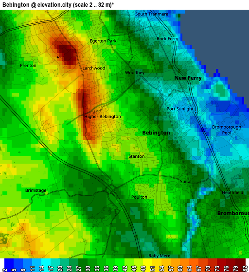
Below is the Elevation map of Bebington, which displays elevation range with different colors. Scale of the first map is from 2 to 82 m (7 to 269 ft) with average elevation of 35.7 meters (=117 ft) [note 1]
These maps also provides idea of topography and contour of this city, they are displayed at different zoom levels. More info about maps, scale and edge coordinates you can find below images.
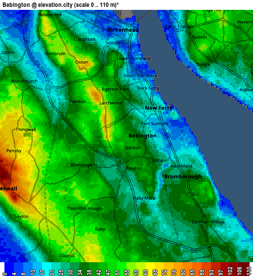
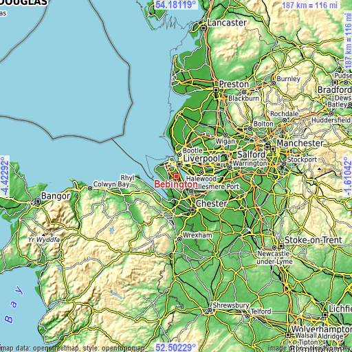
| \ | Map #1 | Map #2 | Topo.Map |
| Scale [m] | 2..82 m | 0..110 m | × |
| Scale [ft] | 7..269 ft | 0..361 ft | × |
| Average | 35.7 m = 117 ft | 37.1 m = 122 ft | × |
| Width | 5.83 km = 3.6 mi | 11.67 km = 7.3 mi | 186.7 km = 116 mi |
| Height | 5.83 km = 3.6 mi | 11.67 km = 7.3 mi | 186.7 km = 116 mi |
| ↑Max Latitude | 53.376224° | 53.402432° | 54.18119° |
| Latitude at center | 53.35° | 53.35° | 53.35° |
| ↓Min Latitude | 53.32376° | 53.297504° | 52.50229° |
| ← Min Longitude | -3.060615° | -3.104561° | -4.42292° |
| Longitude center | -3.01667° | -3.01667° | -3.01667° |
| →Max Longitude | -2.972725° | -2.928779° | -1.61042° |
Nearby cities:
Cities around Bebington sort by population:
• Liverpool elevation 30 m
7.2 km,  20°
20°
• Birkenhead 22 m
4.8 km,  1°
1°
• Wallasey 14 m
8.8 km,  338°
338°
• Heswall 88 m
5.9 km,  244°
244°
• Moreton 13 m
8.7 km,  309°
309°
• Neston 49 m
7.7 km,  196°
196°
• Bromborough 12 m
2.5 km,  93°
93°
• Prenton 39 m
3.2 km, 307°
• Greasby 36 m
7.5 km,  289°
289°
• New Ferry 24 m
1.9 km,  52°
52°
• Willaston 40 m
6.2 km,  168°
168°
• Ledsham 45 m
9.8 km,  160°
160°
Multilingual:
 En español:
Bebington elevación 43 m.
 En France:
Bebington élévation 43 m.
 Auf Deutsch:
Bebington höhe über dem Meeresspiegel ist 43 m.

Sources and notes:
- [note 1] Map square and city borders are not equal. Map elevation data is calculated only from area inside that square.
- [src 1] Elevation data from geonames database provided with same terms of usage.
- [src 2] The elevation map of Bebington is generated using elevation data from NASA's 3 arcsec (90m) resolution SRTM data.
- [src 3] Base (background) map © OpenStreetMap contributors tiles are generated by Geofabrik and OpenTopoMap.
Copyright & License:
This Bebington Elevation Map is licensed under CC BY-SA. You may reuse any part from this page, if you give a proper credit by linking to this URL:
 More info on terms of use page.