Newent elevation
Newent (England, Gloucestershire), United Kingdom elevation is 41 meters and Newent elevation in feet is 135 ft above sea level [src 1]. Newent is a populated place (feature code) with elevation that is 31 meters (102 ft) smaller than average city elevation in United Kingdom.
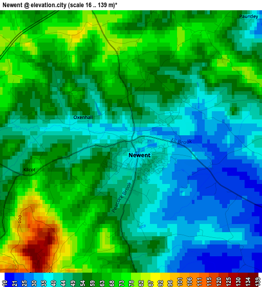
Below is the Elevation map of Newent, which displays elevation range with different colors. Scale of the first map is from 16 to 139 m (52 to 456 ft) with average elevation of 54.3 meters (=178 ft) [note 1]
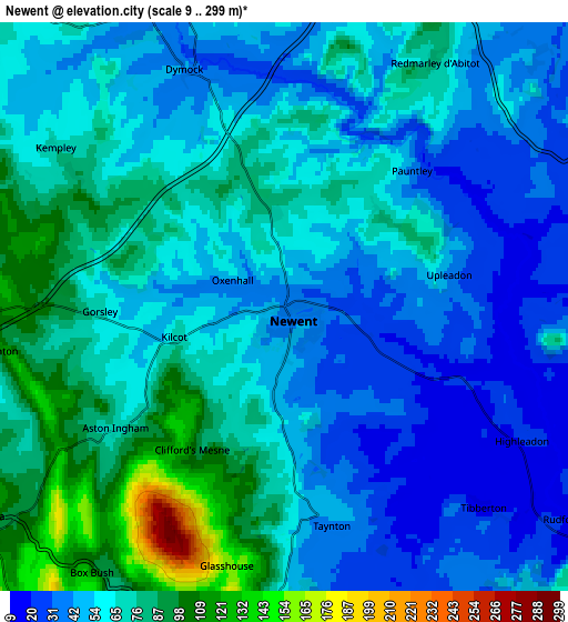
These maps also provides idea of topography and contour of this city, they are displayed at different zoom levels. More info about maps, scale and edge coordinates you can find below images.
| \ | Map #1 | Map #2 | Topo.Map |
| Scale [m] | 16..139 m | 9..299 m | × |
| Scale [ft] | 52..456 ft | 30..981 ft | × |
| Average | 54.3 m = 178 ft | 60.2 m = 198 ft | × |
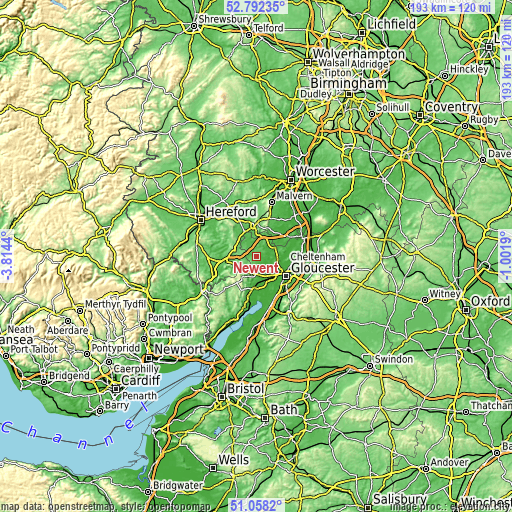
| Width | 6.03 km = 3.7 mi | 12.05 km = 7.5 mi | 192.8 km = 119.8 mi |
| Height | 6.03 km = 3.7 mi | 12.05 km = 7.5 mi | 192.8 km = 119.8 mi |
| ↑Max Latitude | 51.960737° | 51.987808° | 52.79235° |
| Latitude at center | 51.93365° | 51.93365° | 51.93365° |
| ↓Min Latitude | 51.906546° | 51.879426° | 51.0582° |
| ← Min Longitude | -2.452095° | -2.496041° | -3.8144° |
| Longitude center | -2.40815° | -2.40815° | -2.40815° |
| →Max Longitude | -2.364205° | -2.320259° | -1.0019° |
Nearby cities:
Cities around Newent sort by population:
• Ross on Wye elevation 39 m
11 km,  260°
260°
• Ledbury 67 m
11.5 km,  353°
353°
• Mitcheldean 154 m
9.5 km,  215°
215°
• Ruardean 217 m
13.1 km,  228°
228°
• Drybrook 194 m
11.4 km, 220°
• Corse 27 m
7.5 km,  67°
67°
• Huntley 53 m
6.9 km,  176°
176°
• Longhope 72 m
8 km,  201°
201°
• Yatton 134 m
9.3 km,  293°
293°
• Donnington 60 m
7.4 km,  355°
355°
• Lea 112 m
7.3 km,  239°
239°
• Linton 110 m
6.1 km, 261°
Multilingual:
 En español:
Newent elevación 41 m.
 En France:
Newent élévation 41 m.


Sources and notes:
- [note 1] Map square and city borders are not equal. Map elevation data is calculated only from area inside that square.
- [src 1] Elevation data from geonames database provided with same terms of usage.
- [src 2] The elevation map of Newent is generated using elevation data from NASA's 3 arcsec (90m) resolution SRTM data.
- [src 3] Base (background) map © OpenStreetMap contributors tiles are generated by Geofabrik and OpenTopoMap.
Copyright & License:
This Newent Elevation Map is licensed under CC BY-SA. You may reuse any part from this page, if you give a proper credit by linking to this URL:
 More info on terms of use page.