Northallerton elevation
Northallerton (England, North Yorkshire), United Kingdom elevation is 43 meters and Northallerton elevation in feet is 141 ft above sea level [src 1]. Northallerton is a seat of a second-order administrative division (feature code) with elevation that is 29 meters (95 ft) smaller than average city elevation in United Kingdom.
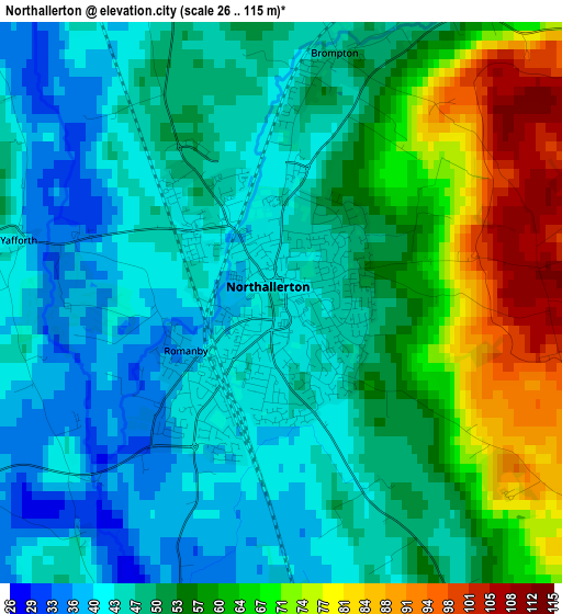
Below is the Elevation map of Northallerton, which displays elevation range with different colors. Scale of the first map is from 26 to 115 m (85 to 377 ft) with average elevation of 52.9 meters (=174 ft) [note 1]
These maps also provides idea of topography and contour of this city, they are displayed at different zoom levels. More info about maps, scale and edge coordinates you can find below images.
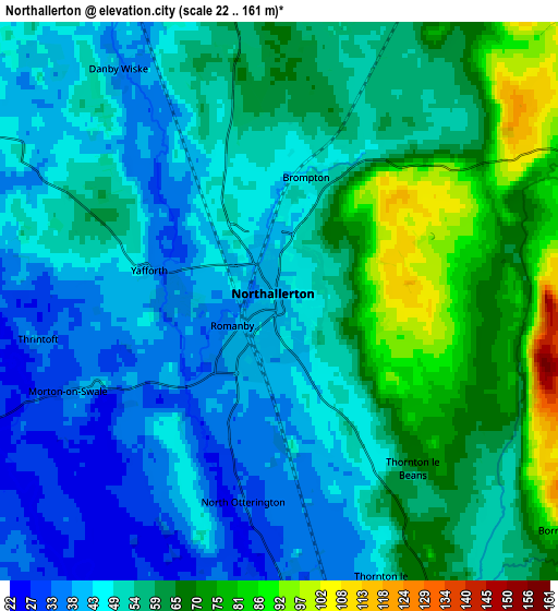
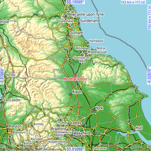
| \ | Map #1 | Map #2 | Topo.Map |
| Scale [m] | 26..115 m | 22..161 m | × |
| Scale [ft] | 85..377 ft | 72..528 ft | × |
| Average | 52.9 m = 174 ft | 54.3 m = 178 ft | × |
| Width | 5.7 km = 3.5 mi | 11.39 km = 7.1 mi | 182.3 km = 113.3 mi |
| Height | 5.7 km = 3.5 mi | 11.39 km = 7.1 mi | 182.3 km = 113.3 mi |
| ↑Max Latitude | 54.364622° | 54.390217° | 55.15069° |
| Latitude at center | 54.33901° | 54.33901° | 54.33901° |
| ↓Min Latitude | 54.313382° | 54.287739° | 53.51098° |
| ← Min Longitude | -1.476375° | -1.520321° | -2.83868° |
| Longitude center | -1.43243° | -1.43243° | -1.43243° |
| →Max Longitude | -1.388485° | -1.344539° | -0.02618° |
Nearby cities:
Cities around Northallerton sort by population:
• Yarm elevation 24 m
18.9 km,  14°
14°
• Catterick Garrison 147 m
19.3 km,  282°
282°
• Thirsk 37 m
13.1 km,  154°
154°
• Richmond 110 m
20.8 km,  290°
290°
• Stokesley 69 m
21.3 km,  46°
46°
• Bedale 43 m
11.8 km,  241°
241°
• Catterick 56 m
13.6 km, 287°
• Brompton 46 m
2.4 km, 12°
• Bilsdale 300 m
20.7 km,  79°
79°
• Masham 87 m
19.5 km,  228°
228°
• Scorton 56 m
13.4 km,  299°
299°
• Hurworth 37 m
18 km,  338°
338°
Multilingual:
 En español:
Northallerton elevación 43 m.
 En France:
Northallerton élévation 43 m.
 Auf Deutsch:
Northallerton höhe über dem Meeresspiegel ist 43 m.

Sources and notes:
- [note 1] Map square and city borders are not equal. Map elevation data is calculated only from area inside that square.
- [src 1] Elevation data from geonames database provided with same terms of usage.
- [src 2] The elevation map of Northallerton is generated using elevation data from NASA's 3 arcsec (90m) resolution SRTM data.
- [src 3] Base (background) map © OpenStreetMap contributors tiles are generated by Geofabrik and OpenTopoMap.
Copyright & License:
This Northallerton Elevation Map is licensed under CC BY-SA. You may reuse any part from this page, if you give a proper credit by linking to this URL:
 More info on terms of use page.