Hurworth elevation
Hurworth (England, Darlington), United Kingdom elevation is 37 meters and Hurworth elevation in feet is 121 ft above sea level [src 1]. Hurworth is a seat of a third-order administrative division (feature code) with elevation that is 35 meters (115 ft) smaller than average city elevation in United Kingdom.
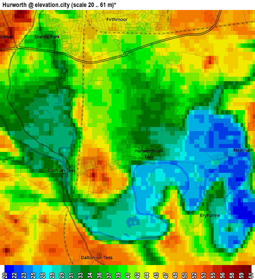
Below is the Elevation map of Hurworth, which displays elevation range with different colors. Scale of the first map is from 20 to 61 m (66 to 200 ft) with average elevation of 38.7 meters (=127 ft) [note 1]
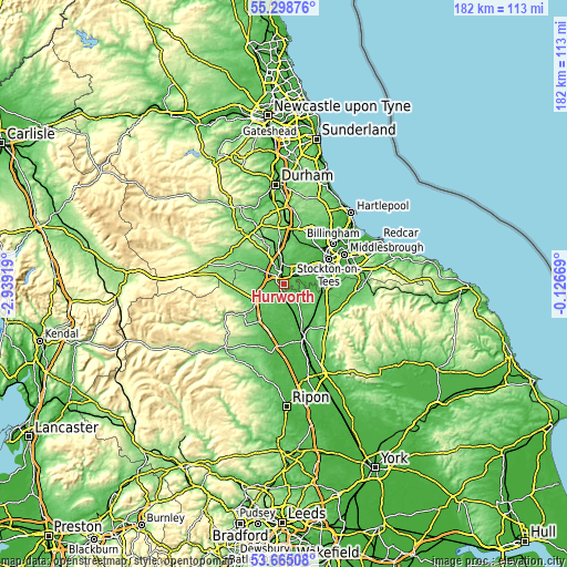
These maps also provides idea of topography and contour of this city, they are displayed at different zoom levels. More info about maps, scale and edge coordinates you can find below images.
| \ | Map #1 | Topo.Map |
| Scale [m] | 20..61 m | × |
| Scale [ft] | 66..200 ft | × |
| Average | 38.7 m = 127 ft | × |
| Width | 5.68 km = 3.5 mi | 181.6 km = 112.8 mi |
| Height | 5.68 km = 3.5 mi | 181.6 km = 112.8 mi |
| ↑Max Latitude | 54.515597° | 55.29876° |
| Latitude at center | 54.49008° | 54.49008° |
| ↓Min Latitude | 54.464547° | 53.66508° |
| ← Min Longitude | -1.576885° | -2.93919° |
| Longitude center | -1.53294° | -1.53294° |
| →Max Longitude | -1.488995° | -0.12669° |
Nearby cities:
Cities around Hurworth sort by population:
• Darlington elevation 40 m
4 km,  343°
343°
• Yarm 24 m
11.4 km,  82°
82°
• Eaglescliffe 28 m
12.4 km,  71°
71°
• Heighington 145 m
13 km, 335°
• Scorton 56 m
11.5 km,  206°
206°
• Summerhouse 86 m
13.2 km,  310°
310°
• Elton 19 m
12.6 km,  58°
58°
• Bishopton 45 m
12.2 km,  31°
31°
• Denton 86 m
12.1 km, 314°
• Walworth 93 m
11.4 km,  318°
318°
• Coatham Mundeville 74 m
10.1 km,  351°
351°
• High Coniscliffe 59 m
9 km,  302°
302°
Multilingual:
 En español:
Hurworth elevación 37 m.
 En France:
Hurworth élévation 37 m.


Sources and notes:
- [note 1] Map square and city borders are not equal. Map elevation data is calculated only from area inside that square.
- [src 1] Elevation data from geonames database provided with same terms of usage.
- [src 2] The elevation map of Hurworth is generated using elevation data from NASA's 3 arcsec (90m) resolution SRTM data.
- [src 3] Base (background) map © OpenStreetMap contributors tiles are generated by Geofabrik and OpenTopoMap.
Copyright & License:
This Hurworth Elevation Map is licensed under CC BY-SA. You may reuse any part from this page, if you give a proper credit by linking to this URL:
 More info on terms of use page.