Stokesley elevation
Stokesley (England, North Yorkshire), United Kingdom elevation is 69 meters and Stokesley elevation in feet is 226 ft above sea level [src 1]. Stokesley is a populated place (feature code) with elevation that is 3 meters (10 ft) smaller than average city elevation in United Kingdom.
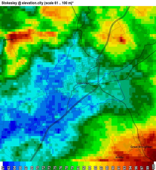
Below is the Elevation map of Stokesley, which displays elevation range with different colors. Scale of the first map is from 61 to 100 m (200 to 328 ft) with average elevation of 74.8 meters (=245 ft) [note 1]
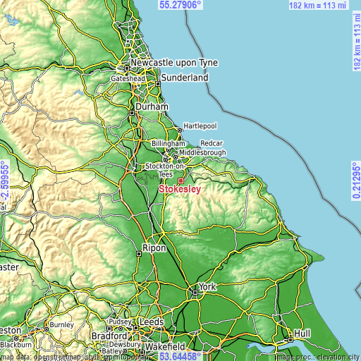
These maps also provides idea of topography and contour of this city, they are displayed at different zoom levels. More info about maps, scale and edge coordinates you can find below images.
| \ | Map #1 | Map #2 | Topo.Map |
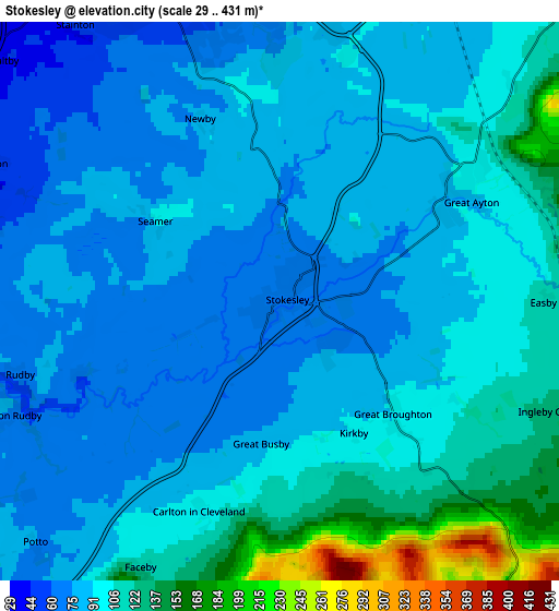
| Scale [m] | 61..100 m | 29..431 m | × |
| Scale [ft] | 200..328 ft | 95..1414 ft | × |
| Average | 74.8 m = 245 ft | 96.8 m = 318 ft | × |
| Width | 5.68 km = 3.5 mi | 11.36 km = 7.1 mi | 181.7 km = 112.9 mi |
| Height | 5.68 km = 3.5 mi | 11.36 km = 7.1 mi | 181.7 km = 112.9 mi |
| ↑Max Latitude | 54.49551° | 54.521024° | 55.27906° |
| Latitude at center | 54.46998° | 54.46998° | 54.46998° |
| ↓Min Latitude | 54.444434° | 54.418872° | 53.64458° |
| ← Min Longitude | -1.237245° | -1.281191° | -2.59955° |
| Longitude center | -1.1933° | -1.1933° | -1.1933° |
| →Max Longitude | -1.149355° | -1.105409° | 0.21295° |
Nearby cities:
Cities around Stokesley sort by population:
• Middlesbrough elevation 15 m
12.1 km,  347°
347°
• Stockton-on-Tees 15 m
13.6 km,  323°
323°
• Thornaby-on-Tees 20 m
9.9 km, 315°
• Yarm 24 m
11.3 km,  289°
289°
• Guisborough 95 m
11.4 km,  50°
50°
• Ingleby Greenhow 128 m
6 km,  111°
111°
• Eaglescliffe 28 m
11.9 km,  301°
301°
• Great Ayton 93 m
4.4 km,  57°
57°
• Bilsdale 300 m
11.7 km,  155°
155°
• Elton 19 m
14.3 km,  308°
308°
• South Bank 22 m
11.1 km,  14°
14°
• Nunthorpe 76 m
6.6 km, 5°
Multilingual:
 En español:
Stokesley elevación 69 m.
 En France:
Stokesley élévation 69 m.
 Auf Deutsch:
Stokesley höhe über dem Meeresspiegel ist 69 m.

Sources and notes:
- [note 1] Map square and city borders are not equal. Map elevation data is calculated only from area inside that square.
- [src 1] Elevation data from geonames database provided with same terms of usage.
- [src 2] The elevation map of Stokesley is generated using elevation data from NASA's 3 arcsec (90m) resolution SRTM data.
- [src 3] Base (background) map © OpenStreetMap contributors tiles are generated by Geofabrik and OpenTopoMap.
Copyright & License:
This Stokesley Elevation Map is licensed under CC BY-SA. You may reuse any part from this page, if you give a proper credit by linking to this URL:
 More info on terms of use page.