Randalstown elevation
Randalstown (Northern Ireland, Antrim and Newtownabbey), United Kingdom elevation is 40 meters and Randalstown elevation in feet is 131 ft above sea level [src 1]. Randalstown is a populated place (feature code) with elevation that is 32 meters (105 ft) smaller than average city elevation in United Kingdom.
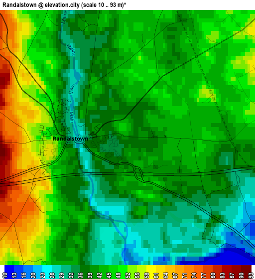
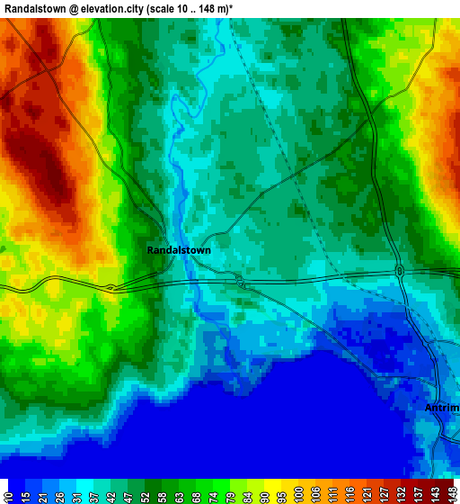
Below is the Elevation map of Randalstown, which displays elevation range with different colors. Scale of the first map is from 10 to 93 m (33 to 305 ft) with average elevation of 43.2 meters (=142 ft) [note 1]
These maps also provides idea of topography and contour of this city, they are displayed at different zoom levels. More info about maps, scale and edge coordinates you can find below images.
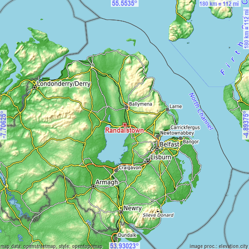
| \ | Map #1 | Map #2 | Topo.Map |
| Scale [m] | 10..93 m | 10..148 m | × |
| Scale [ft] | 33..305 ft | 33..486 ft | × |
| Average | 43.2 m = 142 ft | 52.8 m = 173 ft | × |
| Width | 5.64 km = 3.5 mi | 11.28 km = 7 mi | 180.5 km = 112.2 mi |
| Height | 5.64 km = 3.5 mi | 11.28 km = 7 mi | 180.5 km = 112.2 mi |
| ↑Max Latitude | 54.775355° | 54.800694° | 55.5535° |
| Latitude at center | 54.75° | 54.75° | 54.75° |
| ↓Min Latitude | 54.724629° | 54.699243° | 53.93023° |
| ← Min Longitude | -6.343945° | -6.387891° | -7.70625° |
| Longitude center | -6.3° | -6.3° | -6.3° |
| →Max Longitude | -6.256055° | -6.212109° | -4.89375° |
Nearby cities:
Cities around Randalstown sort by population:
• Ballymena elevation 49 m
12.7 km,  6°
6°
• Antrim 42 m
8.5 km,  130°
130°
• Crumlin 73 m
15.4 km,  159°
159°
• Ahoghill 85 m
13.7 km,  341°
341°
• Broughshane 65 m
16.9 km,  20°
20°
• Cullybackey 72 m
15.7 km,  348°
348°
• Castledawson 33 m
17.1 km,  280°
280°
• Connor 100 m
8.5 km,  49°
49°
• Templepatrick 145 m
15.8 km,  118°
118°
• Portglenone 32 m
17.4 km,  320°
320°
• Doagh 141 m
13.9 km,  90°
90°
• Bellaghy 26 m
15.5 km,  294°
294°
Multilingual:
 En español:
Randalstown elevación 40 m.
 En France:
Randalstown élévation 40 m.
 Auf Deutsch:
Randalstown höhe über dem Meeresspiegel ist 40 m.

Sources and notes:
- [note 1] Map square and city borders are not equal. Map elevation data is calculated only from area inside that square.
- [src 1] Elevation data from geonames database provided with same terms of usage.
- [src 2] The elevation map of Randalstown is generated using elevation data from NASA's 3 arcsec (90m) resolution SRTM data.
- [src 3] Base (background) map © OpenStreetMap contributors tiles are generated by Geofabrik and OpenTopoMap.
Copyright & License:
This Randalstown Elevation Map is licensed under CC BY-SA. You may reuse any part from this page, if you give a proper credit by linking to this URL:
 More info on terms of use page.