Rhosllanerchrugog elevation
Rhosllanerchrugog (Wales, Wrexham), United Kingdom elevation is 175 meters and Rhosllanerchrugog elevation in feet is 574 ft above sea level [src 1]. Rhosllanerchrugog is a populated place (feature code) with elevation that is 103 meters (338 ft) bigger than average city elevation in United Kingdom.
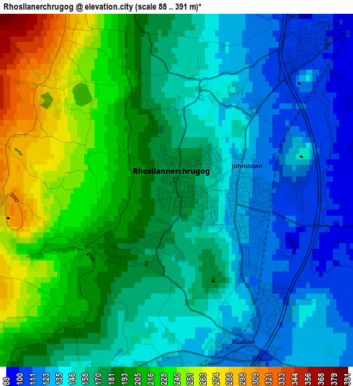
Below is the Elevation map of Rhosllanerchrugog, which displays elevation range with different colors. Scale of the first map is from 88 to 391 m (289 to 1283 ft) with average elevation of 174.7 meters (=573 ft) [note 1]
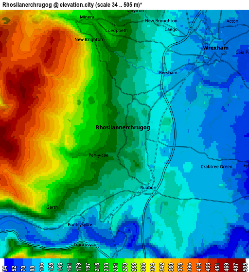
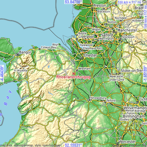
These maps also provides idea of topography and contour of this city, they are displayed at different zoom levels. More info about maps, scale and edge coordinates you can find below images.
| \ | Map #1 | Map #2 | Topo.Map |
| Scale [m] | 88..391 m | 34..505 m | × |
| Scale [ft] | 289..1283 ft | 112..1657 ft | × |
| Average | 174.7 m = 573 ft | 187.7 m = 616 ft | × |
| Width | 5.88 km = 3.7 mi | 11.76 km = 7.3 mi | 188.2 km = 116.9 mi |
| Height | 5.88 km = 3.7 mi | 11.76 km = 7.3 mi | 188.1 km = 116.9 mi |
| ↑Max Latitude | 53.036173° | 53.06259° | 53.84758° |
| Latitude at center | 53.00974° | 53.00974° | 53.00974° |
| ↓Min Latitude | 52.983291° | 52.956826° | 52.15531° |
| ← Min Longitude | -3.102085° | -3.146031° | -4.46439° |
| Longitude center | -3.05814° | -3.05814° | -3.05814° |
| →Max Longitude | -3.014195° | -2.970249° | -1.65189° |
Nearby cities:
Cities around Rhosllanerchrugog sort by population:
• Wrexham elevation 87 m
6.1 km,  47°
47°
• Brymbo 248 m
6.4 km,  354°
354°
• Coedpoeth 205 m
4.9 km,  356°
356°
• Gresford 76 m
10.2 km,  34°
34°
• Hope 87 m
12 km,  7°
7°
• Caergwrle 91 m
11.2 km, 6°
• Chirk 107 m
8.2 km,  179°
179°
• Llangollen 99 m
8.9 km,  238°
238°
• Ruabon 120 m
2.8 km,  152°
152°
• Marchwiel 64 m
6.7 km,  76°
76°
• Overton 67 m
9.6 km,  119°
119°
• Llandegla 271 m
10.9 km,  300°
300°
Multilingual:
 En español:
Rhosllanerchrugog elevación 175 m.
 En France:
Rhosllanerchrugog élévation 175 m.
 Auf Deutsch:
Rhosllanerchrugog höhe über dem Meeresspiegel ist 175 m.

Sources and notes:
- [note 1] Map square and city borders are not equal. Map elevation data is calculated only from area inside that square.
- [src 1] Elevation data from geonames database provided with same terms of usage.
- [src 2] The elevation map of Rhosllanerchrugog is generated using elevation data from NASA's 3 arcsec (90m) resolution SRTM data.
- [src 3] Base (background) map © OpenStreetMap contributors tiles are generated by Geofabrik and OpenTopoMap.
Copyright & License:
This Rhosllanerchrugog Elevation Map is licensed under CC BY-SA. You may reuse any part from this page, if you give a proper credit by linking to this URL:
 More info on terms of use page.