Rickmansworth elevation
Rickmansworth (England, Hertfordshire), United Kingdom elevation is 53 meters and Rickmansworth elevation in feet is 174 ft above sea level [src 1]. Rickmansworth is a populated place (feature code) with elevation that is 19 meters (62 ft) smaller than average city elevation in United Kingdom.
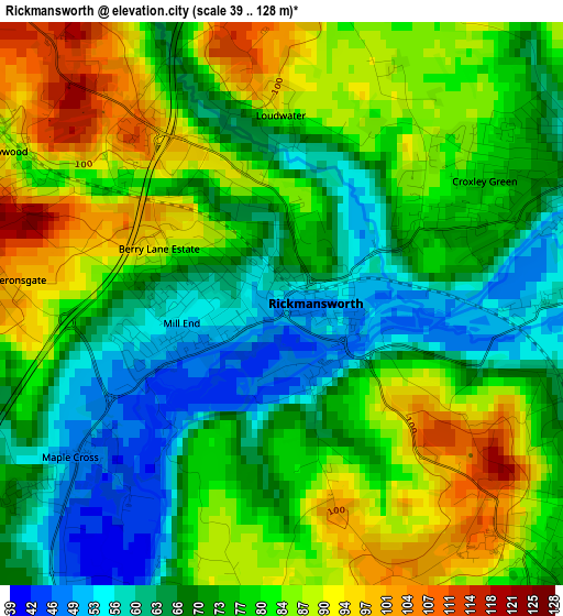
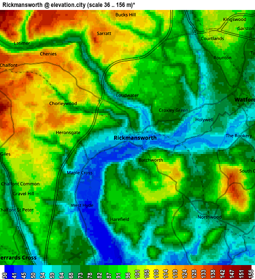
Below is the Elevation map of Rickmansworth, which displays elevation range with different colors. Scale of the first map is from 39 to 128 m (128 to 420 ft) with average elevation of 76.4 meters (=251 ft) [note 1]
These maps also provides idea of topography and contour of this city, they are displayed at different zoom levels. More info about maps, scale and edge coordinates you can find below images.
| \ | Map #1 | Map #2 | Topo.Map |
| Scale [m] | 39..128 m | 36..156 m | × |
| Scale [ft] | 128..420 ft | 118..512 ft | × |
| Average | 76.4 m = 251 ft | 84.5 m = 277 ft | × |
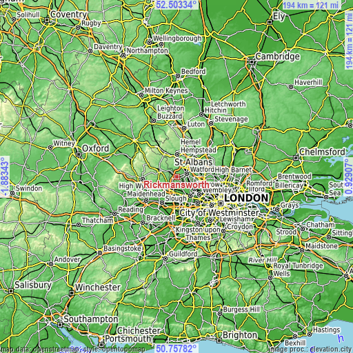
| Width | 6.06 km = 3.8 mi | 12.13 km = 7.5 mi | 194.1 km = 120.6 mi |
| Height | 6.06 km = 3.8 mi | 12.13 km = 7.5 mi | 194.1 km = 120.6 mi |
| ↑Max Latitude | 51.666245° | 51.693493° | 52.50334° |
| Latitude at center | 51.63898° | 51.63898° | 51.63898° |
| ↓Min Latitude | 51.611699° | 51.584401° | 50.75782° |
| ← Min Longitude | -0.521125° | -0.565071° | -1.88343° |
| Longitude center | -0.47718° | -0.47718° | -0.47718° |
| →Max Longitude | -0.433235° | -0.389289° | 0.92907° |
Nearby cities:
Cities around Rickmansworth sort by population:
• Watford elevation 77 m
5.9 km,  72°
72°
• Ruislip 53 m
8.2 km,  152°
152°
• Gerrards Cross 89 m
8 km,  222°
222°
• Chalfont Saint Peter 66 m
6.4 km,  238°
238°
• Pinner 53 m
8.3 km,  127°
127°
• Bushey 99 m
8.1 km,  86°
86°
• Chorleywood 113 m
3.1 km,  304°
304°
• Chalfont St Giles 75 m
6.5 km,  262°
262°
• Harefield 87 m
4 km,  188°
188°
• Little Chalfont 133 m
7.2 km, 296°
• Maple Cross 47 m
2.6 km,  233°
233°
• Denham 43 m
8.2 km, 191°
Multilingual:
 En español:
Rickmansworth elevación 53 m.
 En France:
Rickmansworth élévation 53 m.
 Auf Deutsch:
Rickmansworth höhe über dem Meeresspiegel ist 53 m.

Sources and notes:
- [note 1] Map square and city borders are not equal. Map elevation data is calculated only from area inside that square.
- [src 1] Elevation data from geonames database provided with same terms of usage.
- [src 2] The elevation map of Rickmansworth is generated using elevation data from NASA's 3 arcsec (90m) resolution SRTM data.
- [src 3] Base (background) map © OpenStreetMap contributors tiles are generated by Geofabrik and OpenTopoMap.
Copyright & License:
This Rickmansworth Elevation Map is licensed under CC BY-SA. You may reuse any part from this page, if you give a proper credit by linking to this URL:
 More info on terms of use page.