Ruislip elevation
Ruislip (England, Greater London), United Kingdom elevation is 53 meters and Ruislip elevation in feet is 174 ft above sea level [src 1]. Ruislip is a populated place (feature code) with elevation that is 19 meters (62 ft) smaller than average city elevation in United Kingdom.
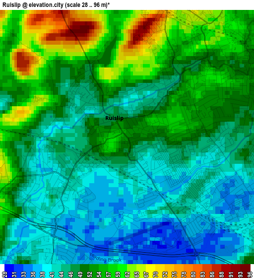
Below is the Elevation map of Ruislip, which displays elevation range with different colors. Scale of the first map is from 28 to 96 m (92 to 315 ft) with average elevation of 49.3 meters (=162 ft) [note 1]
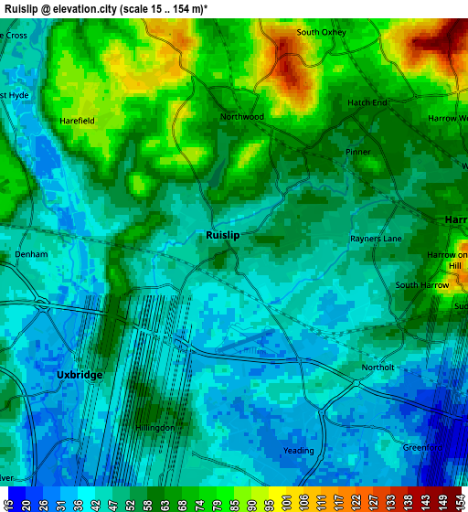
These maps also provides idea of topography and contour of this city, they are displayed at different zoom levels. More info about maps, scale and edge coordinates you can find below images.
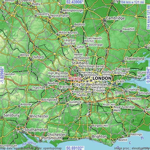
| \ | Map #1 | Map #2 | Topo.Map |
| Scale [m] | 28..96 m | 15..154 m | × |
| Scale [ft] | 92..315 ft | 49..505 ft | × |
| Average | 49.3 m = 162 ft | 54.8 m = 180 ft | × |
| Width | 6.07 km = 3.8 mi | 12.15 km = 7.5 mi | 194.4 km = 120.8 mi |
| Height | 6.07 km = 3.8 mi | 12.15 km = 7.5 mi | 194.3 km = 120.7 mi |
| ↑Max Latitude | 51.600744° | 51.628032° | 52.43906° |
| Latitude at center | 51.57344° | 51.57344° | 51.57344° |
| ↓Min Latitude | 51.546119° | 51.518782° | 50.69102° |
| ← Min Longitude | -0.467355° | -0.511301° | -1.82966° |
| Longitude center | -0.42341° | -0.42341° | -0.42341° |
| →Max Longitude | -0.379465° | -0.335519° | 0.98284° |
Nearby cities:
Cities around Ruislip sort by population:
• Southall elevation 35 m
8 km,  153°
153°
• Hayes 39 m
6.4 km,  179°
179°
• Greenford 34 m
6.9 km,  136°
136°
• Northolt 41 m
4.7 km,  125°
125°
• Pinner 53 m
3.6 km,  51°
51°
• Harrow on the Hill 72 m
6.2 km,  92°
92°
• Greenhill 64 m
6 km,  79°
79°
• Iver Heath 53 m
7.7 km,  237°
237°
• Harefield 87 m
5.4 km,  307°
307°
• Denham 43 m
5.3 km,  261°
261°
• Harrow 69 m
6.3 km, 85°
• Uxbridge 40 m
4.9 km, 236°
Multilingual:
 En español:
Ruislip elevación 53 m.
 En France:
Ruislip élévation 53 m.


Sources and notes:
- [note 1] Map square and city borders are not equal. Map elevation data is calculated only from area inside that square.
- [src 1] Elevation data from geonames database provided with same terms of usage.
- [src 2] The elevation map of Ruislip is generated using elevation data from NASA's 3 arcsec (90m) resolution SRTM data.
- [src 3] Base (background) map © OpenStreetMap contributors tiles are generated by Geofabrik and OpenTopoMap.
Copyright & License:
This Ruislip Elevation Map is licensed under CC BY-SA. You may reuse any part from this page, if you give a proper credit by linking to this URL:
 More info on terms of use page.