Greenford elevation
Greenford (England, Greater London), United Kingdom elevation is 34 meters and Greenford elevation in feet is 112 ft above sea level [src 1]. Greenford is a populated place (feature code) with elevation that is 38 meters (125 ft) smaller than average city elevation in United Kingdom.
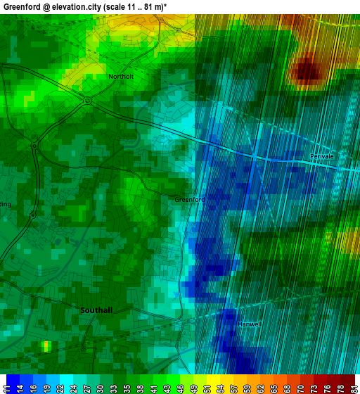
Below is the Elevation map of Greenford, which displays elevation range with different colors. Scale of the first map is from 11 to 81 m (36 to 266 ft) with average elevation of 32.6 meters (=107 ft) [note 1]
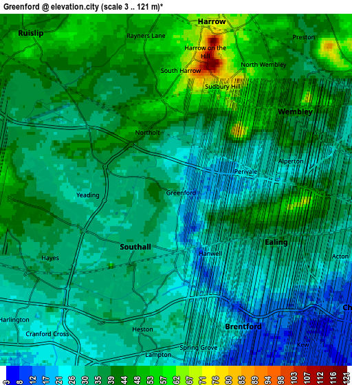
These maps also provides idea of topography and contour of this city, they are displayed at different zoom levels. More info about maps, scale and edge coordinates you can find below images.
| \ | Map #1 | Map #2 | Topo.Map |
| Scale [m] | 11..81 m | 3..121 m | × |
| Scale [ft] | 36..266 ft | 10..397 ft | × |
| Average | 32.6 m = 107 ft | 35.7 m = 117 ft | × |
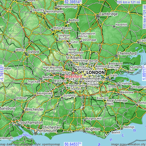
| Width | 6.08 km = 3.8 mi | 12.16 km = 7.6 mi | 194.6 km = 120.9 mi |
| Height | 6.08 km = 3.8 mi | 12.16 km = 7.6 mi | 194.5 km = 120.9 mi |
| ↑Max Latitude | 51.555991° | 51.583306° | 52.39514° |
| Latitude at center | 51.52866° | 51.52866° | 51.52866° |
| ↓Min Latitude | 51.501312° | 51.473948° | 50.64537° |
| ← Min Longitude | -0.399025° | -0.442971° | -1.76133° |
| Longitude center | -0.35508° | -0.35508° | -0.35508° |
| →Max Longitude | -0.311135° | -0.267189° | 1.05117° |
Nearby cities:
Cities around Greenford sort by population:
• Brent elevation 44 m
4.5 km,  53°
53°
• Wembley 46 m
4.8 km,  56°
56°
• Southall 35 m
2.5 km,  207°
207°
• Acton 30 m
5.9 km,  111°
111°
• Hayes 39 m
4.9 km,  253°
253°
• Northolt 41 m
2.4 km,  338°
338°
• Isleworth 21 m
6 km,  171°
171°
• Brentford 15 m
5.7 km,  145°
145°
• Harrow on the Hill 72 m
5 km,  17°
17°
• Greenhill 64 m
6.2 km,  10°
10°
• Harrow 69 m
5.7 km, 16°
• Ealing 38 m
4.1 km,  116°
116°
Multilingual:
 En español:
Greenford elevación 34 m.
 En France:
Greenford élévation 34 m.
 Auf Deutsch:
Greenford höhe über dem Meeresspiegel ist 34 m.

Sources and notes:
- [note 1] Map square and city borders are not equal. Map elevation data is calculated only from area inside that square.
- [src 1] Elevation data from geonames database provided with same terms of usage.
- [src 2] The elevation map of Greenford is generated using elevation data from NASA's 3 arcsec (90m) resolution SRTM data.
- [src 3] Base (background) map © OpenStreetMap contributors tiles are generated by Geofabrik and OpenTopoMap.
Copyright & License:
This Greenford Elevation Map is licensed under CC BY-SA. You may reuse any part from this page, if you give a proper credit by linking to this URL:
 More info on terms of use page.