Uxbridge elevation
Uxbridge (England, Greater London), United Kingdom elevation is 40 meters and Uxbridge elevation in feet is 131 ft above sea level [src 1]. Uxbridge is a seat of a third-order administrative division (feature code) with elevation that is 32 meters (105 ft) smaller than average city elevation in United Kingdom.
Below is the Elevation map of Uxbridge, which displays elevation range with different colors. Scale of the first map is from 27 to 78 m (89 to 256 ft) with average elevation of 44.2 meters (=145 ft) [note 1]
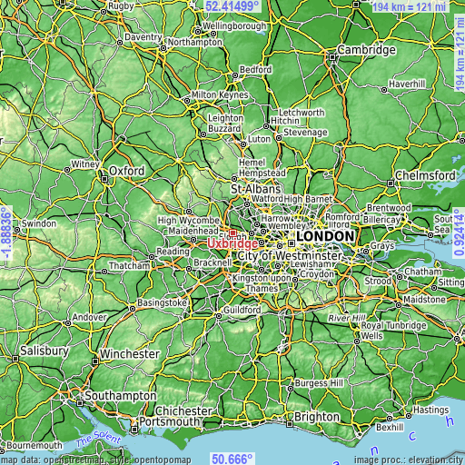
These maps also provides idea of topography and contour of this city, they are displayed at different zoom levels. More info about maps, scale and edge coordinates you can find below images.
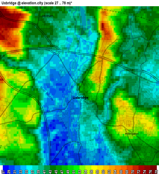
| \ | Map #1 | Topo.Map |
| Scale [m] | 27..78 m | × |
| Scale [ft] | 89..256 ft | × |
| Average | 44.2 m = 145 ft | × |
| Width | 6.08 km = 3.8 mi | 194.5 km = 120.9 mi |
| Height | 6.08 km = 3.8 mi | 194.5 km = 120.9 mi |
| ↑Max Latitude | 51.576219° | 52.41499° |
| Latitude at center | 51.5489° | 51.5489° |
| ↓Min Latitude | 51.521565° | 50.666° |
| ← Min Longitude | -0.526055° | -1.88836° |
| Longitude center | -0.48211° | -0.48211° |
| →Max Longitude | -0.438165° | 0.92414° |
Nearby cities:
Cities around Uxbridge sort by population:
• Hayes elevation 39 m
5.5 km,  132°
132°
• Ruislip 53 m
4.9 km,  56°
56°
• Northolt 41 m
7.9 km,  90°
90°
• Gerrards Cross 89 m
6.5 km,  309°
309°
• Chalfont Saint Peter 66 m
8.4 km,  322°
322°
• West Drayton 29 m
5.5 km,  168°
168°
• Iver Heath 53 m
2.8 km,  240°
240°
• Iver 25 m
5.6 km,  192°
192°
• Harefield 87 m
6.1 km,  357°
357°
• Colnbrook 20 m
7.7 km,  200°
200°
• Stoke Poges 54 m
7.4 km,  266°
266°
• Denham 43 m
2.3 km,  327°
327°
Multilingual:
 En español:
Uxbridge elevación 40 m.
 En France:
Uxbridge élévation 40 m.


Sources and notes:
- [note 1] Map square and city borders are not equal. Map elevation data is calculated only from area inside that square.
- [src 1] Elevation data from geonames database provided with same terms of usage.
- [src 2] The elevation map of Uxbridge is generated using elevation data from NASA's 3 arcsec (90m) resolution SRTM data.
- [src 3] Base (background) map © OpenStreetMap contributors tiles are generated by Geofabrik and OpenTopoMap.
Copyright & License:
This Uxbridge Elevation Map is licensed under CC BY-SA. You may reuse any part from this page, if you give a proper credit by linking to this URL:
 More info on terms of use page.