Shenley elevation
Shenley (England, Hertfordshire), United Kingdom elevation is 134 meters and Shenley elevation in feet is 440 ft above sea level [src 1]. Shenley is a populated place (feature code) with elevation that is 62 meters (203 ft) bigger than average city elevation in United Kingdom.
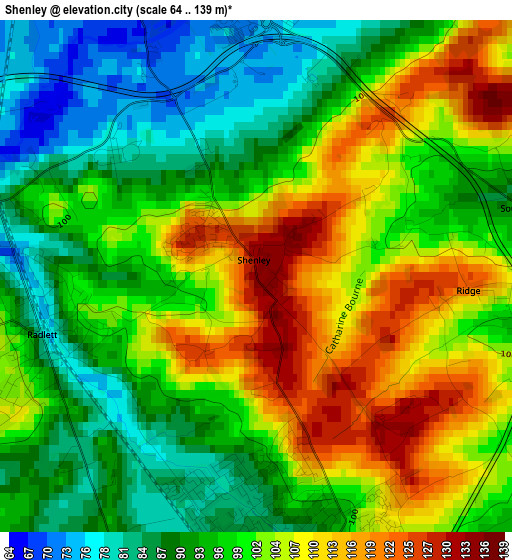
Below is the Elevation map of Shenley, which displays elevation range with different colors. Scale of the first map is from 64 to 139 m (210 to 456 ft) with average elevation of 99.2 meters (=325 ft) [note 1]
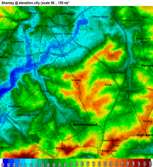
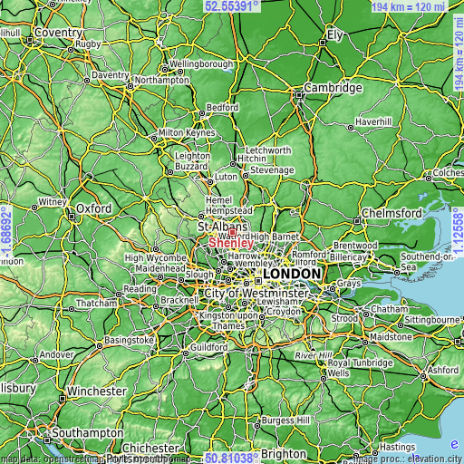
These maps also provides idea of topography and contour of this city, they are displayed at different zoom levels. More info about maps, scale and edge coordinates you can find below images.
| \ | Map #1 | Map #2 | Topo.Map |
| Scale [m] | 64..139 m | 56..155 m | × |
| Scale [ft] | 210..456 ft | 184..509 ft | × |
| Average | 99.2 m = 325 ft | 95.3 m = 313 ft | × |
| Width | 6.06 km = 3.8 mi | 12.12 km = 7.5 mi | 193.9 km = 120.5 mi |
| Height | 6.06 km = 3.8 mi | 12.12 km = 7.5 mi | 193.8 km = 120.4 mi |
| ↑Max Latitude | 51.717774° | 51.744991° | 52.55391° |
| Latitude at center | 51.69054° | 51.69054° | 51.69054° |
| ↓Min Latitude | 51.66329° | 51.636023° | 50.81038° |
| ← Min Longitude | -0.324615° | -0.368561° | -1.68692° |
| Longitude center | -0.28067° | -0.28067° | -0.28067° |
| →Max Longitude | -0.236725° | -0.192779° | 1.12558° |
Nearby cities:
Cities around Shenley sort by population:
• Watford elevation 77 m
8.9 km,  243°
243°
• St Albans 98 m
7.5 km,  331°
331°
• Borehamwood 92 m
4 km,  176°
176°
• Barnet 117 m
7.2 km,  129°
129°
• Potters Bar 125 m
7.1 km,  87°
87°
• Hadley Wood 104 m
8.1 km,  109°
109°
• Bushey 99 m
7.6 km,  226°
226°
• Edgware 64 m
8.7 km, 177°
• Radlett 74 m
2.7 km,  258°
258°
• High Barnet 133 m
6.3 km, 127°
• Stanmore 92 m
8.6 km,  196°
196°
• Elstree 129 m
5.7 km,  191°
191°
Multilingual:
 En español:
Shenley elevación 134 m.
 En France:
Shenley élévation 134 m.


Sources and notes:
- [note 1] Map square and city borders are not equal. Map elevation data is calculated only from area inside that square.
- [src 1] Elevation data from geonames database provided with same terms of usage.
- [src 2] The elevation map of Shenley is generated using elevation data from NASA's 3 arcsec (90m) resolution SRTM data.
- [src 3] Base (background) map © OpenStreetMap contributors tiles are generated by Geofabrik and OpenTopoMap.
Copyright & License:
This Shenley Elevation Map is licensed under CC BY-SA. You may reuse any part from this page, if you give a proper credit by linking to this URL:
 More info on terms of use page.