Barnet elevation
Barnet (England, Greater London), United Kingdom elevation is 117 meters and Barnet elevation in feet is 384 ft above sea level [src 1]. Barnet is a populated place (feature code) with elevation that is 45 meters (148 ft) bigger than average city elevation in United Kingdom.
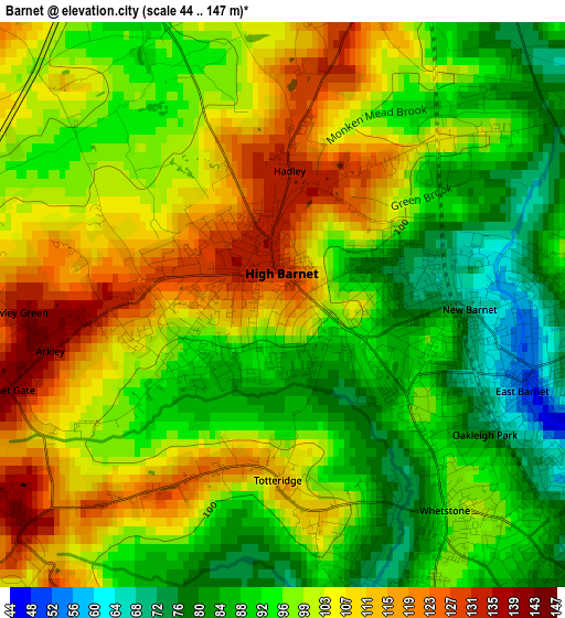
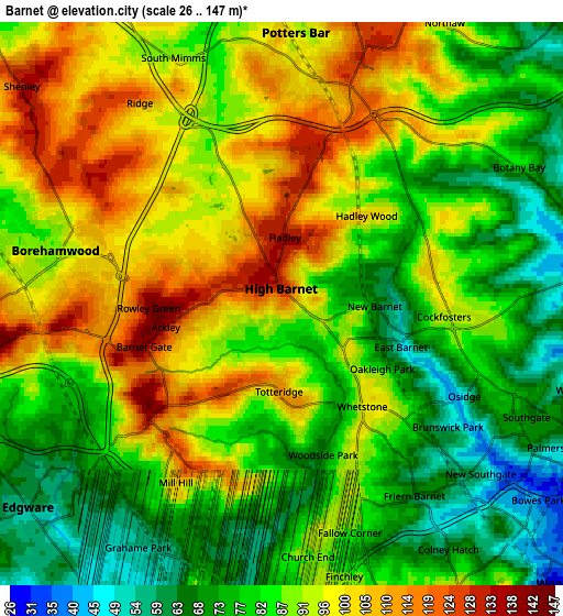
Below is the Elevation map of Barnet, which displays elevation range with different colors. Scale of the first map is from 44 to 147 m (144 to 482 ft) with average elevation of 98.7 meters (=324 ft) [note 1]
These maps also provides idea of topography and contour of this city, they are displayed at different zoom levels. More info about maps, scale and edge coordinates you can find below images.
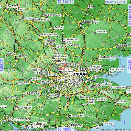
| \ | Map #1 | Map #2 | Topo.Map |
| Scale [m] | 44..147 m | 26..147 m | × |
| Scale [ft] | 144..482 ft | 85..482 ft | × |
| Average | 98.7 m = 324 ft | 87.8 m = 288 ft | × |
| Width | 6.06 km = 3.8 mi | 12.13 km = 7.5 mi | 194 km = 120.5 mi |
| Height | 6.06 km = 3.8 mi | 12.13 km = 7.5 mi | 194 km = 120.5 mi |
| ↑Max Latitude | 51.677258° | 51.7045° | 52.51415° |
| Latitude at center | 51.65° | 51.65° | 51.65° |
| ↓Min Latitude | 51.622725° | 51.595434° | 50.76906° |
| ← Min Longitude | -0.243945° | -0.287891° | -1.60625° |
| Longitude center | -0.2° | -0.2° | -0.2° |
| →Max Longitude | -0.156055° | -0.112109° | 1.20625° |
Nearby cities:
Cities around Barnet sort by population:
• Enfield Town elevation 33 m
7.9 km,  88°
88°
• Borehamwood 92 m
5.4 km,  275°
275°
• Potters Bar 125 m
5.1 km,  17°
17°
• Hadley Wood 104 m
2.8 km,  48°
48°
• Edgware 64 m
6.6 km,  231°
231°
• High Barnet 133 m
0.9 km,  322°
322°
• Cuffley 69 m
8.8 km,  43°
43°
• Stanmore 92 m
8.9 km,  245°
245°
• Shenley 134 m
7.2 km,  309°
309°
• Elstree 129 m
6.8 km,  260°
260°
• Wood Green 38 m
8 km,  134°
134°
• Hendon 63 m
5.7 km,  191°
191°
Multilingual:
 En español:
Municipio de Barnet elevación 117 m.
 En France:
Barnet élévation 117 m.
 Auf Deutsch:
London Borough of Barnet höhe über dem Meeresspiegel ist 117 m.

Sources and notes:
- [note 1] Map square and city borders are not equal. Map elevation data is calculated only from area inside that square.
- [src 1] Elevation data from geonames database provided with same terms of usage.
- [src 2] The elevation map of Barnet is generated using elevation data from NASA's 3 arcsec (90m) resolution SRTM data.
- [src 3] Base (background) map © OpenStreetMap contributors tiles are generated by Geofabrik and OpenTopoMap.
Copyright & License:
This Barnet Elevation Map is licensed under CC BY-SA. You may reuse any part from this page, if you give a proper credit by linking to this URL:
 More info on terms of use page.