Stafford elevation
Stafford (England, Staffordshire), United Kingdom elevation is 77 meters and Stafford elevation in feet is 253 ft above sea level [src 1]. Stafford is a seat of a second-order administrative division (feature code) with elevation that is 5 meters (16 ft) bigger than average city elevation in United Kingdom.
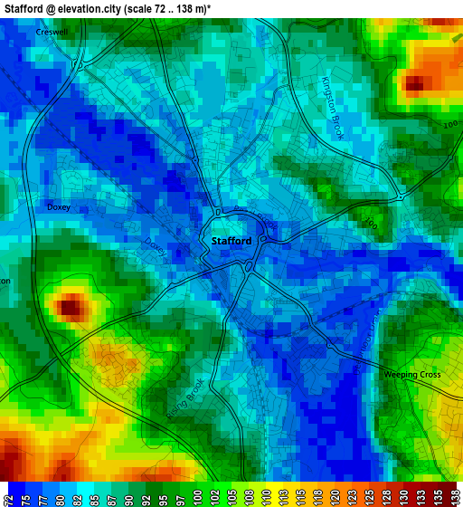
Below is the Elevation map of Stafford, which displays elevation range with different colors. Scale of the first map is from 72 to 138 m (236 to 453 ft) with average elevation of 89.5 meters (=294 ft) [note 1]
These maps also provides idea of topography and contour of this city, they are displayed at different zoom levels. More info about maps, scale and edge coordinates you can find below images.
| \ | Map #1 | Map #2 | Topo.Map |
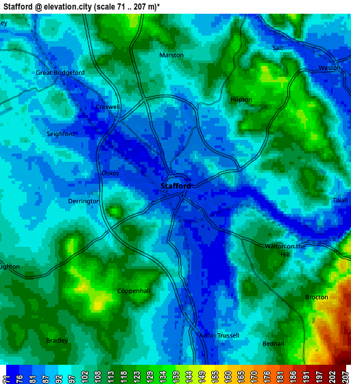
| Scale [m] | 72..138 m | 71..207 m | × |
| Scale [ft] | 236..453 ft | 233..679 ft | × |
| Average | 89.5 m = 294 ft | 101 m = 331 ft | × |
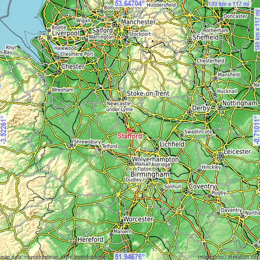
| Width | 5.91 km = 3.7 mi | 11.82 km = 7.3 mi | 189.1 km = 117.5 mi |
| Height | 5.91 km = 3.7 mi | 11.82 km = 7.3 mi | 189 km = 117.4 mi |
| ↑Max Latitude | 52.831768° | 52.85831° | 53.64704° |
| Latitude at center | 52.80521° | 52.80521° | 52.80521° |
| ↓Min Latitude | 52.778636° | 52.752045° | 51.94676° |
| ← Min Longitude | -2.160305° | -2.204251° | -3.52261° |
| Longitude center | -2.11636° | -2.11636° | -2.11636° |
| →Max Longitude | -2.072415° | -2.028469° | -0.71011° |
Nearby cities:
Cities around Stafford sort by population:
• Cannock elevation 154 m
14 km,  155°
155°
• Rugeley 78 m
13.1 km,  112°
112°
• Stone 94 m
11.5 km,  347°
347°
• Penkridge 82 m
8.9 km,  179°
179°
• Gnosall 102 m
9.6 km,  256°
256°
• Eccleshall 98 m
10.7 km,  303°
303°
• Brewood 113 m
14.8 km,  195°
195°
• Colwich 78 m
9.2 km,  102°
102°
• Barlaston 106 m
15.6 km, 346°
• Wheaton Aston 112 m
12.6 km,  213°
213°
• Great Haywood 80 m
7.8 km,  87°
87°
• Abbots Bromley 119 m
16.1 km, 85°
Multilingual:
 En español:
Stafford elevación 77 m.
 En France:
Stafford élévation 77 m.


Sources and notes:
- [note 1] Map square and city borders are not equal. Map elevation data is calculated only from area inside that square.
- [src 1] Elevation data from geonames database provided with same terms of usage.
- [src 2] The elevation map of Stafford is generated using elevation data from NASA's 3 arcsec (90m) resolution SRTM data.
- [src 3] Base (background) map © OpenStreetMap contributors tiles are generated by Geofabrik and OpenTopoMap.
Copyright & License:
This Stafford Elevation Map is licensed under CC BY-SA. You may reuse any part from this page, if you give a proper credit by linking to this URL:
 More info on terms of use page.