Stepps elevation
Stepps (Scotland, North Lanarkshire), United Kingdom elevation is 85 meters and Stepps elevation in feet is 279 ft above sea level [src 1]. Stepps is a populated place (feature code) with elevation that is 13 meters (43 ft) bigger than average city elevation in United Kingdom.
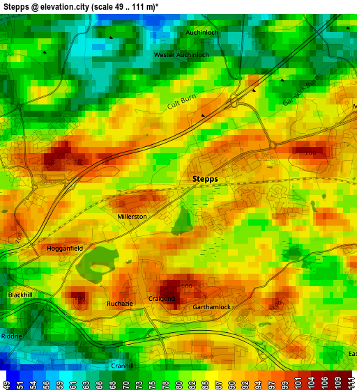
Below is the Elevation map of Stepps, which displays elevation range with different colors. Scale of the first map is from 49 to 111 m (161 to 364 ft) with average elevation of 82.8 meters (=272 ft) [note 1]
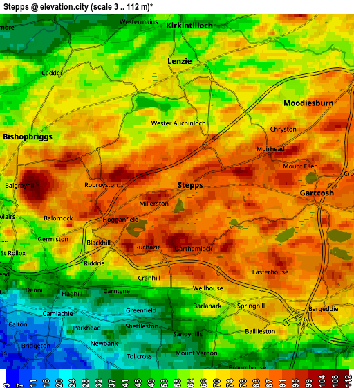
These maps also provides idea of topography and contour of this city, they are displayed at different zoom levels. More info about maps, scale and edge coordinates you can find below images.
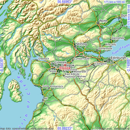
| \ | Map #1 | Map #2 | Topo.Map |
| Scale [m] | 49..111 m | 3..112 m | × |
| Scale [ft] | 161..364 ft | 10..367 ft | × |
| Average | 82.8 m = 272 ft | 66.3 m = 218 ft | × |
| Width | 5.48 km = 3.4 mi | 10.96 km = 6.8 mi | 175.4 km = 109 mi |
| Height | 5.48 km = 3.4 mi | 10.96 km = 6.8 mi | 175.4 km = 109 mi |
| ↑Max Latitude | 55.913627° | 55.938248° | 56.66963° |
| Latitude at center | 55.88899° | 55.88899° | 55.88899° |
| ↓Min Latitude | 55.864338° | 55.83967° | 55.09233° |
| ← Min Longitude | -4.196045° | -4.239991° | -5.55835° |
| Longitude center | -4.1521° | -4.1521° | -4.1521° |
| →Max Longitude | -4.108155° | -4.064209° | -2.74585° |
Nearby cities:
Cities around Stepps sort by population:
• Glasgow elevation 40 m
7.1 km,  248°
248°
• Rutherglen 23 m
7.7 km,  209°
209°
• Bishopbriggs 60 m
4.6 km,  295°
295°
• Kirkintilloch 51 m
5.6 km,  359°
359°
• Lenzie 61 m
4.3 km, 358°
• Moodiesburn 81 m
5.2 km,  55°
55°
• Chryston 89 m
3.2 km, 61°
• Glenboig 89 m
6.6 km,  84°
84°
• Bargeddie 80 m
6 km,  130°
130°
• Torrance 49 m
6.7 km,  327°
327°
• Gartcosh 93 m
4.4 km,  90°
90°
• Muirhead 96 m
3.1 km,  70°
70°
Multilingual:
 En español:
Stepps elevación 85 m.
 En France:
Stepps élévation 85 m.


Sources and notes:
- [note 1] Map square and city borders are not equal. Map elevation data is calculated only from area inside that square.
- [src 1] Elevation data from geonames database provided with same terms of usage.
- [src 2] The elevation map of Stepps is generated using elevation data from NASA's 3 arcsec (90m) resolution SRTM data.
- [src 3] Base (background) map © OpenStreetMap contributors tiles are generated by Geofabrik and OpenTopoMap.
Copyright & License:
This Stepps Elevation Map is licensed under CC BY-SA. You may reuse any part from this page, if you give a proper credit by linking to this URL:
 More info on terms of use page.