Moodiesburn elevation
Moodiesburn (Scotland, North Lanarkshire), United Kingdom elevation is 81 meters and Moodiesburn elevation in feet is 266 ft above sea level [src 1]. Moodiesburn is a populated place (feature code) with elevation that is 9 meters (30 ft) bigger than average city elevation in United Kingdom.
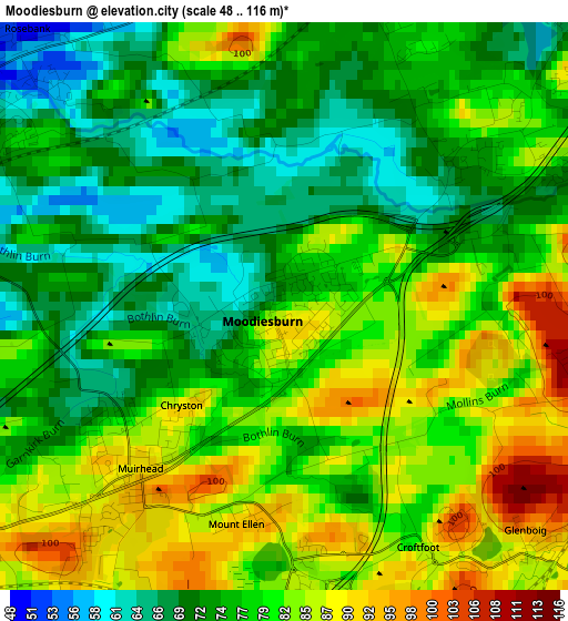
Below is the Elevation map of Moodiesburn, which displays elevation range with different colors. Scale of the first map is from 48 to 116 m (157 to 381 ft) with average elevation of 77.9 meters (=256 ft) [note 1]
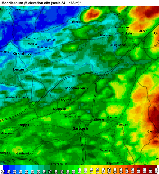
These maps also provides idea of topography and contour of this city, they are displayed at different zoom levels. More info about maps, scale and edge coordinates you can find below images.
| \ | Map #1 | Map #2 | Topo.Map |
| Scale [m] | 48..116 m | 34..166 m | × |
| Scale [ft] | 157..381 ft | 112..545 ft | × |
| Average | 77.9 m = 256 ft | 82.3 m = 270 ft | × |
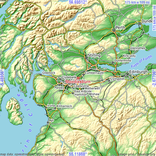
| Width | 5.48 km = 3.4 mi | 10.95 km = 6.8 mi | 175.3 km = 108.9 mi |
| Height | 5.48 km = 3.4 mi | 10.95 km = 6.8 mi | 175.2 km = 108.9 mi |
| ↑Max Latitude | 55.93963° | 55.964235° | 56.69512° |
| Latitude at center | 55.91501° | 55.91501° | 55.91501° |
| ↓Min Latitude | 55.890374° | 55.865723° | 55.11888° |
| ← Min Longitude | -4.127255° | -4.171201° | -5.48956° |
| Longitude center | -4.08331° | -4.08331° | -4.08331° |
| →Max Longitude | -4.039365° | -3.995419° | -2.67706° |
Nearby cities:
Cities around Moodiesburn sort by population:
• Cumbernauld elevation 149 m
6.8 km,  58°
58°
• Kirkintilloch 51 m
5.1 km,  302°
302°
• Lenzie 61 m
4.6 km,  287°
287°
• Stepps 85 m
5.2 km,  235°
235°
• Chryston 89 m
2 km,  228°
228°
• Glenboig 89 m
3.3 km,  134°
134°
• Bargeddie 80 m
6.8 km,  177°
177°
• Glenmavis 176 m
6.6 km,  115°
115°
• Gartcosh 93 m
3 km, 178°
• Croy 116 m
5.8 km,  28°
28°
• Muirhead 96 m
2.4 km,  216°
216°
• Twechar 66 m
4.4 km,  0°
0°
Multilingual:
 En español:
Moodiesburn elevación 81 m.
 En France:
Moodiesburn élévation 81 m.
 Auf Deutsch:
Moodiesburn höhe über dem Meeresspiegel ist 81 m.

Sources and notes:
- [note 1] Map square and city borders are not equal. Map elevation data is calculated only from area inside that square.
- [src 1] Elevation data from geonames database provided with same terms of usage.
- [src 2] The elevation map of Moodiesburn is generated using elevation data from NASA's 3 arcsec (90m) resolution SRTM data.
- [src 3] Base (background) map © OpenStreetMap contributors tiles are generated by Geofabrik and OpenTopoMap.
Copyright & License:
This Moodiesburn Elevation Map is licensed under CC BY-SA. You may reuse any part from this page, if you give a proper credit by linking to this URL:
 More info on terms of use page.