Sutton elevation
Sutton (England, Greater London), United Kingdom elevation is 83 meters and Sutton elevation in feet is 272 ft above sea level [src 1]. Sutton is a seat of a third-order administrative division (feature code) with elevation that is 11 meters (36 ft) bigger than average city elevation in United Kingdom.
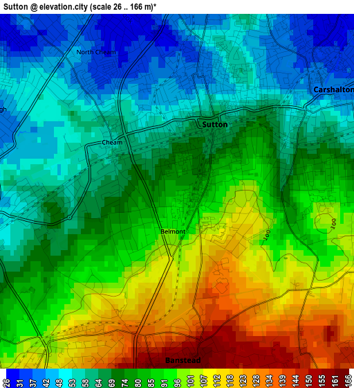
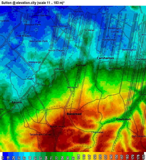
Below is the Elevation map of Sutton, which displays elevation range with different colors. Scale of the first map is from 26 to 166 m (85 to 545 ft) with average elevation of 79.3 meters (=260 ft) [note 1]
These maps also provides idea of topography and contour of this city, they are displayed at different zoom levels. More info about maps, scale and edge coordinates you can find below images.
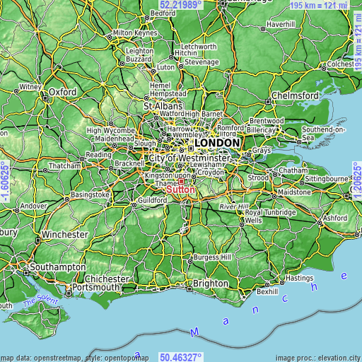
| \ | Map #1 | Map #2 | Topo.Map |
| Scale [m] | 26..166 m | 11..183 m | × |
| Scale [ft] | 85..545 ft | 36..600 ft | × |
| Average | 79.3 m = 260 ft | 76.4 m = 251 ft | × |
| Width | 6.1 km = 3.8 mi | 12.21 km = 7.6 mi | 195.3 km = 121.4 mi |
| Height | 6.1 km = 3.8 mi | 12.21 km = 7.6 mi | 195.3 km = 121.4 mi |
| ↑Max Latitude | 51.377438° | 51.40486° | 52.21989° |
| Latitude at center | 51.35° | 51.35° | 51.35° |
| ↓Min Latitude | 51.322545° | 51.295074° | 50.46327° |
| ← Min Longitude | -0.243945° | -0.287891° | -1.60625° |
| Longitude center | -0.2° | -0.2° | -0.2° |
| →Max Longitude | -0.156055° | -0.112109° | 1.20625° |
Nearby cities:
Cities around Sutton sort by population:
• Purley elevation 97 m
6.3 km,  103°
103°
• Mitcham 22 m
6.3 km,  20°
20°
• Morden 22 m
5.4 km,  1°
1°
• Banstead 160 m
3.1 km,  188°
188°
• Carshalton 39 m
3 km,  47°
47°
• Ewell 38 m
3.4 km,  269°
269°
• Epsom 57 m
5.3 km,  245°
245°
• Coulsdon 82 m
5.3 km,  129°
129°
• New Malden 21 m
7.1 km,  322°
322°
• Worcester Park 24 m
4.5 km, 317°
• Cheam 55 m
1.9 km,  313°
313°
• Tadworth 171 m
6.9 km,  201°
201°
Multilingual:
 En español:
Sutton elevación 83 m.
 En France:
Sutton élévation 83 m.
 Auf Deutsch:
London Borough of Sutton höhe über dem Meeresspiegel ist 83 m.

Sources and notes:
- [note 1] Map square and city borders are not equal. Map elevation data is calculated only from area inside that square.
- [src 1] Elevation data from geonames database provided with same terms of usage.
- [src 2] The elevation map of Sutton is generated using elevation data from NASA's 3 arcsec (90m) resolution SRTM data.
- [src 3] Base (background) map © OpenStreetMap contributors tiles are generated by Geofabrik and OpenTopoMap.
Copyright & License:
This Sutton Elevation Map is licensed under CC BY-SA. You may reuse any part from this page, if you give a proper credit by linking to this URL:
 More info on terms of use page.