Epsom elevation
Epsom (England, Surrey), United Kingdom elevation is 57 meters and Epsom elevation in feet is 187 ft above sea level [src 1]. Epsom is a populated place (feature code) with elevation that is 15 meters (49 ft) smaller than average city elevation in United Kingdom.
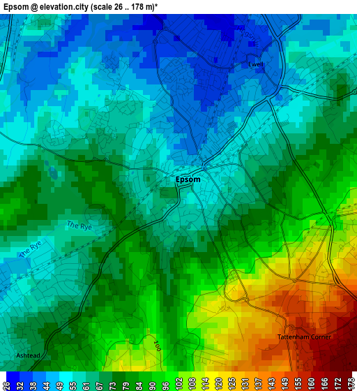
Below is the Elevation map of Epsom, which displays elevation range with different colors. Scale of the first map is from 26 to 178 m (85 to 584 ft) with average elevation of 72.9 meters (=239 ft) [note 1]
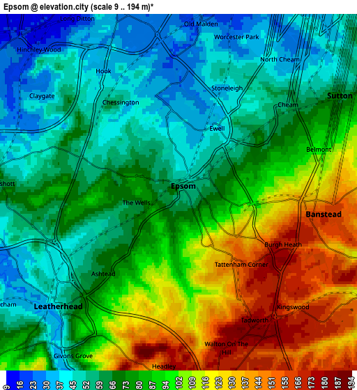
These maps also provides idea of topography and contour of this city, they are displayed at different zoom levels. More info about maps, scale and edge coordinates you can find below images.
| \ | Map #1 | Map #2 | Topo.Map |
| Scale [m] | 26..178 m | 9..194 m | × |
| Scale [ft] | 85..584 ft | 30..636 ft | × |
| Average | 72.9 m = 239 ft | 80.5 m = 264 ft | × |
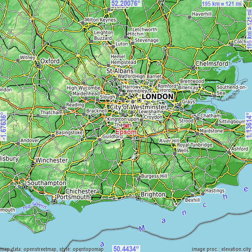
| Width | 6.11 km = 3.8 mi | 12.21 km = 7.6 mi | 195.4 km = 121.4 mi |
| Height | 6.11 km = 3.8 mi | 12.21 km = 7.6 mi | 195.4 km = 121.4 mi |
| ↑Max Latitude | 51.35795° | 51.385384° | 52.20076° |
| Latitude at center | 51.3305° | 51.3305° | 51.3305° |
| ↓Min Latitude | 51.303034° | 51.275551° | 50.4434° |
| ← Min Longitude | -0.314055° | -0.358001° | -1.67636° |
| Longitude center | -0.27011° | -0.27011° | -0.27011° |
| →Max Longitude | -0.226165° | -0.182219° | 1.13614° |
Nearby cities:
Cities around Epsom sort by population:
• Sutton elevation 83 m
5.3 km,  65°
65°
• Banstead 160 m
4.5 km,  101°
101°
• Leatherhead 41 m
5.8 km,  229°
229°
• Ewell 38 m
2.6 km,  34°
34°
• Chessington 44 m
4.3 km,  326°
326°
• Hook 34 m
4.9 km, 328°
• Worcester Park 24 m
5.8 km,  17°
17°
• Ashtead 75 m
3.2 km,  220°
220°
• Cheam 55 m
4.9 km,  45°
45°
• Tadworth 171 m
4.9 km,  151°
151°
• Hinchley Wood 18 m
6.8 km,  315°
315°
• Ditton Hill 35 m
6.2 km, 331°
Multilingual:
 En español:
Epsom elevación 57 m.
 En France:
Epsom élévation 57 m.


Sources and notes:
- [note 1] Map square and city borders are not equal. Map elevation data is calculated only from area inside that square.
- [src 1] Elevation data from geonames database provided with same terms of usage.
- [src 2] The elevation map of Epsom is generated using elevation data from NASA's 3 arcsec (90m) resolution SRTM data.
- [src 3] Base (background) map © OpenStreetMap contributors tiles are generated by Geofabrik and OpenTopoMap.
Copyright & License:
This Epsom Elevation Map is licensed under CC BY-SA. You may reuse any part from this page, if you give a proper credit by linking to this URL:
 More info on terms of use page.