Carshalton elevation
Carshalton (England, Greater London), United Kingdom elevation is 39 meters and Carshalton elevation in feet is 128 ft above sea level [src 1]. Carshalton is a populated place (feature code) with elevation that is 33 meters (108 ft) smaller than average city elevation in United Kingdom.
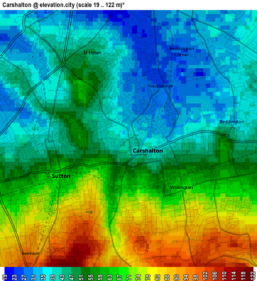
Below is the Elevation map of Carshalton, which displays elevation range with different colors. Scale of the first map is from 19 to 122 m (62 to 400 ft) with average elevation of 54.5 meters (=179 ft) [note 1]
These maps also provides idea of topography and contour of this city, they are displayed at different zoom levels. More info about maps, scale and edge coordinates you can find below images.
| \ | Map #1 | Map #2 | Topo.Map |
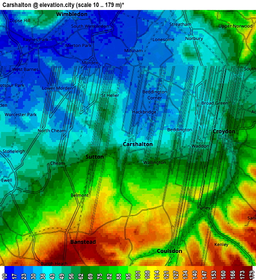
| Scale [m] | 19..122 m | 10..179 m | × |
| Scale [ft] | 62..400 ft | 33..587 ft | × |
| Average | 54.5 m = 179 ft | 65 m = 213 ft | × |
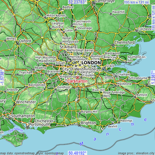
| Width | 6.1 km = 3.8 mi | 12.2 km = 7.6 mi | 195.2 km = 121.3 mi |
| Height | 6.1 km = 3.8 mi | 12.2 km = 7.6 mi | 195.2 km = 121.3 mi |
| ↑Max Latitude | 51.395717° | 51.423128° | 52.23783° |
| Latitude at center | 51.36829° | 51.36829° | 51.36829° |
| ↓Min Latitude | 51.340846° | 51.313386° | 50.48192° |
| ← Min Longitude | -0.211495° | -0.255441° | -1.5738° |
| Longitude center | -0.16755° | -0.16755° | -0.16755° |
| →Max Longitude | -0.123605° | -0.079659° | 1.2387° |
Nearby cities:
Cities around Carshalton sort by population:
• Sutton elevation 83 m
3 km,  227°
227°
• Croydon 54 m
5 km,  70°
70°
• Purley 97 m
5.2 km,  132°
132°
• South Croydon 60 m
5.1 km,  97°
97°
• Mitcham 22 m
3.9 km,  359°
359°
• Morden 22 m
4 km,  327°
327°
• Banstead 160 m
5.8 km,  208°
208°
• Ewell 38 m
6.1 km,  249°
249°
• Coulsdon 82 m
5.7 km,  160°
160°
• Worcester Park 24 m
5.5 km,  283°
283°
• Thornton Heath 53 m
5.9 km,  54°
54°
• Cheam 55 m
3.7 km,  258°
258°
Multilingual:
 En español:
Carshalton elevación 39 m.
 En France:
Carshalton élévation 39 m.
 Auf Deutsch:
Carshalton höhe über dem Meeresspiegel ist 39 m.

Sources and notes:
- [note 1] Map square and city borders are not equal. Map elevation data is calculated only from area inside that square.
- [src 1] Elevation data from geonames database provided with same terms of usage.
- [src 2] The elevation map of Carshalton is generated using elevation data from NASA's 3 arcsec (90m) resolution SRTM data.
- [src 3] Base (background) map © OpenStreetMap contributors tiles are generated by Geofabrik and OpenTopoMap.
Copyright & License:
This Carshalton Elevation Map is licensed under CC BY-SA. You may reuse any part from this page, if you give a proper credit by linking to this URL:
 More info on terms of use page.