Talgarth elevation
Talgarth (Wales, Sir Powys), United Kingdom elevation is 129 meters and Talgarth elevation in feet is 423 ft above sea level [src 1]. Talgarth is a populated place (feature code) with elevation that is 57 meters (187 ft) bigger than average city elevation in United Kingdom.
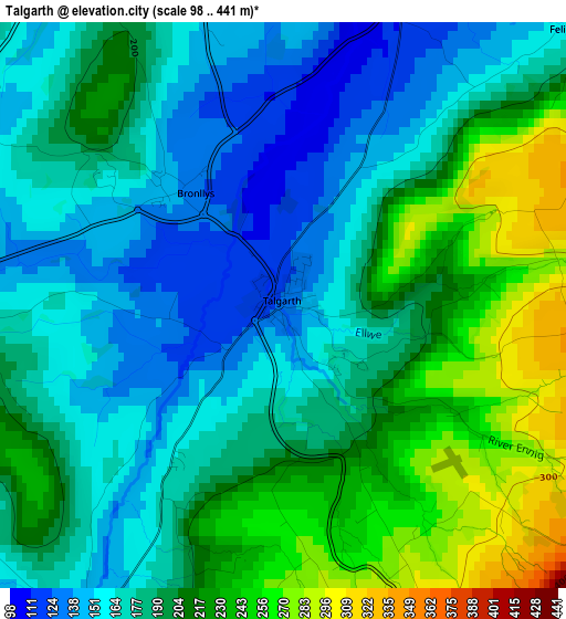
Below is the Elevation map of Talgarth, which displays elevation range with different colors. Scale of the first map is from 98 to 441 m (322 to 1447 ft) with average elevation of 192.4 meters (=631 ft) [note 1]
These maps also provides idea of topography and contour of this city, they are displayed at different zoom levels. More info about maps, scale and edge coordinates you can find below images.
| \ | Map #1 | Topo.Map |
| Scale [m] | 98..441 m | × |
| Scale [ft] | 322..1447 ft | × |
| Average | 192.4 m = 631 ft | × |
| Width | 6.02 km = 3.7 mi | 192.6 km = 119.7 mi |
| Height | 6.02 km = 3.7 mi | 192.5 km = 119.6 mi |
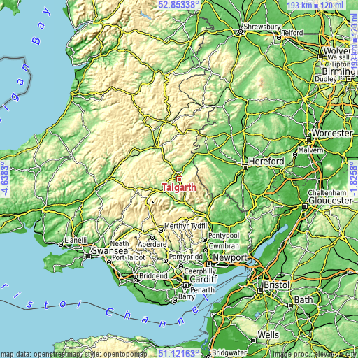
| ↑Max Latitude | 52.02293° | 52.85338° |
| Latitude at center | 51.99588° | 51.99588° |
| ↓Min Latitude | 51.968814° | 51.12163° |
| ← Min Longitude | -3.275995° | -4.6383° |
| Longitude center | -3.23205° | -3.23205° |
| →Max Longitude | -3.188105° | -1.8258° |
Nearby cities:
Cities around Talgarth sort by population:
• Brecon elevation 136 m
12.1 km,  242°
242°
• Builth Wells 130 m
20.8 km,  325°
325°
• Gilwern 105 m
21.3 km,  153°
153°
• Longtown 137 m
17.8 km,  106°
106°
• Crickhowell 90 m
16.4 km,  156°
156°
• Llangynidr 128 m
14.3 km,  178°
178°
• Dorstone 156 m
17.7 km,  63°
63°
• Bacton 137 m
21.6 km,  93°
93°
• Turnastone 128 m
19.7 km,  80°
80°
• Llanveynoe 251 m
16.2 km,  101°
101°
• Clifford 128 m
14.7 km,  37°
37°
• Hay 97 m
11 km, 40°
Multilingual:
 En español:
Talgarth elevación 129 m.
 En France:
Talgarth élévation 129 m.
 Auf Deutsch:
Talgarth höhe über dem Meeresspiegel ist 129 m.

Sources and notes:
- [note 1] Map square and city borders are not equal. Map elevation data is calculated only from area inside that square.
- [src 1] Elevation data from geonames database provided with same terms of usage.
- [src 2] The elevation map of Talgarth is generated using elevation data from NASA's 3 arcsec (90m) resolution SRTM data.
- [src 3] Base (background) map © OpenStreetMap contributors tiles are generated by Geofabrik and OpenTopoMap.
Copyright & License:
This Talgarth Elevation Map is licensed under CC BY-SA. You may reuse any part from this page, if you give a proper credit by linking to this URL:
 More info on terms of use page.