Llangynidr elevation
Llangynidr (Wales, Sir Powys), United Kingdom elevation is 128 meters and Llangynidr elevation in feet is 420 ft above sea level [src 1]. Llangynidr is a populated place (feature code) with elevation that is 56 meters (184 ft) bigger than average city elevation in United Kingdom.
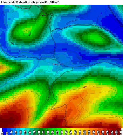
Below is the Elevation map of Llangynidr, which displays elevation range with different colors. Scale of the first map is from 81 to 516 m (266 to 1693 ft) with average elevation of 236.6 meters (=776 ft) [note 1]
These maps also provides idea of topography and contour of this city, they are displayed at different zoom levels. More info about maps, scale and edge coordinates you can find below images.
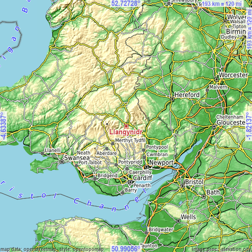
| \ | Map #1 | Topo.Map |
| Scale [m] | 81..516 m | × |
| Scale [ft] | 266..1693 ft | × |
| Average | 236.6 m = 776 ft | × |
| Width | 6.03 km = 3.7 mi | 193.1 km = 120 mi |
| Height | 6.03 km = 3.7 mi | 193.1 km = 120 mi |
| ↑Max Latitude | 51.894427° | 52.72728° |
| Latitude at center | 51.8673° | 51.8673° |
| ↓Min Latitude | 51.840156° | 50.99056° |
| ← Min Longitude | -3.271565° | -4.63387° |
| Longitude center | -3.22762° | -3.22762° |
| →Max Longitude | -3.183675° | -1.82137° |
Nearby cities:
Cities around Llangynidr sort by population:
• Ebbw Vale elevation 311 m
10.1 km,  172°
172°
• Brynmawr 382 m
8.1 km,  157°
157°
• Tredegar 321 m
10.6 km,  187°
187°
• Rhymney 283 m
12.6 km,  198°
198°
• Brecon 136 m
14.1 km,  308°
308°
• Victoria 301 m
13.2 km, 171°
• Blaenavon 334 m
14.3 km,  136°
136°
• Cwm 219 m
14.5 km, 167°
• Gilwern 105 m
10.4 km,  117°
117°
• Crickhowell 90 m
6.2 km,  97°
97°
• Govilon 93 m
12.5 km, 115°
• Talgarth 129 m
14.3 km,  358°
358°
Multilingual:
 En español:
Llangynidr elevación 128 m.
 En France:
Llangynidr élévation 128 m.
 Auf Deutsch:
Llangynidr höhe über dem Meeresspiegel ist 128 m.

Sources and notes:
- [note 1] Map square and city borders are not equal. Map elevation data is calculated only from area inside that square.
- [src 1] Elevation data from geonames database provided with same terms of usage.
- [src 2] The elevation map of Llangynidr is generated using elevation data from NASA's 3 arcsec (90m) resolution SRTM data.
- [src 3] Base (background) map © OpenStreetMap contributors tiles are generated by Geofabrik and OpenTopoMap.
Copyright & License:
This Llangynidr Elevation Map is licensed under CC BY-SA. You may reuse any part from this page, if you give a proper credit by linking to this URL:
 More info on terms of use page.