Whaley Bridge elevation
Whaley Bridge (England, Derbyshire), United Kingdom elevation is 170 meters and Whaley Bridge elevation in feet is 558 ft above sea level [src 1]. Whaley Bridge is a populated place (feature code) with elevation that is 98 meters (322 ft) bigger than average city elevation in United Kingdom.
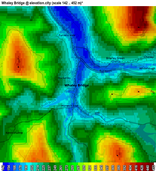
Below is the Elevation map of Whaley Bridge, which displays elevation range with different colors. Scale of the first map is from 142 to 452 m (466 to 1483 ft) with average elevation of 258.4 meters (=848 ft) [note 1]
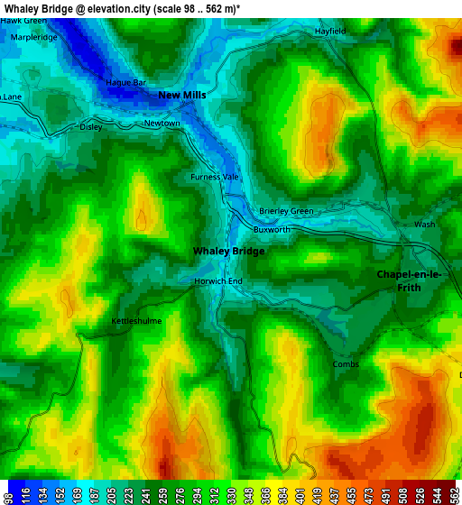
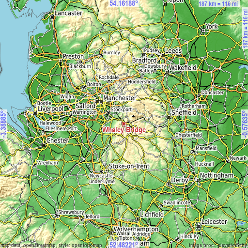
These maps also provides idea of topography and contour of this city, they are displayed at different zoom levels. More info about maps, scale and edge coordinates you can find below images.
| \ | Map #1 | Map #2 | Topo.Map |
| Scale [m] | 142..452 m | 98..562 m | × |
| Scale [ft] | 466..1483 ft | 322..1844 ft | × |
| Average | 258.4 m = 848 ft | 286.2 m = 939 ft | × |
| Width | 5.84 km = 3.6 mi | 11.67 km = 7.3 mi | 186.8 km = 116.1 mi |
| Height | 5.84 km = 3.6 mi | 11.67 km = 7.3 mi | 186.7 km = 116 mi |
| ↑Max Latitude | 53.356546° | 53.382766° | 54.16188° |
| Latitude at center | 53.33031° | 53.33031° | 53.33031° |
| ↓Min Latitude | 53.304058° | 53.277789° | 52.48221° |
| ← Min Longitude | -2.026545° | -2.070491° | -3.38885° |
| Longitude center | -1.9826° | -1.9826° | -1.9826° |
| →Max Longitude | -1.938655° | -1.894709° | -0.57635° |
Nearby cities:
Cities around Whaley Bridge sort by population:
• High Peak elevation 335 m
10 km,  65°
65°
• Buxton 316 m
9.4 km,  149°
149°
• Marple 147 m
8.9 km,  323°
323°
• New Mills 156 m
4.1 km,  343°
343°
• Poynton 97 m
9.2 km,  283°
283°
• Bollington 143 m
9.3 km,  244°
244°
• Chapel en le Frith 225 m
4.7 km,  98°
98°
• Disley 191 m
4.9 km,  310°
310°
• Hayfield 193 m
5.9 km,  24°
24°
• Chinley 208 m
3.1 km, 69°
• Dove Holes 329 m
7.2 km,  119°
119°
• Pott Shrigley 198 m
7.1 km,  251°
251°
Multilingual:
 En español:
Whaley Bridge elevación 170 m.
 En France:
Whaley Bridge élévation 170 m.
 Auf Deutsch:
Whaley Bridge höhe über dem Meeresspiegel ist 170 m.

Sources and notes:
- [note 1] Map square and city borders are not equal. Map elevation data is calculated only from area inside that square.
- [src 1] Elevation data from geonames database provided with same terms of usage.
- [src 2] The elevation map of Whaley Bridge is generated using elevation data from NASA's 3 arcsec (90m) resolution SRTM data.
- [src 3] Base (background) map © OpenStreetMap contributors tiles are generated by Geofabrik and OpenTopoMap.
Copyright & License:
This Whaley Bridge Elevation Map is licensed under CC BY-SA. You may reuse any part from this page, if you give a proper credit by linking to this URL:
 More info on terms of use page.