Wingerworth elevation
Wingerworth (England, Derbyshire), United Kingdom elevation is 151 meters and Wingerworth elevation in feet is 495 ft above sea level [src 1]. Wingerworth is a populated place (feature code) with elevation that is 79 meters (259 ft) bigger than average city elevation in United Kingdom.
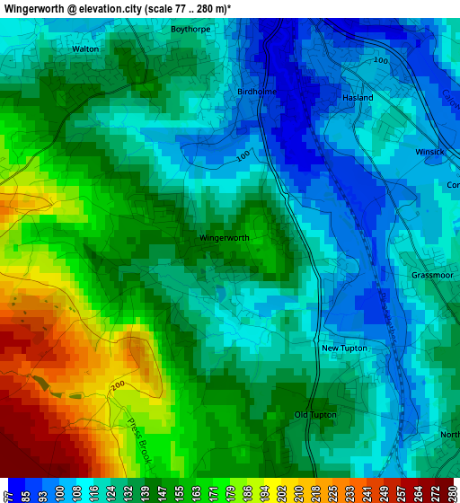
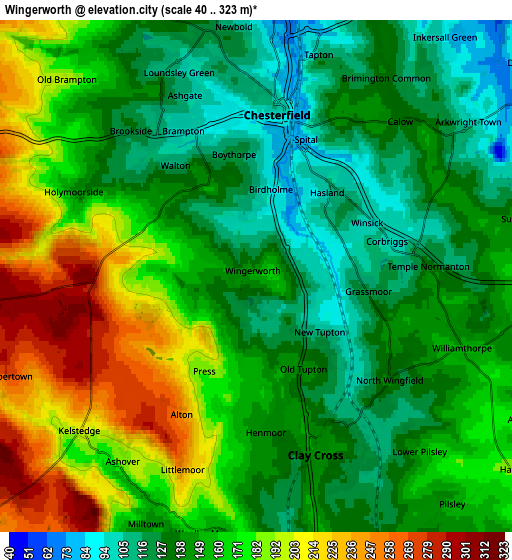
Below is the Elevation map of Wingerworth, which displays elevation range with different colors. Scale of the first map is from 77 to 280 m (253 to 919 ft) with average elevation of 138.3 meters (=454 ft) [note 1]
These maps also provides idea of topography and contour of this city, they are displayed at different zoom levels. More info about maps, scale and edge coordinates you can find below images.
| \ | Map #1 | Map #2 | Topo.Map |
| Scale [m] | 77..280 m | 40..323 m | × |
| Scale [ft] | 253..919 ft | 131..1060 ft | × |
| Average | 138.3 m = 454 ft | 157.6 m = 517 ft | × |
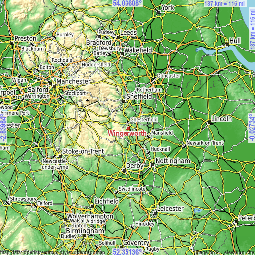
| Width | 5.85 km = 3.6 mi | 11.71 km = 7.3 mi | 187.3 km = 116.4 mi |
| Height | 5.85 km = 3.6 mi | 11.71 km = 7.3 mi | 187.3 km = 116.4 mi |
| ↑Max Latitude | 53.228315° | 53.254614° | 54.03608° |
| Latitude at center | 53.202° | 53.202° | 53.202° |
| ↓Min Latitude | 53.175669° | 53.149322° | 52.35136° |
| ← Min Longitude | -1.477535° | -1.521481° | -2.83984° |
| Longitude center | -1.43359° | -1.43359° | -1.43359° |
| →Max Longitude | -1.389645° | -1.345699° | -0.02734° |
Nearby cities:
Cities around Wingerworth sort by population:
• Chesterfield elevation 89 m
5.5 km,  11°
11°
• Staveley 67 m
9.1 km,  37°
37°
• Dronfield 159 m
11.5 km,  346°
346°
• Matlock 97 m
10.8 km,  228°
228°
• Bolsover 175 m
9.9 km,  72°
72°
• Tibshelf 173 m
8.9 km,  135°
135°
• Shirland 136 m
9.2 km,  167°
167°
• Pilsley 141 m
7.3 km, 142°
• Blackwell 119 m
11.6 km, 144°
• Walton 132 m
2.9 km,  321°
321°
• Glapwell 176 m
10.1 km,  98°
98°
• Tansley 165 m
9.6 km,  216°
216°
Multilingual:
 En español:
Wingerworth elevación 151 m.
 En France:
Wingerworth élévation 151 m.
 Auf Deutsch:
Wingerworth höhe über dem Meeresspiegel ist 151 m.

Sources and notes:
- [note 1] Map square and city borders are not equal. Map elevation data is calculated only from area inside that square.
- [src 1] Elevation data from geonames database provided with same terms of usage.
- [src 2] The elevation map of Wingerworth is generated using elevation data from NASA's 3 arcsec (90m) resolution SRTM data.
- [src 3] Base (background) map © OpenStreetMap contributors tiles are generated by Geofabrik and OpenTopoMap.
Copyright & License:
This Wingerworth Elevation Map is licensed under CC BY-SA. You may reuse any part from this page, if you give a proper credit by linking to this URL:
 More info on terms of use page.