Woodborough elevation
Woodborough (England, Wiltshire), United Kingdom elevation is 120 meters and Woodborough elevation in feet is 394 ft above sea level [src 1]. Woodborough is a seat of a third-order administrative division (feature code) with elevation that is 48 meters (157 ft) bigger than average city elevation in United Kingdom.
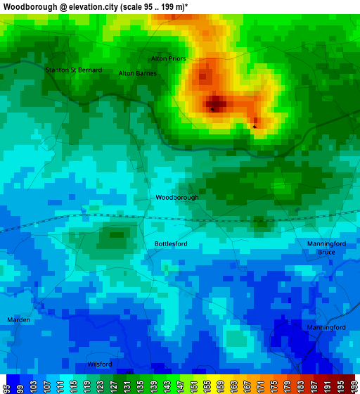
Below is the Elevation map of Woodborough, which displays elevation range with different colors. Scale of the first map is from 95 to 199 m (312 to 653 ft) with average elevation of 121.2 meters (=398 ft) [note 1]
These maps also provides idea of topography and contour of this city, they are displayed at different zoom levels. More info about maps, scale and edge coordinates you can find below images.
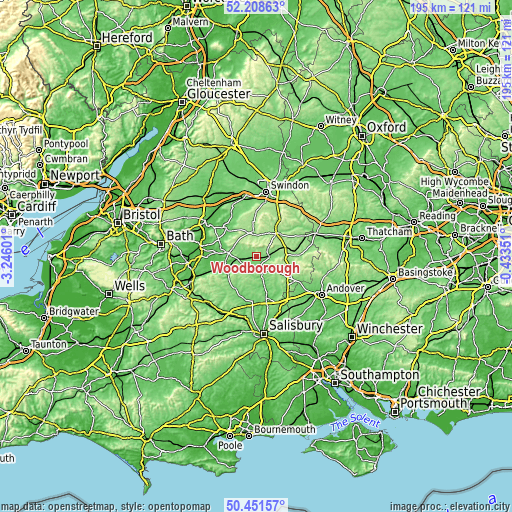
| \ | Map #1 | Topo.Map |
| Scale [m] | 95..199 m | × |
| Scale [ft] | 312..653 ft | × |
| Average | 121.2 m = 398 ft | × |
| Width | 6.11 km = 3.8 mi | 195.4 km = 121.4 mi |
| Height | 6.11 km = 3.8 mi | 195.4 km = 121.4 mi |
| ↑Max Latitude | 51.365965° | 52.20863° |
| Latitude at center | 51.33852° | 51.33852° |
| ↓Min Latitude | 51.311058° | 50.45157° |
| ← Min Longitude | -1.883705° | -3.24601° |
| Longitude center | -1.83976° | -1.83976° |
| →Max Longitude | -1.795815° | -0.43351° |
Nearby cities:
Cities around Woodborough sort by population:
• Devizes elevation 130 m
10.8 km,  277°
277°
• Marlborough 130 m
11.9 km,  40°
40°
• Pewsey 115 m
5.2 km,  89°
89°
• Market Lavington 93 m
11.1 km,  239°
239°
• Burbage 166 m
11.8 km,  82°
82°
• Potterne 99 m
11.5 km,  264°
264°
• Netheravon 83 m
11.9 km,  163°
163°
• Fyfield 137 m
9.5 km,  24°
24°
• Avebury 153 m
8.9 km,  347°
347°
• Rushall 145 m
6.3 km,  165°
165°
• Huish 152 m
4.9 km, 42°
• Wilsford 164 m
4.3 km,  189°
189°
Multilingual:
 En español:
Woodborough elevación 120 m.
 En France:
Woodborough élévation 120 m.
 Auf Deutsch:
Woodborough höhe über dem Meeresspiegel ist 120 m.

Sources and notes:
- [note 1] Map square and city borders are not equal. Map elevation data is calculated only from area inside that square.
- [src 1] Elevation data from geonames database provided with same terms of usage.
- [src 2] The elevation map of Woodborough is generated using elevation data from NASA's 3 arcsec (90m) resolution SRTM data.
- [src 3] Base (background) map © OpenStreetMap contributors tiles are generated by Geofabrik and OpenTopoMap.
Copyright & License:
This Woodborough Elevation Map is licensed under CC BY-SA. You may reuse any part from this page, if you give a proper credit by linking to this URL:
 More info on terms of use page.