Devizes elevation
Devizes (England, Wiltshire), United Kingdom elevation is 130 meters and Devizes elevation in feet is 427 ft above sea level [src 1]. Devizes is a populated place (feature code) with elevation that is 58 meters (190 ft) bigger than average city elevation in United Kingdom.
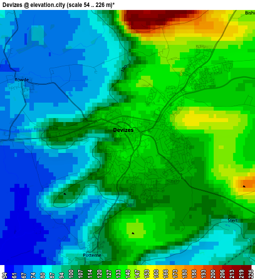
Below is the Elevation map of Devizes, which displays elevation range with different colors. Scale of the first map is from 54 to 226 m (177 to 741 ft) with average elevation of 107.7 meters (=353 ft) [note 1]
These maps also provides idea of topography and contour of this city, they are displayed at different zoom levels. More info about maps, scale and edge coordinates you can find below images.
| \ | Map #1 | Map #2 | Topo.Map |
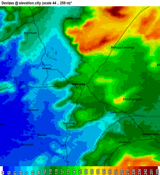
| Scale [m] | 54..226 m | 44..259 m | × |
| Scale [ft] | 177..741 ft | 144..850 ft | × |
| Average | 107.7 m = 353 ft | 108.9 m = 357 ft | × |
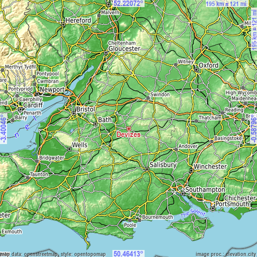
| Width | 6.1 km = 3.8 mi | 12.21 km = 7.6 mi | 195.3 km = 121.4 mi |
| Height | 6.1 km = 3.8 mi | 12.21 km = 7.6 mi | 195.3 km = 121.4 mi |
| ↑Max Latitude | 51.378278° | 51.405699° | 52.22072° |
| Latitude at center | 51.35084° | 51.35084° | 51.35084° |
| ↓Min Latitude | 51.323386° | 51.295915° | 50.46413° |
| ← Min Longitude | -2.038155° | -2.082101° | -3.40046° |
| Longitude center | -1.99421° | -1.99421° | -1.99421° |
| →Max Longitude | -1.950265° | -1.906319° | -0.58796° |
Nearby cities:
Cities around Devizes sort by population:
• Melksham elevation 41 m
10.4 km,  283°
283°
• Calne 77 m
9.8 km,  355°
355°
• Market Lavington 93 m
7.1 km,  170°
170°
• Potterne 99 m
2.5 km,  197°
197°
• Rowde 73 m
2.9 km,  298°
298°
• Edington 113 m
11.4 km,  223°
223°
• Worton 59 m
5.1 km, 220°
• Woodborough 120 m
10.8 km,  97°
97°
• Bulkington 48 m
6.9 km,  244°
244°
• Seend 95 m
6.3 km,  267°
267°
• Erlestoke 94 m
8.5 km,  209°
209°
• Marston 57 m
5.9 km, 220°
Multilingual:
 En español:
Devizes elevación 130 m.
 En France:
Devizes élévation 130 m.


Sources and notes:
- [note 1] Map square and city borders are not equal. Map elevation data is calculated only from area inside that square.
- [src 1] Elevation data from geonames database provided with same terms of usage.
- [src 2] The elevation map of Devizes is generated using elevation data from NASA's 3 arcsec (90m) resolution SRTM data.
- [src 3] Base (background) map © OpenStreetMap contributors tiles are generated by Geofabrik and OpenTopoMap.
Copyright & License:
This Devizes Elevation Map is licensed under CC BY-SA. You may reuse any part from this page, if you give a proper credit by linking to this URL:
 More info on terms of use page.