Saint-Quentin-en-Yvelines elevation
Saint-Quentin-en-Yvelines (Île-de-France, Yvelines), France elevation is 166 meters and Saint-Quentin-en-Yvelines elevation in feet is 545 ft above sea level [src 1]. Saint-Quentin-en-Yvelines is a populated place (feature code) with elevation that is 8 meters (26 ft) smaller than average city elevation in France.
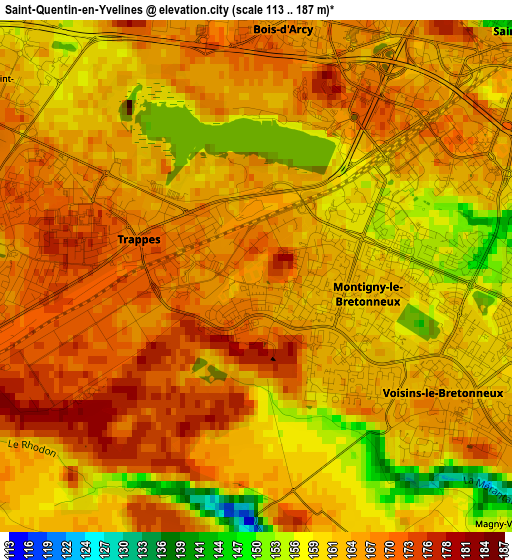
Below is the Elevation map of Saint-Quentin-en-Yvelines, which displays elevation range with different colors. Scale of the first map is from 113 to 187 m (371 to 614 ft) with average elevation of 164.4 meters (=539 ft) [note 1]
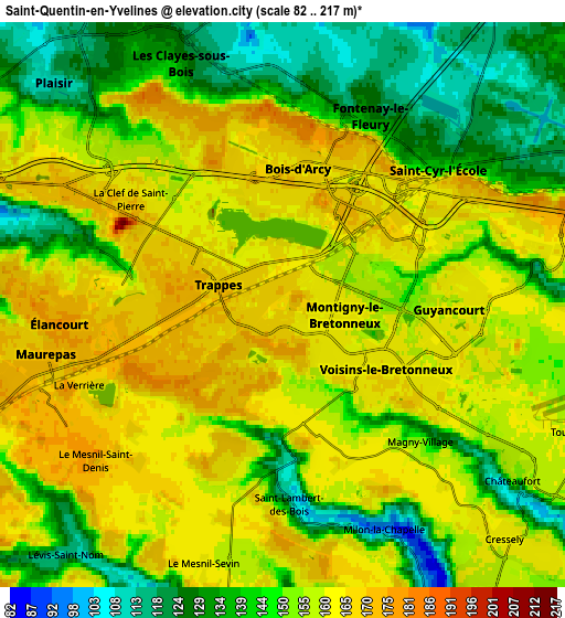
These maps also provides idea of topography and contour of this city, they are displayed at different zoom levels. More info about maps, scale and edge coordinates you can find below images.
| \ | Map #1 | Map #2 | Topo.Map |
| Scale [m] | 113..187 m | 82..217 m | × |
| Scale [ft] | 371..614 ft | 269..712 ft | × |
| Average | 164.4 m = 539 ft | 152.3 m = 500 ft | × |
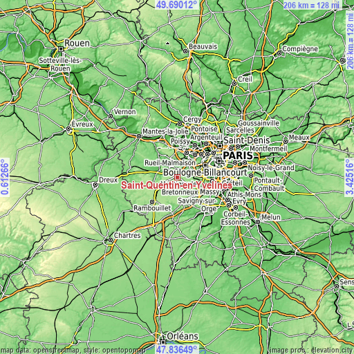
| Width | 6.44 km = 4 mi | 12.88 km = 8 mi | 206.1 km = 128.1 mi |
| Height | 6.44 km = 4 mi | 12.88 km = 8 mi | 206.1 km = 128.1 mi |
| ↑Max Latitude | 48.800814° | 48.829752° | 49.69012° |
| Latitude at center | 48.77186° | 48.77186° | 48.77186° |
| ↓Min Latitude | 48.742889° | 48.713901° | 47.83649° |
| ← Min Longitude | 1.974965° | 1.931019° | 0.61266° |
| Longitude center | 2.01891° | 2.01891° | 2.01891° |
| →Max Longitude | 2.062855° | 2.106801° | 3.42516° |
Nearby cities:
Cities around Saint-Quentin-en-Yvelines sort by population:
• Montigny-le-Bretonneux elevation 162 m
1.3 km,  118°
118°
• Guyancourt 161 m
4 km,  87°
87°
• Élancourt 133 m
4.9 km,  286°
286°
• Trappes 173 m
0.3 km,  342°
342°
• Les Clayes-sous-Bois 132 m
6.1 km, 337°
• Saint-Cyr-l’École 153 m
4.7 km,  50°
50°
• Voisins-le-Bretonneux 164 m
2.8 km, 123°
• Bois-d’Arcy 167 m
3.1 km,  5°
5°
• Fontenay-le-Fleury 122 m
5 km,  25°
25°
• Magny-les-Hameaux 154 m
4.4 km,  135°
135°
• Le Mesnil-Saint-Denis 174 m
5.5 km,  236°
236°
• La Verrière 173 m
5.7 km,  247°
247°
Multilingual:
 En español:
Saint-Quentin-en-Yvelines elevación 166 m.
 En France:
Saint-Quentin-en-Yvelines élévation 166 m.
 Auf Deutsch:
Communauté d’agglomération de Saint-Quentin-en-Yvelines höhe über dem Meeresspiegel ist 166 m.
 На русском:
Saint-Quentin-en-Yvelines высота над уровнем моря 166 м
Sources and notes:
- [note 1] Map square and city borders are not equal. Map elevation data is calculated only from area inside that square.
- [src 1] Elevation data from geonames database provided with same terms of usage.
- [src 2] The elevation map of Saint-Quentin-en-Yvelines is generated using elevation data from NASA's 3 arcsec (90m) resolution SRTM data.
- [src 3] Base (background) map © OpenStreetMap contributors tiles are generated by Geofabrik and OpenTopoMap.
Copyright & License:
This Saint-Quentin-en-Yvelines Elevation Map is licensed under CC BY-SA. You may reuse any part from this page, if you give a proper credit by linking to this URL:
 More info on terms of use page.