Saint-Cyr-l’École elevation
Saint-Cyr-l’École (Île-de-France, Yvelines), France elevation is 153 meters and Saint-Cyr-l’École elevation in feet is 502 ft above sea level [src 1]. Saint-Cyr-l’École is a populated place (feature code) with elevation that is 21 meters (69 ft) smaller than average city elevation in France.
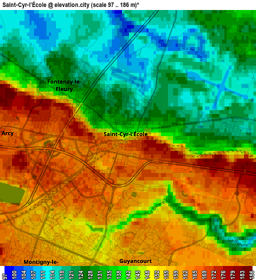
Below is the Elevation map of Saint-Cyr-l’École, which displays elevation range with different colors. Scale of the first map is from 97 to 186 m (318 to 610 ft) with average elevation of 142.8 meters (=469 ft) [note 1]
These maps also provides idea of topography and contour of this city, they are displayed at different zoom levels. More info about maps, scale and edge coordinates you can find below images.
| \ | Map #1 | Map #2 | Topo.Map |
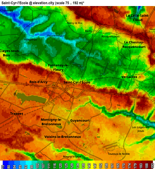
| Scale [m] | 97..186 m | 75..192 m | × |
| Scale [ft] | 318..610 ft | 246..630 ft | × |
| Average | 142.8 m = 469 ft | 146.2 m = 480 ft | × |
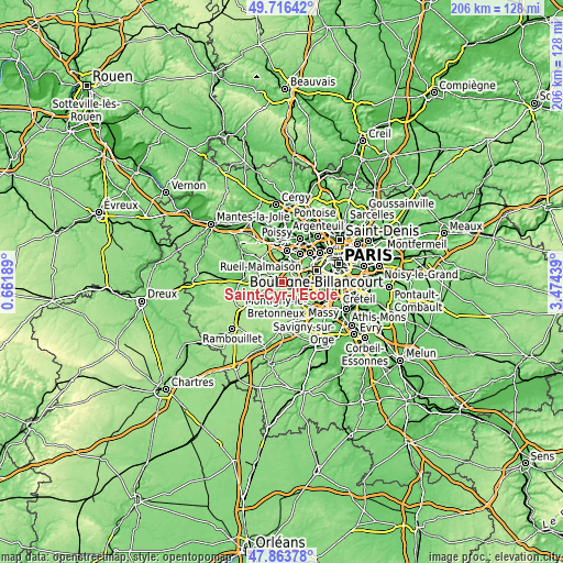
| Width | 6.44 km = 4 mi | 12.87 km = 8 mi | 206 km = 128 mi |
| Height | 6.44 km = 4 mi | 12.87 km = 8 mi | 206 km = 128 mi |
| ↑Max Latitude | 48.827589° | 48.856511° | 49.71642° |
| Latitude at center | 48.79865° | 48.79865° | 48.79865° |
| ↓Min Latitude | 48.769695° | 48.740722° | 47.86378° |
| ← Min Longitude | 2.024195° | 1.980249° | 0.66189° |
| Longitude center | 2.06814° | 2.06814° | 2.06814° |
| →Max Longitude | 2.112085° | 2.156031° | 3.47439° |
Nearby cities:
Cities around Saint-Cyr-l’École sort by population:
• Saint-Quentin-en-Yvelines elevation 166 m
4.7 km,  230°
230°
• Versailles 130 m
4.9 km,  83°
83°
• Montigny-le-Bretonneux 162 m
4.4 km,  214°
214°
• Guyancourt 161 m
2.8 km,  171°
171°
• Le Chesnay 122 m
4.7 km,  56°
56°
• Trappes 173 m
4.6 km, 233°
• Voisins-le-Bretonneux 164 m
4.7 km,  195°
195°
• Bois-d’Arcy 167 m
3.3 km,  271°
271°
• Fontenay-le-Fleury 122 m
2.1 km,  317°
317°
• Buc 122 m
4.9 km,  120°
120°
• Bailly 147 m
4.8 km,  7°
7°
• Rocquencourt 143 m
5 km,  29°
29°
Multilingual:
 En español:
Saint-Cyr-l’École elevación 153 m.
 En France:
Saint-Cyr-l'École élévation 153 m.
 Auf Deutsch:
Saint-Cyr-l’École höhe über dem Meeresspiegel ist 153 m.

Sources and notes:
- [note 1] Map square and city borders are not equal. Map elevation data is calculated only from area inside that square.
- [src 1] Elevation data from geonames database provided with same terms of usage.
- [src 2] The elevation map of Saint-Cyr-l’École is generated using elevation data from NASA's 3 arcsec (90m) resolution SRTM data.
- [src 3] Base (background) map © OpenStreetMap contributors tiles are generated by Geofabrik and OpenTopoMap.
Copyright & License:
This Saint-Cyr-l’École Elevation Map is licensed under CC BY-SA. You may reuse any part from this page, if you give a proper credit by linking to this URL:
 More info on terms of use page.