Albert elevation
Albert (Hauts-de-France, Somme), France elevation is 69 meters and Albert elevation in feet is 226 ft above sea level [src 1]. Albert is a populated place (feature code) with elevation that is 105 meters (344 ft) smaller than average city elevation in France.
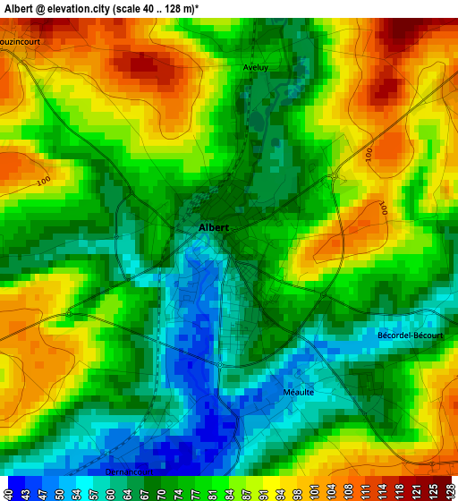
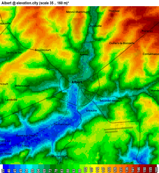
Below is the Elevation map of Albert, which displays elevation range with different colors. Scale of the first map is from 40 to 128 m (131 to 420 ft) with average elevation of 79.1 meters (=260 ft) [note 1]
These maps also provides idea of topography and contour of this city, they are displayed at different zoom levels. More info about maps, scale and edge coordinates you can find below images.
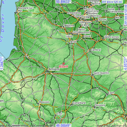
| \ | Map #1 | Map #2 | Topo.Map |
| Scale [m] | 40..128 m | 35..160 m | × |
| Scale [ft] | 131..420 ft | 115..525 ft | × |
| Average | 79.1 m = 260 ft | 92.6 m = 304 ft | × |
| Width | 6.28 km = 3.9 mi | 12.56 km = 7.8 mi | 201 km = 124.9 mi |
| Height | 6.28 km = 3.9 mi | 12.56 km = 7.8 mi | 201 km = 124.9 mi |
| ↑Max Latitude | 50.029149° | 50.057371° | 50.89633° |
| Latitude at center | 50.00091° | 50.00091° | 50.00091° |
| ↓Min Latitude | 49.972655° | 49.944383° | 49.08849° |
| ← Min Longitude | 2.607015° | 2.563069° | 1.24471° |
| Longitude center | 2.65096° | 2.65096° | 2.65096° |
| →Max Longitude | 2.694905° | 2.738851° | 4.05721° |
Nearby cities:
Cities around Albert sort by population:
• Péronne elevation 51 m
21.8 km,  110°
110°
• Corbie 32 m
14.7 km,  224°
224°
• Bapaume 124 m
18.2 km,  51°
51°
• Villers-Bretonneux 102 m
17.6 km,  213°
213°
• Rosières-en-Santerre 91 m
21.1 km,  170°
170°
• Moislains 70 m
22.4 km,  93°
93°
• Bray-sur-Somme 48 m
8.2 km,  144°
144°
• Harbonnières 89 m
16.9 km,  175°
175°
• Bucquoy 127 m
16 km,  15°
15°
• Méaulte 52 m
2.3 km,  161°
161°
• Beauquesne 141 m
20.7 km,  296°
296°
• Achiet-le-Grand 120 m
17.2 km,  32°
32°
Multilingual:
 En español:
Albert elevación 69 m.
 En France:
Albert élévation 69 m.


Sources and notes:
- [note 1] Map square and city borders are not equal. Map elevation data is calculated only from area inside that square.
- [src 1] Elevation data from geonames database provided with same terms of usage.
- [src 2] The elevation map of Albert is generated using elevation data from NASA's 3 arcsec (90m) resolution SRTM data.
- [src 3] Base (background) map © OpenStreetMap contributors tiles are generated by Geofabrik and OpenTopoMap.
Copyright & License:
This Albert Elevation Map is licensed under CC BY-SA. You may reuse any part from this page, if you give a proper credit by linking to this URL:
 More info on terms of use page.