Péronne elevation
Péronne (Hauts-de-France, Somme), France elevation is 51 meters and Péronne elevation in feet is 167 ft above sea level [src 1]. Péronne is a seat of a third-order administrative division (feature code) with elevation that is 123 meters (404 ft) smaller than average city elevation in France.
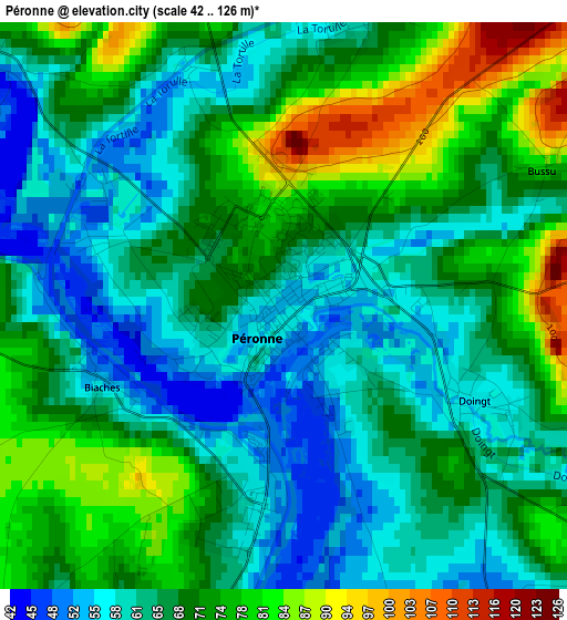
Below is the Elevation map of Péronne, which displays elevation range with different colors. Scale of the first map is from 42 to 126 m (138 to 413 ft) with average elevation of 67.8 meters (=222 ft) [note 1]
These maps also provides idea of topography and contour of this city, they are displayed at different zoom levels. More info about maps, scale and edge coordinates you can find below images.
| \ | Map #1 | Map #2 | Topo.Map |
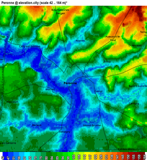
| Scale [m] | 42..126 m | 42..164 m | × |
| Scale [ft] | 138..413 ft | 138..538 ft | × |
| Average | 67.8 m = 222 ft | 79.8 m = 262 ft | × |
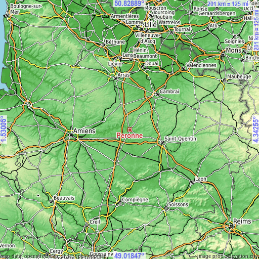
| Width | 6.29 km = 3.9 mi | 12.58 km = 7.8 mi | 201.3 km = 125.1 mi |
| Height | 6.29 km = 3.9 mi | 12.58 km = 7.8 mi | 201.3 km = 125.1 mi |
| ↑Max Latitude | 49.960459° | 49.988721° | 50.82889° |
| Latitude at center | 49.93218° | 49.93218° | 49.93218° |
| ↓Min Latitude | 49.903884° | 49.875572° | 49.01847° |
| ← Min Longitude | 2.892355° | 2.848409° | 1.53005° |
| Longitude center | 2.9363° | 2.9363° | 2.9363° |
| →Max Longitude | 2.980245° | 3.024191° | 4.34255° |
Nearby cities:
Cities around Péronne sort by population:
• Bapaume elevation 124 m
20.1 km,  342°
342°
• Nesle 78 m
19.4 km,  185°
185°
• Roisel 84 m
11.8 km,  81°
81°
• Chaulnes 103 m
16.1 km,  217°
217°
• Doingt 58 m
2.6 km,  118°
118°
• Moislains 70 m
6.5 km,  17°
17°
• Bray-sur-Somme 48 m
15.6 km,  273°
273°
• Méaulte 52 m
20.4 km,  285°
285°
• Gouzeaucourt 123 m
19.2 km,  44°
44°
• Épehy 134 m
16 km,  61°
61°
• Vermand 89 m
16.5 km,  112°
112°
• Étreillers 99 m
19.6 km,  125°
125°
Multilingual:
 En español:
Péronne elevación 51 m.
 En France:
Péronne élévation 51 m.


Sources and notes:
- [note 1] Map square and city borders are not equal. Map elevation data is calculated only from area inside that square.
- [src 1] Elevation data from geonames database provided with same terms of usage.
- [src 2] The elevation map of Péronne is generated using elevation data from NASA's 3 arcsec (90m) resolution SRTM data.
- [src 3] Base (background) map © OpenStreetMap contributors tiles are generated by Geofabrik and OpenTopoMap.
Copyright & License:
This Péronne Elevation Map is licensed under CC BY-SA. You may reuse any part from this page, if you give a proper credit by linking to this URL:
 More info on terms of use page.