Boissy-le-Cutté elevation
Boissy-le-Cutté (Île-de-France, Département de l'Essonne), France elevation is 76 meters and Boissy-le-Cutté elevation in feet is 249 ft above sea level [src 1]. Boissy-le-Cutté is a populated place (feature code) with elevation that is 98 meters (322 ft) smaller than average city elevation in France.
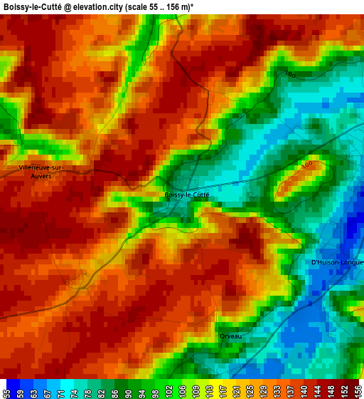
Below is the Elevation map of Boissy-le-Cutté, which displays elevation range with different colors. Scale of the first map is from 55 to 156 m (180 to 512 ft) with average elevation of 117.3 meters (=385 ft) [note 1]
These maps also provides idea of topography and contour of this city, they are displayed at different zoom levels. More info about maps, scale and edge coordinates you can find below images.
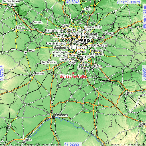
| \ | Map #1 | Topo.Map |
| Scale [m] | 55..156 m | × |
| Scale [ft] | 180..512 ft | × |
| Average | 117.3 m = 385 ft | × |
| Width | 6.48 km = 4 mi | 207.3 km = 128.8 mi |
| Height | 6.48 km = 4 mi | 207.3 km = 128.8 mi |
| ↑Max Latitude | 48.499328° | 49.394° |
| Latitude at center | 48.4702° | 48.4702° |
| ↓Min Latitude | 48.441055° | 47.52927° |
| ← Min Longitude | 2.239315° | 0.87701° |
| Longitude center | 2.28326° | 2.28326° |
| →Max Longitude | 2.327205° | 3.68951° |
Nearby cities:
Cities around Boissy-le-Cutté sort by population:
• Étréchy elevation 79 m
7.1 km,  292°
292°
• Itteville 73 m
6.7 km,  41°
41°
• Lardy 70 m
5.4 km,  352°
352°
• Morigny-Champigny 71 m
7.8 km,  250°
250°
• La Ferté-Alais 63 m
5 km,  73°
73°
• Cerny 69 m
3.4 km,  75°
75°
• Boutigny-sur-Essonne 119 m
8.4 km,  119°
119°
• Janville-sur-Juine 95 m
4.9 km, 349°
• Bouray-sur-Juine 71 m
5.7 km,  12°
12°
• Baulne 73 m
6.4 km, 66°
• Auvers-Saint-Georges 66 m
5.3 km,  298°
298°
• Chamarande 98 m
7.1 km,  316°
316°
Multilingual:
 En español:
Boissy-le-Cutté elevación 76 m.
 En France:
Boissy-le-Cutté élévation 76 m.
 Auf Deutsch:
Boissy-le-Cutté höhe über dem Meeresspiegel ist 76 m.

Sources and notes:
- [note 1] Map square and city borders are not equal. Map elevation data is calculated only from area inside that square.
- [src 1] Elevation data from geonames database provided with same terms of usage.
- [src 2] The elevation map of Boissy-le-Cutté is generated using elevation data from NASA's 3 arcsec (90m) resolution SRTM data.
- [src 3] Base (background) map © OpenStreetMap contributors tiles are generated by Geofabrik and OpenTopoMap.
Copyright & License:
This Boissy-le-Cutté Elevation Map is licensed under CC BY-SA. You may reuse any part from this page, if you give a proper credit by linking to this URL:
 More info on terms of use page.