Étréchy elevation
Étréchy (Île-de-France, Département de l'Essonne), France elevation is 79 meters and Étréchy elevation in feet is 259 ft above sea level [src 1]. Étréchy is a populated place (feature code) with elevation that is 95 meters (312 ft) smaller than average city elevation in France.
Below is the Elevation map of Étréchy, which displays elevation range with different colors. Scale of the first map is from 56 to 162 m (184 to 531 ft) with average elevation of 116.3 meters (=382 ft) [note 1]
These maps also provides idea of topography and contour of this city, they are displayed at different zoom levels. More info about maps, scale and edge coordinates you can find below images.
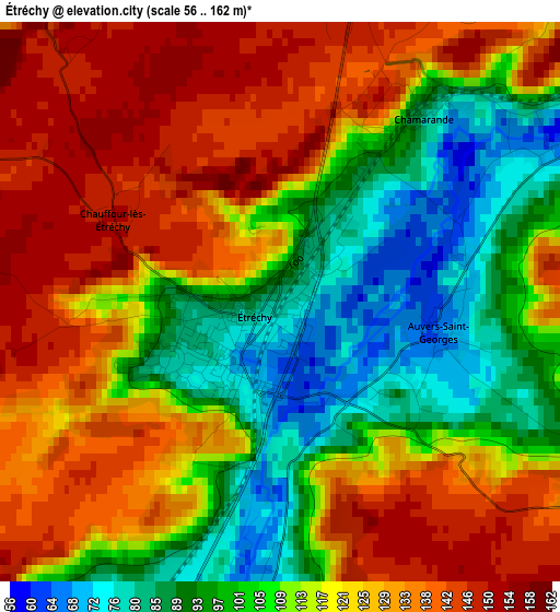
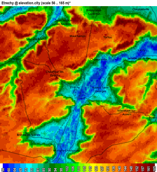
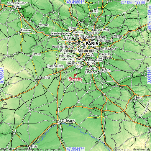
| \ | Map #1 | Map #2 | Topo.Map |
| Scale [m] | 56..162 m | 56..165 m | × |
| Scale [ft] | 184..531 ft | 184..541 ft | × |
| Average | 116.3 m = 382 ft | 122.8 m = 403 ft | × |
| Width | 6.48 km = 4 mi | 12.95 km = 8 mi | 207.2 km = 128.7 mi |
| Height | 6.48 km = 4 mi | 12.95 km = 8 mi | 207.2 km = 128.7 mi |
| ↑Max Latitude | 48.523764° | 48.552861° | 49.41801° |
| Latitude at center | 48.49465° | 48.49465° | 48.49465° |
| ↓Min Latitude | 48.46552° | 48.436372° | 47.55417° |
| ← Min Longitude | 2.150945° | 2.106999° | 0.78864° |
| Longitude center | 2.19489° | 2.19489° | 2.19489° |
| →Max Longitude | 2.238835° | 2.282781° | 3.60114° |
Nearby cities:
Cities around Étréchy sort by population:
• Étampes elevation 70 m
7 km,  199°
199°
• Breuillet 92 m
8.6 km,  349°
349°
• Saint-Chéron 101 m
8.4 km,  321°
321°
• Lardy 70 m
6.4 km,  65°
65°
• Morigny-Champigny 71 m
5.4 km,  188°
188°
• Boissy-sous-Saint-Yon 91 m
6.7 km,  10°
10°
• Janville-sur-Juine 95 m
6 km, 69°
• Bouray-sur-Juine 71 m
8.2 km, 70°
• Cheptainville 79 m
8.7 km,  43°
43°
• Boissy-le-Cutté 76 m
7.1 km,  112°
112°
• Auvers-Saint-Georges 66 m
1.9 km,  96°
96°
• Chamarande 98 m
3 km,  33°
33°
Multilingual:
 En español:
Étréchy elevación 79 m.
 En France:
Étréchy élévation 79 m.


Sources and notes:
- [note 1] Map square and city borders are not equal. Map elevation data is calculated only from area inside that square.
- [src 1] Elevation data from geonames database provided with same terms of usage.
- [src 2] The elevation map of Étréchy is generated using elevation data from NASA's 3 arcsec (90m) resolution SRTM data.
- [src 3] Base (background) map © OpenStreetMap contributors tiles are generated by Geofabrik and OpenTopoMap.
Copyright & License:
This Étréchy Elevation Map is licensed under CC BY-SA. You may reuse any part from this page, if you give a proper credit by linking to this URL:
 More info on terms of use page.