La Ferté-Alais elevation
La Ferté-Alais (Île-de-France, Département de l'Essonne), France elevation is 63 meters and La Ferté-Alais elevation in feet is 207 ft above sea level [src 1]. La Ferté-Alais is a populated place (feature code) with elevation that is 111 meters (364 ft) smaller than average city elevation in France.
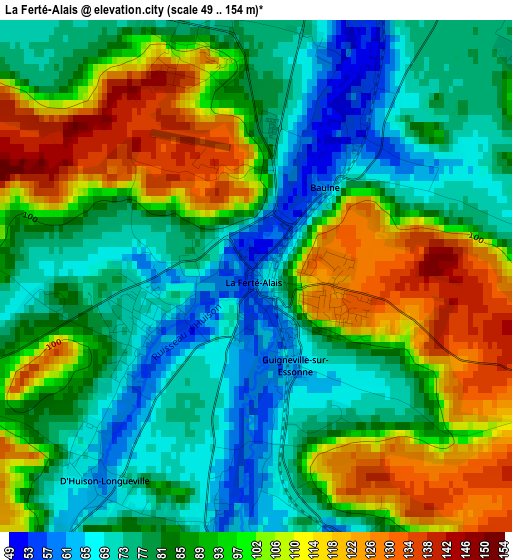
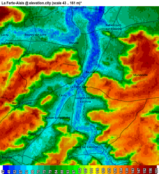
Below is the Elevation map of La Ferté-Alais, which displays elevation range with different colors. Scale of the first map is from 49 to 154 m (161 to 505 ft) with average elevation of 90.4 meters (=297 ft) [note 1]
These maps also provides idea of topography and contour of this city, they are displayed at different zoom levels. More info about maps, scale and edge coordinates you can find below images.
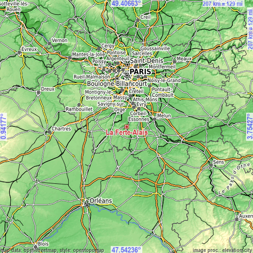
| \ | Map #1 | Map #2 | Topo.Map |
| Scale [m] | 49..154 m | 43..161 m | × |
| Scale [ft] | 161..505 ft | 141..528 ft | × |
| Average | 90.4 m = 297 ft | 99.4 m = 326 ft | × |
| Width | 6.48 km = 4 mi | 12.96 km = 8.1 mi | 207.3 km = 128.8 mi |
| Height | 6.48 km = 4 mi | 12.96 km = 8.1 mi | 207.3 km = 128.8 mi |
| ↑Max Latitude | 48.51218° | 48.541284° | 49.40663° |
| Latitude at center | 48.48306° | 48.48306° | 48.48306° |
| ↓Min Latitude | 48.453923° | 48.424769° | 47.54236° |
| ← Min Longitude | 2.304075° | 2.260129° | 0.94177° |
| Longitude center | 2.34802° | 2.34802° | 2.34802° |
| →Max Longitude | 2.391965° | 2.435911° | 3.75427° |
Nearby cities:
Cities around La Ferté-Alais sort by population:
• Ballancourt-sur-Essonne elevation 67 m
5.5 km,  30°
30°
• Itteville 73 m
3.6 km,  355°
355°
• Lardy 70 m
6.8 km,  305°
305°
• Cerny 69 m
1.6 km,  248°
248°
• Boutigny-sur-Essonne 119 m
6.1 km,  154°
154°
• Saint-Vrain 69 m
6.8 km,  350°
350°
• Champcueil 80 m
8.1 km,  63°
63°
• Vert-le-Petit 68 m
7.7 km,  9°
9°
• Janville-sur-Juine 95 m
6.6 km,  300°
300°
• Bouray-sur-Juine 71 m
5.4 km,  319°
319°
• Baulne 73 m
1.5 km,  43°
43°
• Boissy-le-Cutté 76 m
5 km, 253°
Multilingual:
 En español:
La Ferté-Alais elevación 63 m.
 En France:
La Ferté-Alais élévation 63 m.
 Auf Deutsch:
La Ferté-Alais höhe über dem Meeresspiegel ist 63 m.

Sources and notes:
- [note 1] Map square and city borders are not equal. Map elevation data is calculated only from area inside that square.
- [src 1] Elevation data from geonames database provided with same terms of usage.
- [src 2] The elevation map of La Ferté-Alais is generated using elevation data from NASA's 3 arcsec (90m) resolution SRTM data.
- [src 3] Base (background) map © OpenStreetMap contributors tiles are generated by Geofabrik and OpenTopoMap.
Copyright & License:
This La Ferté-Alais Elevation Map is licensed under CC BY-SA. You may reuse any part from this page, if you give a proper credit by linking to this URL:
 More info on terms of use page.