Bonneval elevation
Bonneval (Centre, Département d'Eure-et-Loir), France elevation is 125 meters and Bonneval elevation in feet is 410 ft above sea level [src 1]. Bonneval is a populated place (feature code) with elevation that is 49 meters (161 ft) smaller than average city elevation in France.
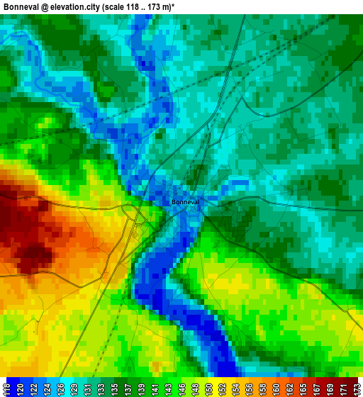
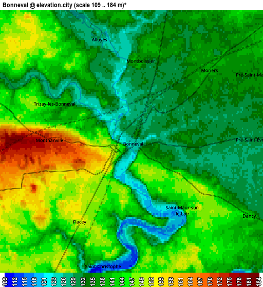
Below is the Elevation map of Bonneval, which displays elevation range with different colors. Scale of the first map is from 118 to 173 m (387 to 568 ft) with average elevation of 137.8 meters (=452 ft) [note 1]
These maps also provides idea of topography and contour of this city, they are displayed at different zoom levels. More info about maps, scale and edge coordinates you can find below images.
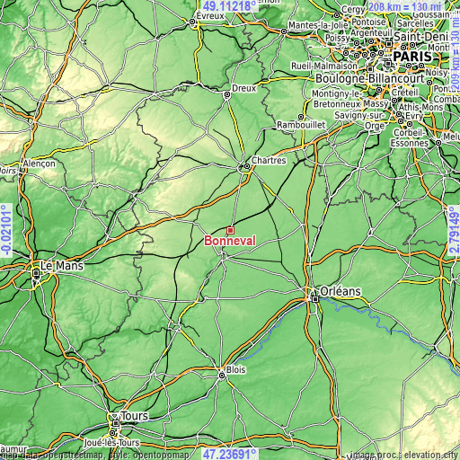
| \ | Map #1 | Map #2 | Topo.Map |
| Scale [m] | 118..173 m | 109..184 m | × |
| Scale [ft] | 387..568 ft | 358..604 ft | × |
| Average | 137.8 m = 452 ft | 139.9 m = 459 ft | × |
| Width | 6.52 km = 4.1 mi | 13.03 km = 8.1 mi | 208.5 km = 129.6 mi |
| Height | 6.52 km = 4.1 mi | 13.03 km = 8.1 mi | 208.5 km = 129.6 mi |
| ↑Max Latitude | 48.212412° | 48.241688° | 49.11218° |
| Latitude at center | 48.18312° | 48.18312° | 48.18312° |
| ↓Min Latitude | 48.153811° | 48.124485° | 47.23691° |
| ← Min Longitude | 1.341295° | 1.297349° | -0.02101° |
| Longitude center | 1.38524° | 1.38524° | 1.38524° |
| →Max Longitude | 1.429185° | 1.473131° | 2.79149° |
Nearby cities:
Cities around Bonneval sort by population:
• Châteaudun elevation 129 m
13 km,  195°
195°
• Brou 157 m
16.7 km,  283°
283°
• Voves 145 m
20.3 km,  61°
61°
• Arrou 161 m
21.3 km,  243°
243°
• Yèvres 160 m
15 km, 281°
• Saint-Denis-les-Ponts 106 m
14.5 km,  206°
206°
• Bailleau-le-Pin 173 m
20.9 km,  348°
348°
• Dammarie 148 m
19.5 km,  24°
24°
• La Chapelle-du-Noyer 138 m
17.7 km, 198°
• Marboué 114 m
8.7 km, 207°
• Orgères-en-Beauce 130 m
22.5 km,  100°
100°
• Unverre 164 m
21.8 km,  274°
274°
Multilingual:
 En español:
Bonneval elevación 125 m.
 En France:
Bonneval élévation 125 m.
 Auf Deutsch:
Bonneval höhe über dem Meeresspiegel ist 125 m.

Sources and notes:
- [note 1] Map square and city borders are not equal. Map elevation data is calculated only from area inside that square.
- [src 1] Elevation data from geonames database provided with same terms of usage.
- [src 2] The elevation map of Bonneval is generated using elevation data from NASA's 3 arcsec (90m) resolution SRTM data.
- [src 3] Base (background) map © OpenStreetMap contributors tiles are generated by Geofabrik and OpenTopoMap.
Copyright & License:
This Bonneval Elevation Map is licensed under CC BY-SA. You may reuse any part from this page, if you give a proper credit by linking to this URL:
 More info on terms of use page.